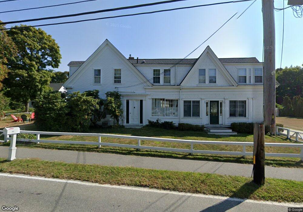
854 Main St Cotuit, MA 02635
Cotuit NeighborhoodEstimated Value: $2,501,884 - $3,320,000
5
Beds
3
Baths
5,614
Sq Ft
$490/Sq Ft
Est. Value
About This Home
This home is located at 854 Main St, Cotuit, MA 02635 and is currently estimated at $2,749,221, approximately $489 per square foot. 854 Main St is a home located in Barnstable County with nearby schools including West Villages Elementary School, Barnstable United Elementary School, and Barnstable Intermediate School.
Create a Home Valuation Report for This Property
The Home Valuation Report is an in-depth analysis detailing your home's value as well as a comparison with similar homes in the area
Home Values in the Area
Average Home Value in this Area
Tax History
| Year | Tax Paid | Tax Assessment Tax Assessment Total Assessment is a certain percentage of the fair market value that is determined by local assessors to be the total taxable value of land and additions on the property. | Land | Improvement |
|---|---|---|---|---|
| 2025 | $17,476 | $2,092,900 | $914,400 | $1,178,500 |
| 2024 | $15,740 | $1,997,400 | $914,400 | $1,083,000 |
| 2023 | $13,942 | $1,665,700 | $755,700 | $910,000 |
| 2022 | $12,731 | $1,231,200 | $492,600 | $738,600 |
| 2021 | $11,584 | $1,049,200 | $447,800 | $601,400 |
| 2020 | $11,569 | $988,000 | $447,800 | $540,200 |
| 2019 | $11,203 | $943,000 | $470,200 | $472,800 |
| 2018 | $9,630 | $810,600 | $447,800 | $362,800 |
| 2017 | $9,497 | $804,800 | $447,800 | $357,000 |
| 2016 | $9,161 | $795,900 | $438,900 | $357,000 |
| 2015 | $9,798 | $850,500 | $443,600 | $406,900 |
Source: Public Records
Map
Nearby Homes
- 804 Main St
- 925 Main St Unit 3
- 33 Oyster Place Rd
- 135 Putnam Avenue (Land)
- 181 School St
- 1081 Main St
- 30 Wings Ln
- 552 Main St
- 239 Oxford Dr
- 47 Cherry Tree Rd
- 6 Cedar St
- 6 Cedar St
- 15 Riverview Ave Unit D
- 15 Riverview Ave Unit D
- 440 Grand Island Dr
- 7 Oxford Dr
- 10 Abbey Gate Rd
- Lot 288 Seapuit River Rd A
- Lot 289 Seapuit River Road B
- 311 Waquoit Rd
Your Personal Tour Guide
Ask me questions while you tour the home.