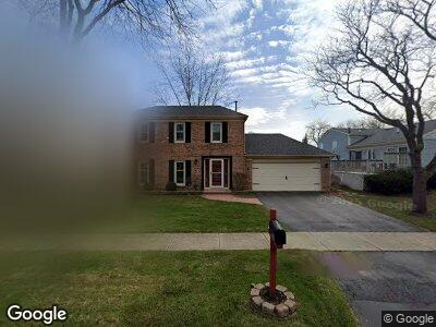
854 Pawnee Dr Carol Stream, IL 60188
Estimated Value: $387,325 - $411,000
3
Beds
2
Baths
1,980
Sq Ft
$201/Sq Ft
Est. Value
About This Home
This home is located at 854 Pawnee Dr, Carol Stream, IL 60188 and is currently estimated at $398,081, approximately $201 per square foot. 854 Pawnee Dr is a home located in DuPage County with nearby schools including Evergreen Elementary School, Benjamin Middle School, and West Chicago Community High School.
Ownership History
Date
Name
Owned For
Owner Type
Purchase Details
Closed on
Mar 14, 2000
Sold by
Rivas Robert F and Rivas Lisa L
Bought by
Gerster Shawn M and Gerster Kimberly L
Current Estimated Value
Home Financials for this Owner
Home Financials are based on the most recent Mortgage that was taken out on this home.
Original Mortgage
$156,500
Interest Rate
8.3%
Purchase Details
Closed on
Jun 22, 1992
Sold by
Flannery Michael A and Flannery Misty
Bought by
Rivas Robert F and Rivas Lisa L
Home Financials for this Owner
Home Financials are based on the most recent Mortgage that was taken out on this home.
Original Mortgage
$119,000
Interest Rate
7.54%
Create a Home Valuation Report for This Property
The Home Valuation Report is an in-depth analysis detailing your home's value as well as a comparison with similar homes in the area
Home Values in the Area
Average Home Value in this Area
Purchase History
| Date | Buyer | Sale Price | Title Company |
|---|---|---|---|
| Gerster Shawn M | $165,500 | Fox Title Company |
Source: Public Records
Mortgage History
| Date | Status | Borrower | Loan Amount |
|---|---|---|---|
| Open | Gerster Shawn M | $220,000 | |
| Closed | Gerster Kimberly L | $22,323 | |
| Closed | Gerster Shawn M | $187,654 | |
| Closed | Gerster Shawn M | $26,000 | |
| Closed | Gerster Shawn M | $200,000 | |
| Closed | Gerster Shawn M | $60,000 | |
| Closed | Gerster Shawn M | $11,000 | |
| Closed | Gerster Shawn M | $156,000 | |
| Closed | Gerster Shawn M | $155,700 | |
| Closed | Gerster Shawn M | $156,500 | |
| Previous Owner | Rivas Robert F | $15,000 | |
| Previous Owner | Rivas Robert F | $119,000 |
Source: Public Records
Tax History Compared to Growth
Tax History
| Year | Tax Paid | Tax Assessment Tax Assessment Total Assessment is a certain percentage of the fair market value that is determined by local assessors to be the total taxable value of land and additions on the property. | Land | Improvement |
|---|---|---|---|---|
| 2023 | $8,252 | $98,090 | $31,360 | $66,730 |
| 2022 | $7,865 | $91,160 | $29,140 | $62,020 |
| 2021 | $7,520 | $86,540 | $27,660 | $58,880 |
| 2020 | $7,793 | $88,910 | $26,830 | $62,080 |
| 2019 | $7,600 | $85,730 | $25,870 | $59,860 |
| 2018 | $6,996 | $80,040 | $24,160 | $55,880 |
| 2017 | $6,863 | $76,850 | $23,200 | $53,650 |
| 2016 | $6,724 | $73,410 | $22,160 | $51,250 |
| 2015 | $6,650 | $69,490 | $20,980 | $48,510 |
| 2014 | $6,379 | $65,480 | $20,450 | $45,030 |
| 2013 | $6,256 | $67,050 | $20,940 | $46,110 |
Source: Public Records
Map
Nearby Homes
- 601 Oswego Dr
- 27W270 Jefferson St
- 534 Alton Ct
- 620 Teton Cir
- 491 Dakota Ct Unit 2
- 706 Shining Water Dr
- 1054 Evergreen Dr
- 27W046 North Ave
- 28W051 Timber Ln
- 1096 Gunsmoke Ct
- 942 Hill Crest Dr
- 789 Hemlock Ln
- 1192 Brookstone Dr
- 443 Indianwood Dr
- 27W120 Timber Creek Dr
- 28W251 Oak Creek Ct
- 1358 Lance Ln
- 1089 Baybrook Ln
- 1209 Easton Dr
- 1188 Parkview Ct