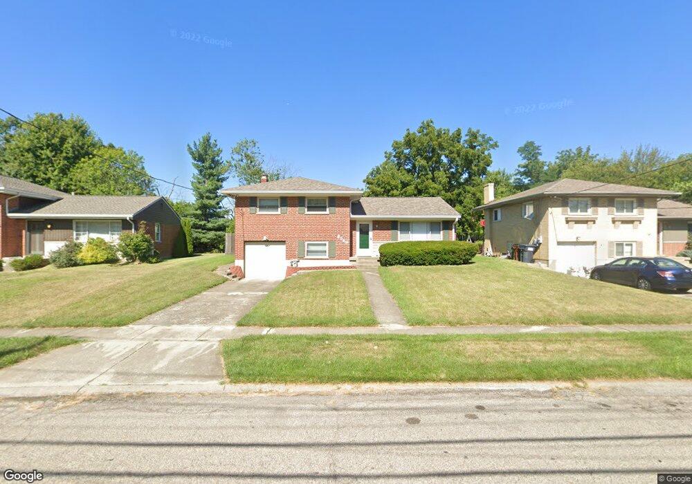
8549 Mockingbird Ln Cincinnati, OH 45231
Finneytown NeighborhoodEstimated Value: $257,970 - $271,000
3
Beds
3
Baths
2,020
Sq Ft
$130/Sq Ft
Est. Value
About This Home
This home is located at 8549 Mockingbird Ln, Cincinnati, OH 45231 and is currently estimated at $262,493, approximately $129 per square foot. 8549 Mockingbird Ln is a home located in Hamilton County with nearby schools including Finneytown Elementary School, Finneytown Secondary Campus, and St. Vivian School.
Ownership History
Date
Name
Owned For
Owner Type
Purchase Details
Closed on
Apr 29, 1996
Sold by
Moser Donald F
Bought by
Ford Consumer Finance Co Inc
Current Estimated Value
Purchase Details
Closed on
Jan 16, 1996
Sold by
Ford Consumer Finance Co Inc
Bought by
Davidson Orville and Davidson Patricia
Home Financials for this Owner
Home Financials are based on the most recent Mortgage that was taken out on this home.
Original Mortgage
$82,500
Interest Rate
7.66%
Create a Home Valuation Report for This Property
The Home Valuation Report is an in-depth analysis detailing your home's value as well as a comparison with similar homes in the area
Home Values in the Area
Average Home Value in this Area
Purchase History
| Date | Buyer | Sale Price | Title Company |
|---|---|---|---|
| Ford Consumer Finance Co Inc | -- | -- | |
| Ford Consumer Finance Co Inc | -- | -- | |
| Davidson Orville | $92,000 | -- |
Source: Public Records
Mortgage History
| Date | Status | Borrower | Loan Amount |
|---|---|---|---|
| Previous Owner | Davidson Orville | $82,500 |
Source: Public Records
Tax History
| Year | Tax Paid | Tax Assessment Tax Assessment Total Assessment is a certain percentage of the fair market value that is determined by local assessors to be the total taxable value of land and additions on the property. | Land | Improvement |
|---|---|---|---|---|
| 2025 | $4,750 | $67,712 | $11,939 | $55,773 |
| 2023 | $4,540 | $67,712 | $11,939 | $55,773 |
| 2022 | $3,750 | $40,548 | $9,391 | $31,157 |
| 2021 | $3,680 | $40,548 | $9,391 | $31,157 |
| 2020 | $3,739 | $40,548 | $9,391 | $31,157 |
| 2019 | $3,434 | $34,363 | $7,959 | $26,404 |
| 2018 | $3,170 | $34,363 | $7,959 | $26,404 |
| 2017 | $3,021 | $34,363 | $7,959 | $26,404 |
| 2016 | $3,195 | $35,718 | $7,998 | $27,720 |
| 2015 | $3,215 | $35,718 | $7,998 | $27,720 |
| 2014 | $3,218 | $35,718 | $7,998 | $27,720 |
| 2013 | $3,177 | $36,449 | $8,162 | $28,287 |
Source: Public Records
Map
Nearby Homes
- 1055 Hempstead Dr
- 8628 Mockingbird Ln
- 1144 Hempstead Dr
- 1116 Madeleine Cir
- 1006 Hearthstone Dr
- 1088 Pinehollow Ln
- 8754 Monsanto Dr
- 8829 Mockingbird Ln
- 958 Hollytree Dr
- 881 Sabino Ct
- 1101 Meadowind Ct
- 1165 W Galbraith Rd
- 8943 Monsanto Dr
- 1297 Landis Ln
- 8719 Hood Ct
- 9137 Fontainebleau Terrace
- 816 Sabino Ct
- 838 W Galbraith Rd
- 8771 Desoto Dr
- 833 W Galbraith Rd
- 8561 Mockingbird Ln
- 8539 Mockingbird Ln
- 8573 Mockingbird Ln
- 8586 Hallridge Ct
- 8527 Mockingbird Ln
- 8592 Hallridge Ct
- 8580 Hallridge Ct
- 8585 Mockingbird Ln
- 8572 Hallridge Ct
- 8548 Mockingbird Ln
- 1069 Redbird Dr
- 8536 Mockingbird Ln
- 8515 Mockingbird Ln
- 8598 Hallridge Ct
- 8566 Hallridge Ct
- 8520 Mockingbird Ln
- 8505 Mockingbird Ln
- 1065 Redbird Dr
- 1081 Hempstead Dr
- 1077 Hempstead Dr
Your Personal Tour Guide
Ask me questions while you tour the home.