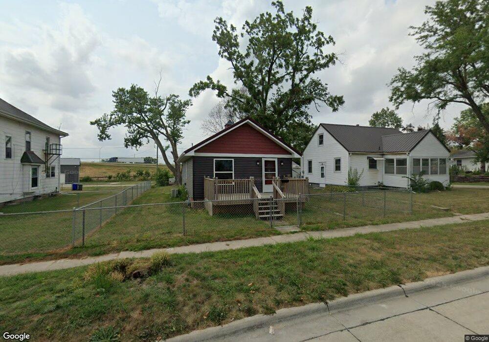
855 12th St NE Cedar Rapids, IA 52402
Mound View NeighborhoodEstimated Value: $103,000 - $134,151
2
Beds
2
Baths
680
Sq Ft
$177/Sq Ft
Est. Value
About This Home
This home is located at 855 12th St NE, Cedar Rapids, IA 52402 and is currently estimated at $120,538, approximately $177 per square foot. 855 12th St NE is a home with nearby schools including Garfield Elementary School, Franklin Middle School, and George Washington High School.
Ownership History
Date
Name
Owned For
Owner Type
Purchase Details
Closed on
Oct 10, 2017
Sold by
Fowlkes Kent S and Fowlkes Jacqueline A
Bought by
Nelson Joshua E
Current Estimated Value
Home Financials for this Owner
Home Financials are based on the most recent Mortgage that was taken out on this home.
Original Mortgage
$73,720
Outstanding Balance
$61,511
Interest Rate
3.78%
Mortgage Type
New Conventional
Estimated Equity
$59,027
Purchase Details
Closed on
Jun 10, 2016
Sold by
Williams Donald F and Williams Ramona M
Bought by
Fowlkes Kent S and Fowlkes Jacqueline A
Home Financials for this Owner
Home Financials are based on the most recent Mortgage that was taken out on this home.
Original Mortgage
$52,500
Interest Rate
3.57%
Mortgage Type
Future Advance Clause Open End Mortgage
Create a Home Valuation Report for This Property
The Home Valuation Report is an in-depth analysis detailing your home's value as well as a comparison with similar homes in the area
Home Values in the Area
Average Home Value in this Area
Purchase History
| Date | Buyer | Sale Price | Title Company |
|---|---|---|---|
| Nelson Joshua E | $76,000 | None Available | |
| Fowlkes Kent S | -- | None Available |
Source: Public Records
Mortgage History
| Date | Status | Borrower | Loan Amount |
|---|---|---|---|
| Open | Nelson Joshua E | $73,720 | |
| Previous Owner | Fowlkes Kent S | $52,500 |
Source: Public Records
Tax History Compared to Growth
Tax History
| Year | Tax Paid | Tax Assessment Tax Assessment Total Assessment is a certain percentage of the fair market value that is determined by local assessors to be the total taxable value of land and additions on the property. | Land | Improvement |
|---|---|---|---|---|
| 2025 | $1,794 | $118,700 | $22,500 | $96,200 |
| 2024 | $1,792 | $111,800 | $20,300 | $91,500 |
| 2023 | $1,792 | $111,800 | $20,300 | $91,500 |
| 2022 | $1,562 | $93,800 | $19,100 | $74,700 |
| 2021 | $1,502 | $84,400 | $15,800 | $68,600 |
| 2020 | $1,502 | $76,700 | $8,000 | $68,700 |
| 2019 | $1,604 | $74,400 | $8,000 | $66,400 |
| 2018 | $656 | $74,400 | $8,000 | $66,400 |
| 2017 | $174 | $8,000 | $8,000 | $0 |
| 2016 | $170 | $8,000 | $8,000 | $0 |
| 2015 | $170 | $8,000 | $8,000 | $0 |
| 2014 | $620 | $8,000 | $8,000 | $0 |
| 2013 | $166 | $8,000 | $8,000 | $0 |
Source: Public Records
Map
Nearby Homes
- 832 Daniels St NE
- 826 Daniels St NE
- 1046 12th St NE
- 910 Maplewood Dr NE
- 2011 Sierra Cir NE
- 2015 Sierra Cir NE
- 2019 Sierra Cir NE
- 2000 Sierra Cir NE
- 2006 Sierra Cir NE
- 2023 Sierra Cir NE
- 2103 Sierra Cir NE
- 2012 Sierra Cir NE
- 2018 Sierra Cir NE
- 2109 Sierra Cir NE
- 2115 Sierra Cir NE
- 2102 Sierra Cir NE
- 2110 Sierra Cir NE
- 2121 Sierra Cir NE
- 2127 Sierra Cir NE
- 2116 Sierra Cir NE