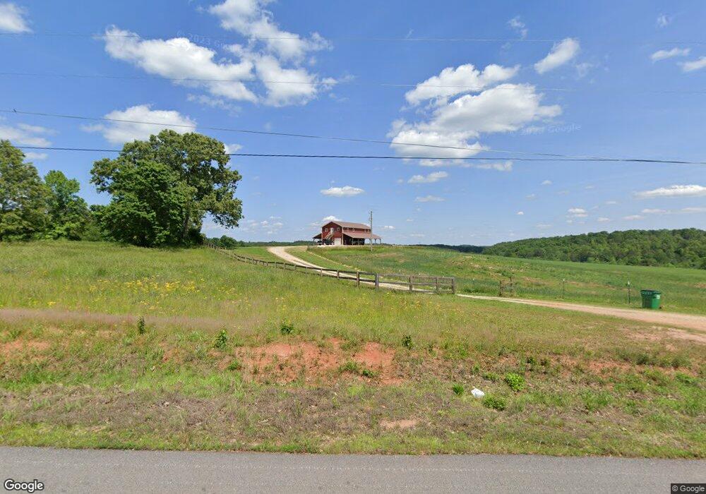
855 Coker Rd Toccoa, GA 30577
Estimated Value: $929,181
2
Beds
3
Baths
1,568
Sq Ft
$593/Sq Ft
Est. Value
About This Home
This home is located at 855 Coker Rd, Toccoa, GA 30577 and is currently estimated at $929,181, approximately $592 per square foot. 855 Coker Rd is a home located in Stephens County with nearby schools including Stephens County High School.
Ownership History
Date
Name
Owned For
Owner Type
Purchase Details
Closed on
Sep 2, 2021
Sold by
The Spectre Grp Inc
Bought by
Tall Cotton Farm Llc
Current Estimated Value
Purchase Details
Closed on
May 28, 2021
Sold by
Whitfield Kenneth L
Bought by
The Spectre Grp Inc
Purchase Details
Closed on
May 31, 2013
Sold by
Owens Talmadge W
Bought by
Whitfield Kenneth L and Whitfield Rebecca M
Home Financials for this Owner
Home Financials are based on the most recent Mortgage that was taken out on this home.
Original Mortgage
$172,150
Interest Rate
3.37%
Mortgage Type
New Conventional
Create a Home Valuation Report for This Property
The Home Valuation Report is an in-depth analysis detailing your home's value as well as a comparison with similar homes in the area
Home Values in the Area
Average Home Value in this Area
Purchase History
| Date | Buyer | Sale Price | Title Company |
|---|---|---|---|
| Tall Cotton Farm Llc | -- | -- | |
| The Spectre Grp Inc | $685,000 | -- | |
| Whitfield Kenneth L | $215,190 | -- |
Source: Public Records
Mortgage History
| Date | Status | Borrower | Loan Amount |
|---|---|---|---|
| Previous Owner | Whitfield Kenneth L | $172,150 |
Source: Public Records
Tax History Compared to Growth
Tax History
| Year | Tax Paid | Tax Assessment Tax Assessment Total Assessment is a certain percentage of the fair market value that is determined by local assessors to be the total taxable value of land and additions on the property. | Land | Improvement |
|---|---|---|---|---|
| 2024 | $5,588 | $183,530 | $71,180 | $112,350 |
| 2023 | $5,435 | $178,480 | $71,180 | $107,300 |
| 2022 | $4,078 | $137,000 | $64,706 | $72,294 |
| 2021 | $2,748 | $87,892 | $20,290 | $67,602 |
| 2020 | $955 | $76,137 | $64,706 | $11,431 |
| 2019 | $942 | $73,055 | $61,624 | $11,431 |
| 2018 | $563 | $61,624 | $61,624 | $0 |
| 2017 | $556 | $61,624 | $61,624 | $0 |
| 2016 | $531 | $61,624 | $61,624 | $0 |
| 2015 | $540 | $61,624 | $61,624 | $0 |
| 2014 | $533 | $61,624 | $61,624 | $0 |
| 2013 | -- | $61,720 | $61,720 | $0 |
Source: Public Records
Map
Nearby Homes
- 1387 Mize Rd
- 97 Hillside Dr
- 151 Richardson St
- 1662 Carnes Creek Rd
- 184 Scott Cir
- 9369 Sherwood Ct
- 1037 S Pond St
- 0 Switchback Run Unit 10437289
- 275 Southern Trace
- 255 Southern Trace
- 1009 S Pond St
- 943 S Pond St
- 16 Terri Ln
- 372 Hilltop Way
- 739 Poplar St
- 475 Hilltop Way
- 266 Cawthon Rd
- 136 Julia Ct
- 189 Julia Ln
- 215 Old Mize Rd
- 855 Coker Rd Unit 72 Acre
- 855 Coker Rd Unit 72 Acres
- 855 Coker Rd
- 855 Coker Rd Unit 25 Acre
- 1716 Mize Rd
- 1654 Mize Rd
- 1760 Mize Rd
- 82 Simmons Rd
- 1705 Mize Rd
- 1671 Mize Rd
- 1667 Mize Rd
- 1573 Mize Rd
- 1573 Mize Rd
- 1477 Highway 106
- 1815 Mize Rd
- 1836 Mize Rd
- 1565 Mize Rd
- 1548 Mize Rd
- 1547 Mize Rd
- 565 Simmons Rd