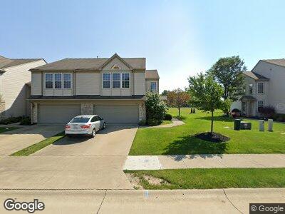
8553 Dunham Dr Olmsted Falls, OH 44138
Estimated Value: $244,000 - $257,315
2
Beds
3
Baths
1,696
Sq Ft
$148/Sq Ft
Est. Value
About This Home
This home is located at 8553 Dunham Dr, Olmsted Falls, OH 44138 and is currently estimated at $251,579, approximately $148 per square foot. 8553 Dunham Dr is a home located in Cuyahoga County with nearby schools including Olmsted Falls Intermediate Building, Falls-Lenox Primary Elementary School, and Olmsted Falls Middle School.
Ownership History
Date
Name
Owned For
Owner Type
Purchase Details
Closed on
Dec 7, 2005
Sold by
Pulte Homes Of Ohio Llc
Bought by
Challenger Roderique A and Challenger Valerie A
Current Estimated Value
Home Financials for this Owner
Home Financials are based on the most recent Mortgage that was taken out on this home.
Original Mortgage
$139,455
Outstanding Balance
$82,801
Interest Rate
6.37%
Mortgage Type
Fannie Mae Freddie Mac
Estimated Equity
$169,738
Create a Home Valuation Report for This Property
The Home Valuation Report is an in-depth analysis detailing your home's value as well as a comparison with similar homes in the area
Home Values in the Area
Average Home Value in this Area
Purchase History
| Date | Buyer | Sale Price | Title Company |
|---|---|---|---|
| Challenger Roderique A | $154,950 | Pulte Title Agency |
Source: Public Records
Mortgage History
| Date | Status | Borrower | Loan Amount |
|---|---|---|---|
| Open | Challenger Roderique A | $139,455 |
Source: Public Records
Tax History Compared to Growth
Tax History
| Year | Tax Paid | Tax Assessment Tax Assessment Total Assessment is a certain percentage of the fair market value that is determined by local assessors to be the total taxable value of land and additions on the property. | Land | Improvement |
|---|---|---|---|---|
| 2024 | $6,266 | $78,925 | $16,870 | $62,055 |
| 2023 | $6,329 | $65,240 | $17,360 | $47,880 |
| 2022 | $6,284 | $65,240 | $17,360 | $47,880 |
| 2021 | $6,229 | $65,240 | $17,360 | $47,880 |
| 2020 | $6,406 | $59,850 | $15,930 | $43,930 |
| 2019 | $5,834 | $171,000 | $45,500 | $125,500 |
| 2018 | $5,241 | $59,850 | $15,930 | $43,930 |
| 2017 | $4,894 | $47,430 | $12,360 | $35,070 |
| 2016 | $4,872 | $47,430 | $12,360 | $35,070 |
| 2015 | $5,076 | $47,430 | $12,360 | $35,070 |
| 2014 | $5,076 | $48,900 | $12,740 | $36,160 |
Source: Public Records
Map
Nearby Homes
- 8481 Jennings Rd
- 0 Schady Rd Unit 5119600
- 0 Schady Rd Unit 5119612
- 0 Schady Rd Unit 5086053
- 36879 W Shore Pkwy
- 27348 Maurer Dr
- 8739 Timber Edge Dr
- 9113 Riverwood Dr
- 9165 Pleasant Ridge Cir
- 0 Bronson Rd
- V/L Bronson Rd
- 9613 Taberna Ln
- 9048 Riverwood Dr
- 9057 Riverwood Dr
- 9032 Riverwood Dr
- 32575 Bagley Rd
- 0 Bagley Rd
- 9831 Seton Dr
- 9000 Riverwood Dr
- 29A Willow Woods Dr
- 8553 Dunham Dr
- 8549 Dunham Dr
- 8549 Dunham Dr Unit 34
- 8561 Dunham Dr
- 8545 Dunham Dr
- 8541 Dunham Dr
- 8565 Dunham Dr
- 8537 Dunham Dr
- 8569 Dunham Dr
- 8573 Dunham Dr
- 29027 Nottingham Ct
- 8533 Dunham Dr
- 8577 Dunham Dr
- 29023 Nottingham Ct
- 29010 Nottingham Ct
- 29019 Nottingham Ct
- 29010 Pembrooke Blvd
- 8581 Dunham Dr
- 29014 Nottingham Ct
- 29015 Nottingham Ct