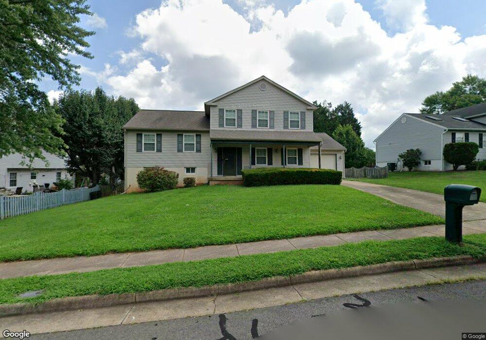
8553 King Carter St Manassas, VA 20110
Estimated Value: $557,000 - $586,083
5
Beds
3
Baths
1,300
Sq Ft
$440/Sq Ft
Est. Value
About This Home
This home is located at 8553 King Carter St, Manassas, VA 20110 and is currently estimated at $571,521, approximately $439 per square foot. 8553 King Carter St is a home located in Manassas City with nearby schools including Weems Elementary School, Mayfield Intermediate School, and Grace E. Metz Middle School.
Ownership History
Date
Name
Owned For
Owner Type
Purchase Details
Closed on
Oct 22, 1998
Sold by
Spiro Leon
Bought by
Fyffe Dewayne
Current Estimated Value
Home Financials for this Owner
Home Financials are based on the most recent Mortgage that was taken out on this home.
Original Mortgage
$163,400
Outstanding Balance
$33,555
Interest Rate
6.74%
Estimated Equity
$537,966
Purchase Details
Closed on
Oct 30, 1995
Sold by
Holt Leigh M
Bought by
Spiro Leon
Home Financials for this Owner
Home Financials are based on the most recent Mortgage that was taken out on this home.
Original Mortgage
$155,650
Interest Rate
7.6%
Create a Home Valuation Report for This Property
The Home Valuation Report is an in-depth analysis detailing your home's value as well as a comparison with similar homes in the area
Home Values in the Area
Average Home Value in this Area
Purchase History
| Date | Buyer | Sale Price | Title Company |
|---|---|---|---|
| Fyffe Dewayne | $168,500 | -- | |
| Spiro Leon | $158,000 | -- |
Source: Public Records
Mortgage History
| Date | Status | Borrower | Loan Amount |
|---|---|---|---|
| Open | Fyffe Dewayne | $163,400 | |
| Previous Owner | Spiro Leon | $155,650 |
Source: Public Records
Tax History
| Year | Tax Paid | Tax Assessment Tax Assessment Total Assessment is a certain percentage of the fair market value that is determined by local assessors to be the total taxable value of land and additions on the property. | Land | Improvement |
|---|---|---|---|---|
| 2025 | $6,790 | $538,900 | $167,000 | $371,900 |
| 2024 | $6,790 | $504,200 | $167,000 | $337,200 |
| 2023 | $6,214 | $493,200 | $162,000 | $331,200 |
| 2022 | $5,855 | $436,300 | $141,000 | $295,300 |
| 2021 | $5,550 | $388,400 | $126,000 | $262,400 |
| 2020 | $5,446 | $373,000 | $121,500 | $251,500 |
| 2019 | $5,387 | $364,000 | $118,000 | $246,000 |
| 2018 | $5,104 | $349,600 | $112,500 | $237,100 |
| 2017 | -- | $341,200 | $112,500 | $228,700 |
| 2016 | $4,607 | $328,400 | $0 | $0 |
| 2015 | -- | $311,800 | $112,500 | $199,300 |
| 2014 | -- | $0 | $0 | $0 |
Source: Public Records
Map
Nearby Homes
- 165 Cabbel Dr
- 105 Kirby St
- 124 Polk Dr
- 129 Evans St
- 169 Scott Dr
- 167 Scott Dr
- 117 Manassas Dr
- 8450 Stonewall Rd
- 8575 Cold Harbor Loop
- 309 Moseby Ct
- 122 Scott Dr
- 8605 Kirby St
- 8552 Cabot Ct
- 250 Manassas Dr
- 8737 Bretton Woods Dr
- 8192 Oakglen Rd
- 113 Colburn Dr
- 8516 Sandstone Way
- 115 Travis St
- 186 Lambert Dr
- 8555 King Carter St
- 8947 Kamlea Dr
- 8945 Kamlea Dr
- 8943 Kamlea Dr
- 8552 King Carter St
- 8949 Kamlea Dr
- 8941 Kamlea Dr
- 8557 King Carter St
- 8556 King Carter St
- 8946 Kamlea Dr
- 8951 Kamlea Dr
- 8939 Kamlea Dr
- 8559 King Carter St
- 8558 King Carter St
- 8948 Kamlea Dr
- 8942 Kamlea Dr
- 8944 Kamlea Dr
- 8940 Kamlea Dr
- 8481 Kirby St
- 8483 Kirby St
Your Personal Tour Guide
Ask me questions while you tour the home.