Estimated Value: $148,000
--
Bed
1
Bath
1,488
Sq Ft
$99/Sq Ft
Est. Value
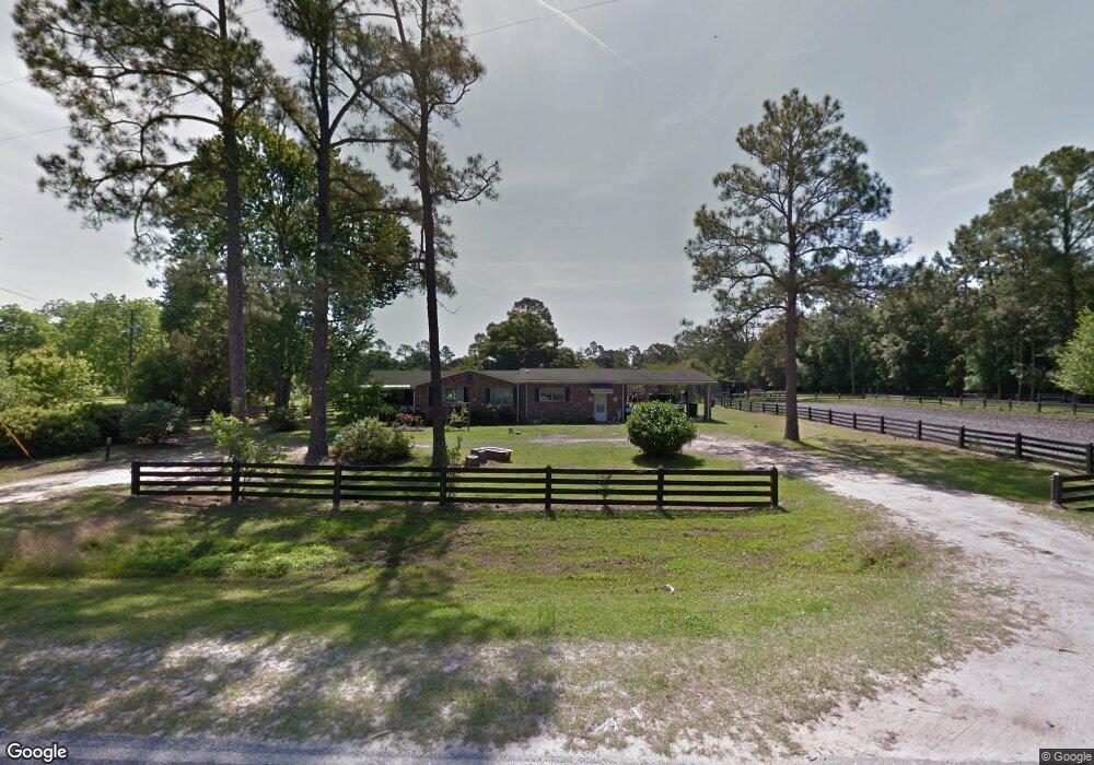
About This Home
This home is located at 8555 Manningtown Rd, Jesup, GA 31546 and is currently estimated at $148,000, approximately $99 per square foot. 8555 Manningtown Rd is a home located in Wayne County with nearby schools including Jesup Elementary School, Arthur Williams Middle School, and Wayne County High School.
Ownership History
Date
Name
Owned For
Owner Type
Purchase Details
Closed on
Oct 30, 2020
Sold by
Wainright Liston
Bought by
Manning Gerald Wayne
Current Estimated Value
Purchase Details
Closed on
Jun 19, 2019
Sold by
Hickox Kandace
Bought by
Wainright Liston
Purchase Details
Closed on
Apr 26, 2019
Sold by
Manning Wayne
Bought by
Manning Wayne
Purchase Details
Closed on
Aug 1, 1987
Bought by
Manning Gerald Wayne
Purchase Details
Closed on
Jul 1, 1985
Bought by
Manning Wayne
Purchase Details
Closed on
Jul 1, 1983
Bought by
Manning Gerald W
Create a Home Valuation Report for This Property
The Home Valuation Report is an in-depth analysis detailing your home's value as well as a comparison with similar homes in the area
Home Values in the Area
Average Home Value in this Area
Purchase History
| Date | Buyer | Sale Price | Title Company |
|---|---|---|---|
| Manning Gerald Wayne | -- | -- | |
| Manning Wayne | -- | -- | |
| Brookington Sheila | -- | -- | |
| Wainright Liston | -- | -- | |
| Manning Wayne | -- | -- | |
| Hickox Kandice | -- | -- | |
| Giddens Becky | -- | -- | |
| Brockington Sheila | -- | -- | |
| Wanning Diane | -- | -- | |
| Manning Gerald Wayne | $4,200 | -- | |
| Manning Wayne | $16,000 | -- | |
| Manning Gerald W | -- | -- |
Source: Public Records
Tax History Compared to Growth
Tax History
| Year | Tax Paid | Tax Assessment Tax Assessment Total Assessment is a certain percentage of the fair market value that is determined by local assessors to be the total taxable value of land and additions on the property. | Land | Improvement |
|---|---|---|---|---|
| 2024 | $353 | $13,308 | $13,308 | $0 |
| 2023 | $399 | $13,308 | $13,308 | $0 |
| 2022 | $419 | $13,308 | $13,308 | $0 |
| 2021 | $449 | $13,308 | $13,308 | $0 |
| 2020 | $1,294 | $54,976 | $28,076 | $26,900 |
| 2019 | $616 | $62,264 | $35,364 | $26,900 |
| 2018 | $611 | $62,264 | $35,364 | $26,900 |
| 2017 | $437 | $62,264 | $35,364 | $26,900 |
Source: Public Records
Map
Nearby Homes
- 7256 Manningtown Rd
- 5100 Flowers Branch Rd
- 1554 Flowers Break Rd
- 0 Rogers Break Unit 1656131
- 301 Broadhurst Rd
- 176 Covey Way Rd
- 0 Johns Rd
- 0N E Rd
- 0 Us Highway 301
- 6911 Old Hortense Rd
- 6406 Mount Pleasant Rd
- 6432 Mount Pleasant Rd
- 694 Overstreet Rd
- 603 Cumberland Rd
- 49 Pine Forest Dr
- 26 Odessa Rd
- 4545 S US Hwy 341
- 12 Par Dr
- 2903 S Us Hwy 301
- 255 Spell Landing Rd