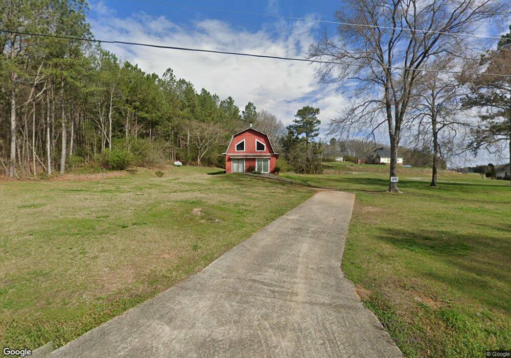
858 Huntington Rd Cedartown, GA 30125
Estimated Value: $222,000 - $240,129
3
Beds
2
Baths
1,406
Sq Ft
$162/Sq Ft
Est. Value
About This Home
This home is located at 858 Huntington Rd, Cedartown, GA 30125 and is currently estimated at $227,782, approximately $162 per square foot. 858 Huntington Rd is a home.
Ownership History
Date
Name
Owned For
Owner Type
Purchase Details
Closed on
Nov 22, 1995
Sold by
Hopkins Shirley Admn
Bought by
Hopkins Shirley
Current Estimated Value
Purchase Details
Closed on
Sep 3, 1986
Sold by
Hopkins Mark T and Hopkins Shirley
Bought by
Hopkins Shirley
Purchase Details
Closed on
Nov 30, 1981
Sold by
Fortune Troy
Bought by
Hopkins Mark
Purchase Details
Closed on
May 28, 1971
Sold by
Joiner W L
Bought by
Fortune Troy L
Purchase Details
Closed on
May 23, 1970
Sold by
Keel James H
Bought by
Joiner W L
Purchase Details
Closed on
Dec 30, 1966
Sold by
Keel James H
Bought by
Keel James H
Purchase Details
Closed on
Nov 7, 1961
Sold by
Tanner M M Mrs
Bought by
Keel James H
Purchase Details
Closed on
Jun 22, 1960
Bought by
Tanner M M Mrs
Create a Home Valuation Report for This Property
The Home Valuation Report is an in-depth analysis detailing your home's value as well as a comparison with similar homes in the area
Home Values in the Area
Average Home Value in this Area
Purchase History
| Date | Buyer | Sale Price | Title Company |
|---|---|---|---|
| Hopkins Shirley | -- | -- | |
| Hopkins Shirley | -- | -- | |
| Hopkins Mark | -- | -- | |
| Fortune Troy L | -- | -- | |
| Joiner W L | -- | -- | |
| Keel James H | -- | -- | |
| Keel James H | -- | -- | |
| Tanner M M Mrs | -- | -- |
Source: Public Records
Tax History Compared to Growth
Tax History
| Year | Tax Paid | Tax Assessment Tax Assessment Total Assessment is a certain percentage of the fair market value that is determined by local assessors to be the total taxable value of land and additions on the property. | Land | Improvement |
|---|---|---|---|---|
| 2024 | $972 | $61,231 | $5,175 | $56,056 |
| 2023 | $635 | $40,166 | $5,175 | $34,991 |
| 2022 | $470 | $33,188 | $3,450 | $29,738 |
| 2021 | $476 | $33,188 | $3,450 | $29,738 |
| 2020 | $477 | $33,188 | $3,450 | $29,738 |
| 2019 | $424 | $29,138 | $3,450 | $25,688 |
| 2018 | $413 | $28,341 | $3,450 | $24,891 |
| 2017 | $404 | $28,341 | $3,450 | $24,891 |
| 2016 | $412 | $28,648 | $5,184 | $23,464 |
| 2015 | $384 | $27,594 | $5,184 | $22,410 |
| 2014 | $386 | $27,594 | $5,184 | $22,410 |
Source: Public Records
Map
Nearby Homes
- 0 Buchanan Hwy Unit 10558945
- 0 Youngs Farm Rd Unit 24829378
- 00 Antioch Rd
- 160 Tate Rd
- 95 Wieuca Way
- 4550 Buchanan Hwy
- 0 Wieuca Way Unit 10614129
- 000 Wieuca Way
- 142 Acres On Judkin Mill Rd
- 766 Antioch Rd
- 00 Buchanan Hwy
- 1987 Buchanan Hwy
- 4267 Buchanan Hwy
- 35 Old Mill Rd
- 497 Judkin Mill Rd
- 203 Cason Rd
- 525 Grogan Rd
- 0 Judkin Mill Rd Unit LotWP001 19369404
- 539 Grogan Rd
- 557 Grogan Rd
- 801 Huntington Rd
- 874 Huntington Rd
- 785 Huntington Rd
- 775 Huntington Rd
- 728 Huntington Rd
- 709 Huntington Rd
- 3123 Buchanan Hwy
- 112 York Cir
- 811 Huntington Rd
- 689 Huntington Rd
- 696 Huntington Rd
- 45 York Cir
- 3198 Buchanan Hwy
- 86 York Cir
- 677 Huntington Rd
- 682 Huntington Rd
- 0 York Cir Unit 8125732
- 0 York Cir Unit 7580905
- 70 York Cir
- 642 Huntington Rd