Estimated Value: $769,000 - $1,002,000
3
Beds
2
Baths
1,650
Sq Ft
$531/Sq Ft
Est. Value
About This Home
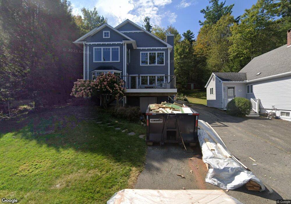
This home is located at 858 Tolland Rd, Otis, MA 01253 and is currently estimated at $875,853, approximately $530 per square foot. 858 Tolland Rd is a home located in Berkshire County with nearby schools including Farmington River Elementary School.
Ownership History
Date
Name
Owned For
Owner Type
Purchase Details
Closed on
Jul 18, 2011
Sold by
Bell Frederick C and Bell Patricia A
Bought by
Pelland Thomas G and Pelland Natalie A
Current Estimated Value
Home Financials for this Owner
Home Financials are based on the most recent Mortgage that was taken out on this home.
Original Mortgage
$265,000
Outstanding Balance
$182,913
Interest Rate
4.58%
Mortgage Type
Purchase Money Mortgage
Estimated Equity
$692,940
Purchase Details
Closed on
Aug 18, 1998
Sold by
Margret S Knowles Ret and Knowles Margret S
Bought by
Bell Frederick C and Bell Patricia A
Home Financials for this Owner
Home Financials are based on the most recent Mortgage that was taken out on this home.
Original Mortgage
$176,000
Interest Rate
6.94%
Mortgage Type
Purchase Money Mortgage
Create a Home Valuation Report for This Property
The Home Valuation Report is an in-depth analysis detailing your home's value as well as a comparison with similar homes in the area
Home Values in the Area
Average Home Value in this Area
Purchase History
| Date | Buyer | Sale Price | Title Company |
|---|---|---|---|
| Pelland Thomas G | $465,000 | -- | |
| Pelland Thomas G | $465,000 | -- | |
| Bell Frederick C | $220,000 | -- | |
| Bell Frederick C | $220,000 | -- |
Source: Public Records
Mortgage History
| Date | Status | Borrower | Loan Amount |
|---|---|---|---|
| Open | Pelland Thomas G | $265,000 | |
| Closed | Bell Frederick C | $265,000 | |
| Previous Owner | Bell Frederick C | $176,000 |
Source: Public Records
Tax History Compared to Growth
Tax History
| Year | Tax Paid | Tax Assessment Tax Assessment Total Assessment is a certain percentage of the fair market value that is determined by local assessors to be the total taxable value of land and additions on the property. | Land | Improvement |
|---|---|---|---|---|
| 2025 | $5,231 | $809,800 | $115,300 | $694,500 |
| 2024 | $4,999 | $771,400 | $113,400 | $658,000 |
| 2023 | $5,060 | $764,300 | $106,300 | $658,000 |
| 2022 | $4,112 | $530,600 | $102,500 | $428,100 |
| 2021 | $3,734 | $440,800 | $102,500 | $338,300 |
| 2020 | $3,620 | $434,100 | $102,500 | $331,600 |
| 2019 | $3,594 | $434,100 | $102,500 | $331,600 |
| 2018 | $4,856 | $434,100 | $102,500 | $331,600 |
| 2017 | $3,508 | $434,100 | $102,500 | $331,600 |
| 2016 | $3,434 | $437,400 | $102,500 | $334,900 |
| 2015 | $3,149 | $418,200 | $76,800 | $341,400 |
Source: Public Records
Map
Nearby Homes
- 168 Tolland Rd
- 91 Pike Rd
- 7 Reservoir Heights Rd
- 129 W Shore Rd
- 23 S Pine St
- 185 Pine Rd
- 98 Loop Dr
- 369 Pine Rd
- 307 Stanley Rd
- 454 Pine Rd
- 58 Stanley Rd
- 56 Otis-Tolland Rd
- 0 Leisure Ln
- 236 Ridge Ave
- 134 Kibbe Rd
- 15B-7 E Otis Rd
- 38 Norton Road Extension
- 36 Brookman Dr
- 30 Brookman Dr
- 0 Curtis Hall Rd Unit 73425043
- 2012 E Otis Rd
- 2152 E Otis Rd
- 2099 E Otis Rd
- 0 E Otis Rd Unit 70715807
- 0 E Otis Rd Unit 70727727
- 0 E Otis Rd Unit 70827400
- 0 E Otis Rd Unit 72040484
- 0 E Otis Rd Unit 246507
- 0 E Otis Rd Unit 70191105
- 0 E Otis Rd Unit 178703
- 0 E Otis Rd Unit 171914
- 0 E Otis Rd Unit 168556
- 0 E Otis Rd Unit 168330
- 0 E Otis Rd Unit 161970
- 0 E Otis Rd Unit 159354
- 0 E Otis Rd Unit 148721
- 0 E Otis Rd Unit 147843
- 0 E Otis Rd Unit 73252862
- 0 E Otis Rd Unit 239459
- 0 E Otis Rd Unit 70645673