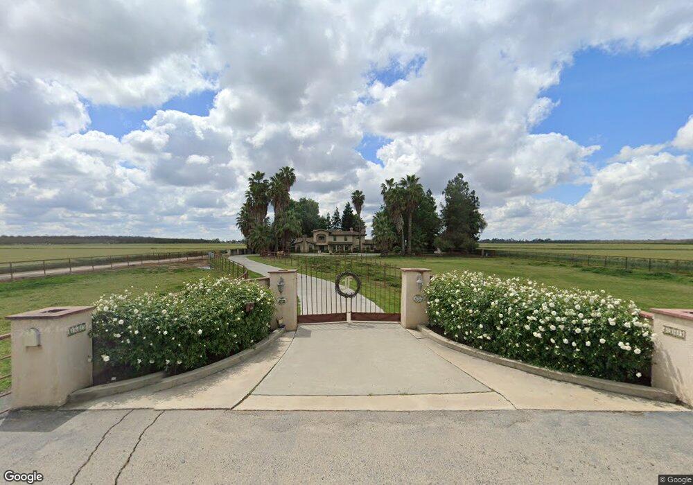
8585 Flint Ave Hanford, CA 93230
Estimated Value: $695,000 - $1,172,736
3
Beds
4
Baths
4,080
Sq Ft
$245/Sq Ft
Est. Value
About This Home
This home is located at 8585 Flint Ave, Hanford, CA 93230 and is currently estimated at $1,001,245, approximately $245 per square foot. 8585 Flint Ave is a home located in Kings County with nearby schools including Hanford High School, Kings River-Hardwick Elementary School, and Pioneer Middle School.
Ownership History
Date
Name
Owned For
Owner Type
Purchase Details
Closed on
Aug 15, 2012
Sold by
Fagundes John L and Fagundes John L
Bought by
Fagundes John L
Current Estimated Value
Home Financials for this Owner
Home Financials are based on the most recent Mortgage that was taken out on this home.
Original Mortgage
$365,000
Interest Rate
3.53%
Mortgage Type
New Conventional
Purchase Details
Closed on
Jan 31, 2011
Sold by
Fagundes Donna K
Bought by
Fagundes John L
Home Financials for this Owner
Home Financials are based on the most recent Mortgage that was taken out on this home.
Original Mortgage
$125,000
Interest Rate
4.9%
Mortgage Type
Seller Take Back
Create a Home Valuation Report for This Property
The Home Valuation Report is an in-depth analysis detailing your home's value as well as a comparison with similar homes in the area
Home Values in the Area
Average Home Value in this Area
Purchase History
| Date | Buyer | Sale Price | Title Company |
|---|---|---|---|
| Fagundes John L | -- | Fidelity National Title Comp | |
| Fagundes John L | -- | None Available |
Source: Public Records
Mortgage History
| Date | Status | Borrower | Loan Amount |
|---|---|---|---|
| Closed | Fagundes John L | $365,000 | |
| Closed | Fagundes John L | $125,000 |
Source: Public Records
Tax History
| Year | Tax Paid | Tax Assessment Tax Assessment Total Assessment is a certain percentage of the fair market value that is determined by local assessors to be the total taxable value of land and additions on the property. | Land | Improvement |
|---|---|---|---|---|
| 2025 | $6,382 | $614,132 | $106,709 | $507,423 |
| 2023 | $6,382 | $590,286 | $102,566 | $487,720 |
| 2022 | $6,144 | $578,712 | $100,555 | $478,157 |
| 2021 | $6,021 | $567,366 | $98,584 | $468,782 |
| 2020 | $5,943 | $561,548 | $97,573 | $463,975 |
| 2019 | $5,891 | $550,537 | $95,660 | $454,877 |
| 2018 | $5,753 | $536,862 | $90,904 | $445,958 |
| 2017 | $5,650 | $529,159 | $91,945 | $437,214 |
| 2016 | $5,498 | $518,783 | $90,142 | $428,641 |
| 2015 | $5,436 | $510,990 | $88,788 | $422,202 |
| 2014 | $5,359 | $500,981 | $87,049 | $413,932 |
Source: Public Records
Map
Nearby Homes
- 952 Meadow View Rd
- 907 E Palm Dr
- 982 Cedarwood St
- 950 Cedarwood St
- 6505 10th Ave
- 603 E Capistrano St
- 2411 Cottonwood Dr
- 2343 Cottonwood Dr
- 821 E Redwood Cir
- 594 Diana Ct
- 968 Lakewood Dr
- 969 Lakewood Dr
- 2202 Cottonwood Ct
- 399 Palm Cir
- 259 E Sherwood Dr
- 2134 Oakwood Ct
- 2504 N Kensington Way
- 0 Flint Ave
- 450 E Birch Ave
- 1306 Waterview St
- 8768 Flint Ave
- 8481 Flint Ave
- 8874 Flint Ave
- 8361 Flint Ave
- 8888 Flint Ave
- 8290 Flint Ave
- 9009 Flint Ave
- 8289 Flint Ave
- 6728 8 1/2 Ave
- 9036 Flint Ave
- 6720 8 1/2 Ave
- 8229 Flint Ave
- 7514 8 1/2 Ave
- 9210 Flint Ave
- 6454 8 1/2 Ave
- 6454 8 1 2 Ave
- 6391 8 1/2 Ave
- 7900 8 1/2 Ave
- 8576 Fargo Ave
- 7541 Highway 43