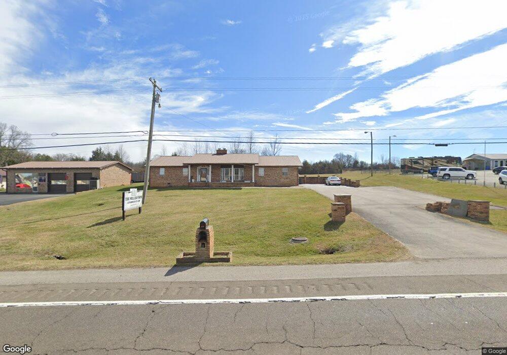
859 E Highway 11 E Jefferson City, TN 37760
Estimated Value: $336,212 - $458,000
--
Bed
2
Baths
2,150
Sq Ft
$180/Sq Ft
Est. Value
About This Home
This home is located at 859 E Highway 11 E, Jefferson City, TN 37760 and is currently estimated at $387,737, approximately $180 per square foot. 859 E Highway 11 E is a home located in Jefferson County.
Ownership History
Date
Name
Owned For
Owner Type
Purchase Details
Closed on
Nov 3, 2015
Sold by
Holt Frank
Bought by
Holt George Gary and Holt Lea-Ann
Current Estimated Value
Purchase Details
Closed on
Mar 29, 1988
Bought by
Holt George L and Holt Dorothy B
Purchase Details
Closed on
Oct 5, 1987
Purchase Details
Closed on
Jan 30, 1987
Bought by
Prater Anna M
Purchase Details
Closed on
Aug 19, 1983
Bought by
Prater Harry and Prater Anna M
Create a Home Valuation Report for This Property
The Home Valuation Report is an in-depth analysis detailing your home's value as well as a comparison with similar homes in the area
Home Values in the Area
Average Home Value in this Area
Purchase History
| Date | Buyer | Sale Price | Title Company |
|---|---|---|---|
| Holt George Gary | -- | -- | |
| Holt George L | -- | -- | |
| -- | $65,000 | -- | |
| Prater Anna M | -- | -- | |
| Prater Harry | -- | -- |
Source: Public Records
Tax History Compared to Growth
Tax History
| Year | Tax Paid | Tax Assessment Tax Assessment Total Assessment is a certain percentage of the fair market value that is determined by local assessors to be the total taxable value of land and additions on the property. | Land | Improvement |
|---|---|---|---|---|
| 2025 | $2,869 | $117,760 | $32,240 | $85,520 |
| 2023 | $2,869 | $81,960 | $0 | $0 |
| 2022 | $2,779 | $81,960 | $25,800 | $56,160 |
| 2021 | $2,779 | $81,960 | $25,800 | $56,160 |
| 2020 | $2,779 | $81,960 | $25,800 | $56,160 |
| 2019 | $2,779 | $81,960 | $25,800 | $56,160 |
| 2018 | $2,728 | $76,840 | $24,600 | $52,240 |
| 2017 | $2,728 | $76,840 | $24,600 | $52,240 |
| 2016 | $2,728 | $76,840 | $24,600 | $52,240 |
| 2015 | $2,689 | $76,840 | $24,600 | $52,240 |
| 2014 | $2,651 | $76,840 | $24,600 | $52,240 |
Source: Public Records
Map
Nearby Homes
- Parcel 086 N Chucky Pike
- 248 Belle Ct
- 230 Fieldcrest Dr
- 120 Waverly Path
- 509 Alpine Cir
- 1171 W E Hwy 11e E
- 1601 Mossy Oak Dr
- 8020 W Pointe Dr
- 104 Settlers Ln
- 8070 W Pointe Dr
- 1003 Battle Ridge
- 1004 Battle Ridge
- Cabral Plan at Battle Ridge
- Macon Plan at Battle Ridge
- Aria Plan at Battle Ridge
- Sullivan Plan at Battle Ridge
- Freeport Plan at Battle Ridge
- Glendale Plan at Battle Ridge
- Cali Plan at Battle Ridge
- Belhaven Plan at Battle Ridge
- 867 E Highway 11 E
- 875 E Highway 11 E
- 864 E Highway 11 E
- 2109 Fraker Rd
- 868 E Highway 11 E
- 839 E Broadway Blvd
- 2131 Fraker Rd
- 911 E Broadway Blvd
- 0 E Highway 11 E
- 2120 Fraker Rd
- 2139 Fraker Rd
- 2132 Fraker Rd
- 2134 Fraker Rd
- 272 Rocktown Rd
- 334 Rocktown Rd
- 340 Rocktown Rd
- 818 E Broadway Blvd
- 2138 Fraker Rd
- 808 E Broadway Blvd
- 2215 Moser Rd