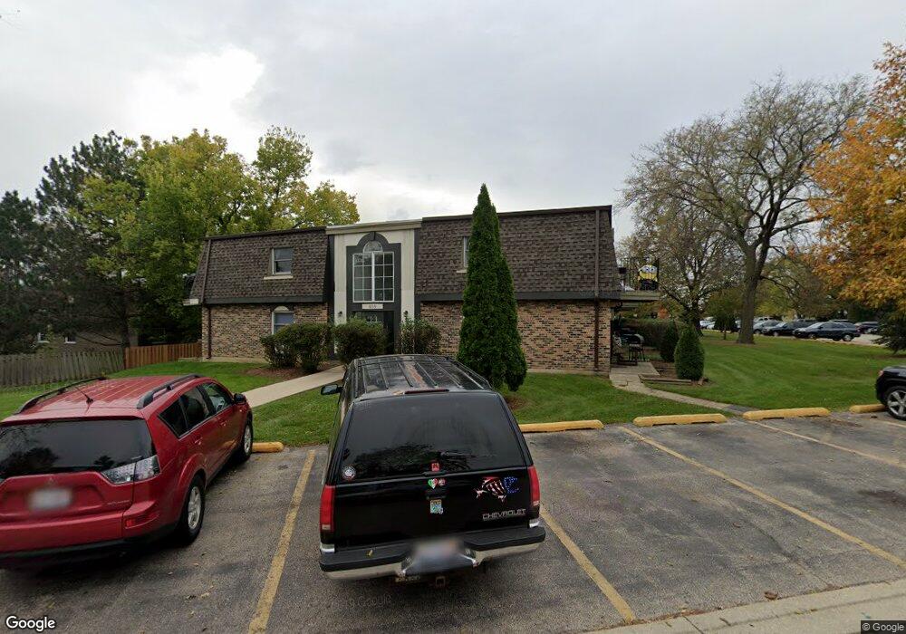
859 Trace Dr Unit 2207 Buffalo Grove, IL 60089
South Buffalo Grove NeighborhoodEstimated Value: $119,000 - $170,000
2
Beds
--
Bath
900
Sq Ft
$171/Sq Ft
Est. Value
About This Home
This home is located at 859 Trace Dr Unit 2207, Buffalo Grove, IL 60089 and is currently estimated at $153,617, approximately $170 per square foot. 859 Trace Dr Unit 2207 is a home located in Cook County with nearby schools including Edgar A. Poe Elementary School, Cooper Middle School, and Buffalo Grove High School.
Ownership History
Date
Name
Owned For
Owner Type
Purchase Details
Closed on
Sep 15, 2011
Sold by
First Midwest Bank
Bought by
Shamo Adnan
Current Estimated Value
Purchase Details
Closed on
Jul 29, 2011
Sold by
Shamo Adnan and Shamo Sheila
Bought by
Adnan N Shamo Revocable Living Trust and Sheila E Shamo Revocable Living Trust
Purchase Details
Closed on
Jul 28, 2009
Sold by
Shamo Adnan
Bought by
First Midwest Bank and Trust #8507
Purchase Details
Closed on
Mar 17, 1999
Sold by
Kwilas Regina D
Bought by
Shamo Adnan
Create a Home Valuation Report for This Property
The Home Valuation Report is an in-depth analysis detailing your home's value as well as a comparison with similar homes in the area
Home Values in the Area
Average Home Value in this Area
Purchase History
| Date | Buyer | Sale Price | Title Company |
|---|---|---|---|
| Shamo Adnan | -- | None Available | |
| Adnan N Shamo Revocable Living Trust | -- | None Available | |
| First Midwest Bank | -- | None Available | |
| Shamo Adnan | $51,000 | -- |
Source: Public Records
Tax History Compared to Growth
Tax History
| Year | Tax Paid | Tax Assessment Tax Assessment Total Assessment is a certain percentage of the fair market value that is determined by local assessors to be the total taxable value of land and additions on the property. | Land | Improvement |
|---|---|---|---|---|
| 2024 | $3,611 | $11,281 | $2,916 | $8,365 |
| 2023 | $3,474 | $11,281 | $2,916 | $8,365 |
| 2022 | $3,474 | $11,281 | $2,916 | $8,365 |
| 2021 | $2,211 | $6,258 | $291 | $5,967 |
| 2020 | $2,152 | $6,258 | $291 | $5,967 |
| 2019 | $2,141 | $6,914 | $291 | $6,623 |
| 2018 | $1,878 | $5,452 | $233 | $5,219 |
| 2017 | $1,843 | $5,452 | $233 | $5,219 |
| 2016 | $1,712 | $5,452 | $233 | $5,219 |
| 2015 | $1,814 | $5,341 | $1,458 | $3,883 |
| 2014 | $1,784 | $5,341 | $1,458 | $3,883 |
| 2013 | $1,650 | $5,341 | $1,458 | $3,883 |
Source: Public Records
Map
Nearby Homes
- 705 Grove Dr Unit 101
- 751 W Happfield Dr Unit 30
- 5 Villa Verde Dr Unit 207
- 715 W Happfield Dr
- 476 W Happfield Dr Unit 10AL
- 6 Villa Verde Dr Unit 103
- 720 Weidner Rd Unit 302
- 715 W Whiting Ln
- 18 E Heritage Ct
- 1130 Bernard Dr
- 812 W Whiting Ln
- 3227 N Heritage Ln
- 780 Weidner Rd Unit 300
- 3222 N Heritage Ln
- 859 Beechwood Rd
- 1115 Miller Ln Unit 104
- 813 Stradford Cir Unit 21B2
- 972 Thornton Ln Unit 102
- 1149 Miller Ln Unit 107
- 820 Weidner Rd Unit 409
- 859 Trace Dr Unit 2210
- 859 Trace Dr Unit 2208
- 859 Trace Dr Unit 2203
- 859 Trace Dr Unit 2202
- 859 Trace Dr Unit 2205
- 859 Trace Dr Unit 2107
- 859 Trace Dr Unit 2110
- 859 Trace Dr Unit 2206
- 859 Trace Dr Unit 2108
- 859 Trace Dr Unit 205
- 859 Trace Dr Unit 210
- 859 Trace Dr Unit 105
- 859 Trace Dr Unit 110
- 879 Trace Dr Unit 206
- 879 Trace Dr Unit 1206
- 879 Trace Dr Unit 1101
- 879 Trace Dr Unit 1205
- 879 Trace Dr Unit 1203
- 879 Trace Dr Unit 1201
- 879 Trace Dr Unit 1107