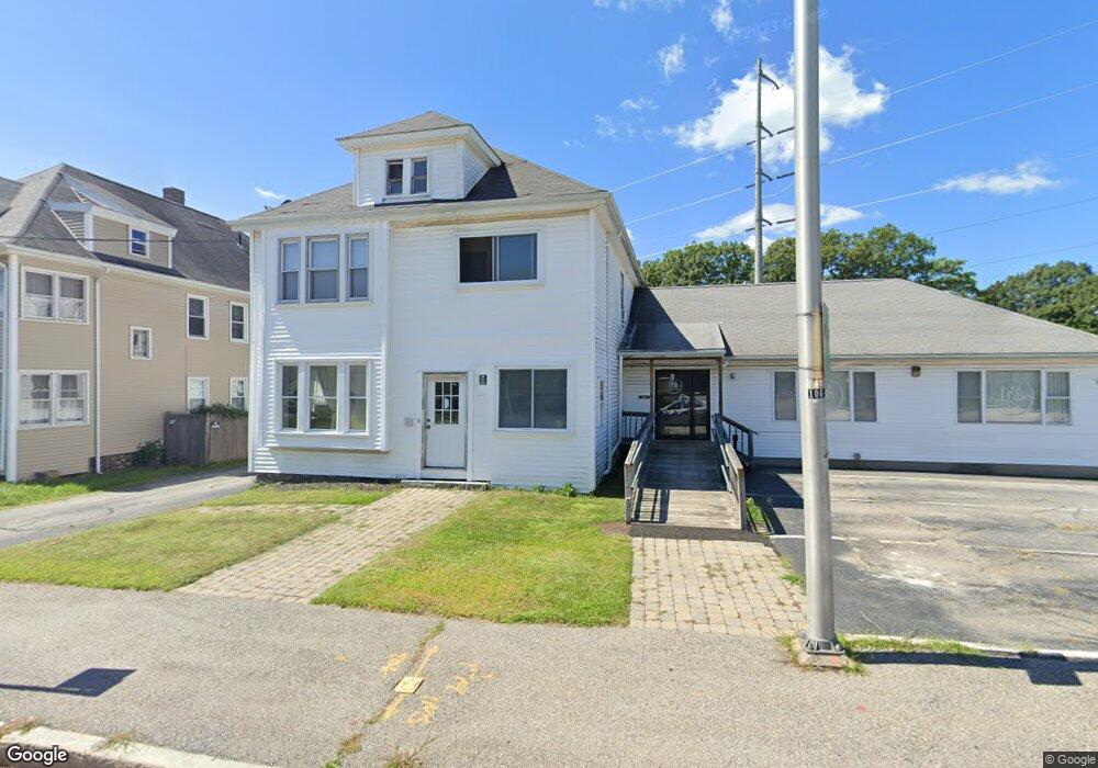
859 W Boylston St Unit 1 Worcester, MA 01606
Greendale NeighborhoodEstimated Value: $660,685
--
Bed
15
Baths
1,920
Sq Ft
$344/Sq Ft
Est. Value
About This Home
This home is located at 859 W Boylston St Unit 1, Worcester, MA 01606 and is currently estimated at $660,685, approximately $344 per square foot. 859 W Boylston St Unit 1 is a home located in Worcester County with nearby schools including Norrback Avenue Elementary School, Jacob Hiatt Magnet School, and Chandler Magnet.
Ownership History
Date
Name
Owned For
Owner Type
Purchase Details
Closed on
Oct 28, 2022
Sold by
Dewolfe Properties Llc
Bought by
Mayo Family Re Hldg Llc
Current Estimated Value
Home Financials for this Owner
Home Financials are based on the most recent Mortgage that was taken out on this home.
Original Mortgage
$275,000
Outstanding Balance
$264,269
Interest Rate
6.02%
Mortgage Type
Purchase Money Mortgage
Estimated Equity
$396,416
Purchase Details
Closed on
Mar 29, 2017
Sold by
Dewolfe Gary and Dewolfe Kenneth
Bought by
Dewolfe Properties Llc
Create a Home Valuation Report for This Property
The Home Valuation Report is an in-depth analysis detailing your home's value as well as a comparison with similar homes in the area
Home Values in the Area
Average Home Value in this Area
Purchase History
| Date | Buyer | Sale Price | Title Company |
|---|---|---|---|
| Mayo Family Re Hldg Llc | $549,000 | None Available | |
| Dewolfe Properties Llc | -- | -- |
Source: Public Records
Mortgage History
| Date | Status | Borrower | Loan Amount |
|---|---|---|---|
| Open | Mayo Family Re Hldg Llc | $275,000 |
Source: Public Records
Tax History Compared to Growth
Tax History
| Year | Tax Paid | Tax Assessment Tax Assessment Total Assessment is a certain percentage of the fair market value that is determined by local assessors to be the total taxable value of land and additions on the property. | Land | Improvement |
|---|---|---|---|---|
| 2025 | -- | $533,500 | $221,400 | $312,100 |
| 2024 | -- | $485,500 | $221,400 | $264,100 |
| 2023 | $0 | $552,500 | $192,500 | $360,000 |
| 2022 | $0 | $461,200 | $192,500 | $268,700 |
| 2021 | $0 | $426,600 | $146,600 | $280,000 |
| 2020 | $0 | $410,400 | $146,600 | $263,800 |
| 2019 | $0 | $394,500 | $146,600 | $247,900 |
| 2018 | $0 | $384,700 | $146,600 | $238,100 |
| 2017 | $0 | $384,700 | $146,600 | $238,100 |
| 2016 | -- | $369,500 | $142,100 | $227,400 |
| 2015 | -- | $369,500 | $142,100 | $227,400 |
| 2014 | $9,292 | $369,400 | $142,100 | $227,300 |
Source: Public Records
Map
Nearby Homes
- 49 E Mountain St
- 87 Malden St
- 12 Dixfield Rd
- 9 Idalla Ave
- 29 E Mountain
- 10 Beale St
- 31 Danielles Way
- 22 Danielles Way
- 26 Danielles Way
- 15 Cumberland St
- 15 Inwood Rd
- 1110 W Boylston St Unit A
- 23 Orono St
- 29 Isleboro St
- 33 Isleboro St
- 95 Saint Nicholas Ave
- 40 Francis St
- 71 Hillside Village Dr
- 2 Maria Ln Unit 2
- 28 Brooks St
- 859 W Boylston St
- 857 W Boylston St
- 857 W Boylston St Unit 1
- 857 W Boylston St Unit 2
- 856 W Boylston St
- 854 W Boylston St
- 868 W Boylston St Unit 8
- 868 W Boylston St Unit 6
- 868 W Boylston St Unit 4
- 1 Vendora Rd
- 852 W Boylston St
- 1 Hunnewell Rd
- 27 W Mountain St
- 28 W Mountain St
- 3 Vendora Rd
- 0 West Mountain Unit 72195171
- 3 Hunnewell Rd
- 2 Vendora Rd
- 3 Triangle St
- 5 Vendora Rd