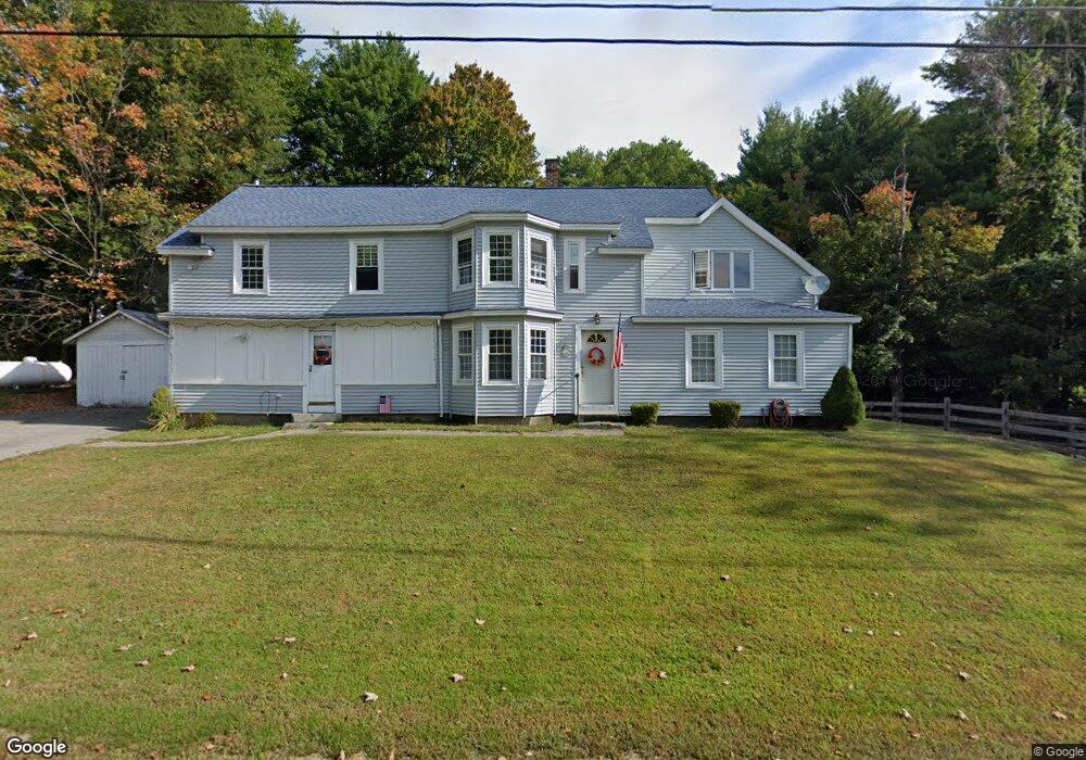
86 1st Crown Point Rd Strafford, NH 03884
Estimated Value: $486,086 - $579,000
4
Beds
2
Baths
3,092
Sq Ft
$176/Sq Ft
Est. Value
About This Home
This home is located at 86 1st Crown Point Rd, Strafford, NH 03884 and is currently estimated at $544,522, approximately $176 per square foot. 86 1st Crown Point Rd is a home located in Strafford County with nearby schools including Strafford School and Coe-Brown Northwood Academy.
Ownership History
Date
Name
Owned For
Owner Type
Purchase Details
Closed on
Aug 16, 2005
Sold by
Reilly Vincent
Bought by
Postle William R and Postle Janette L
Current Estimated Value
Home Financials for this Owner
Home Financials are based on the most recent Mortgage that was taken out on this home.
Original Mortgage
$240,000
Interest Rate
5.54%
Create a Home Valuation Report for This Property
The Home Valuation Report is an in-depth analysis detailing your home's value as well as a comparison with similar homes in the area
Home Values in the Area
Average Home Value in this Area
Purchase History
| Date | Buyer | Sale Price | Title Company |
|---|---|---|---|
| Postle William R | $240,000 | -- |
Source: Public Records
Mortgage History
| Date | Status | Borrower | Loan Amount |
|---|---|---|---|
| Open | Postle William R | $299,679 | |
| Closed | Postle William R | $315,425 | |
| Closed | Postle William R | $279,125 | |
| Closed | Postle William R | $240,000 |
Source: Public Records
Tax History Compared to Growth
Tax History
| Year | Tax Paid | Tax Assessment Tax Assessment Total Assessment is a certain percentage of the fair market value that is determined by local assessors to be the total taxable value of land and additions on the property. | Land | Improvement |
|---|---|---|---|---|
| 2024 | $6,539 | $330,900 | $63,000 | $267,900 |
| 2023 | $6,168 | $330,900 | $63,000 | $267,900 |
| 2022 | $5,668 | $330,900 | $63,000 | $267,900 |
| 2021 | $6,084 | $329,600 | $63,000 | $266,600 |
| 2020 | $5,894 | $229,800 | $57,000 | $172,800 |
| 2019 | $5,393 | $229,800 | $57,000 | $172,800 |
| 2018 | $5,444 | $230,400 | $57,000 | $173,400 |
| 2016 | $4,896 | $230,400 | $57,000 | $173,400 |
| 2015 | $4,591 | $210,500 | $69,700 | $140,800 |
| 2014 | $4,875 | $210,500 | $69,700 | $140,800 |
| 2013 | $4,774 | $210,500 | $69,700 | $140,800 |
| 2012 | $4,711 | $210,500 | $69,700 | $140,800 |
Source: Public Records
Map
Nearby Homes
- 948 Strafford Rd
- 345 Dry Hill Rd
- 243 Second Crown Point Rd
- 38 Strafford Rd
- 86 Long Shores Dr
- 68 Berry River Rd
- 0 Long Shores Dr Unit 5057687
- 83 Sloper Rd
- 0 Sloper Rd Unit 6
- 272 Walnut St
- 00 Squire Rd
- Map 220 Lot 16 Four Rod Rd
- 217-13 Washington St
- 212-0003-01 Washington St
- 207-002 Washington St
- 40 Dry Hill Rd Unit Lot 0250/0006/0000
- 10 Blue Hills Dr
- 30 Avalon Rd
- 8 Juniper Ln
- 395 Greenhill Rd
- 94 1st Crown Point Rd
- 94 1st Crown Point Rd
- 89 1st Crown Point Rd
- 100 1st Crown Point Rd
- 59 1st Crown Point Rd
- 58 1st Crown Point Rd
- 70 1st Crown Point Rd
- 128 1st Crown Point Rd
- 132 1st Crown Point Rd
- 119 1st Crown Point Rd
- 137 1st Crown Point Rd
- 7 Jodi Ln
- 145 1st Crown Point Rd
- 192 1st Crown Point Rd
- 25 Jodi Ln
- 25 Kristie Ln
- 29 Jodi Ln
- 39 Jodi Ln
- Lot 13 Jodi Ln Unit 13
- 149 1st Crown Point Rd