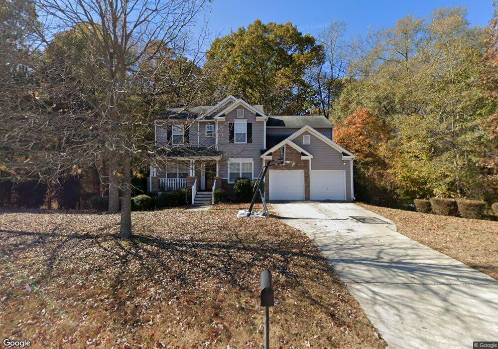
86 Bridgestone Ln Douglasville, GA 30134
Estimated Value: $335,000 - $373,000
4
Beds
3
Baths
2,399
Sq Ft
$148/Sq Ft
Est. Value
About This Home
This home is located at 86 Bridgestone Ln, Douglasville, GA 30134 and is currently estimated at $355,670, approximately $148 per square foot. 86 Bridgestone Ln is a home located in Paulding County with nearby schools including Connie Dugan Elementary School, Irma C. Austin Middle School, and South Paulding High School.
Ownership History
Date
Name
Owned For
Owner Type
Purchase Details
Closed on
Sep 3, 2025
Sold by
Robinson William
Bought by
Robinson Shanetta W and Robinson William
Current Estimated Value
Purchase Details
Closed on
May 28, 2004
Sold by
Colony Homes Llc
Bought by
Robinson Shanetta W
Home Financials for this Owner
Home Financials are based on the most recent Mortgage that was taken out on this home.
Original Mortgage
$161,900
Interest Rate
6.25%
Mortgage Type
New Conventional
Create a Home Valuation Report for This Property
The Home Valuation Report is an in-depth analysis detailing your home's value as well as a comparison with similar homes in the area
Home Values in the Area
Average Home Value in this Area
Purchase History
| Date | Buyer | Sale Price | Title Company |
|---|---|---|---|
| Robinson Shanetta W | -- | -- | |
| Robinson Shanetta W | $179,900 | -- |
Source: Public Records
Mortgage History
| Date | Status | Borrower | Loan Amount |
|---|---|---|---|
| Previous Owner | Robinson Shanetta W | $161,900 |
Source: Public Records
Tax History Compared to Growth
Tax History
| Year | Tax Paid | Tax Assessment Tax Assessment Total Assessment is a certain percentage of the fair market value that is determined by local assessors to be the total taxable value of land and additions on the property. | Land | Improvement |
|---|---|---|---|---|
| 2024 | $3,371 | $138,772 | $12,000 | $126,772 |
| 2023 | $3,867 | $150,864 | $12,000 | $138,864 |
| 2022 | $3,238 | $126,068 | $12,000 | $114,068 |
| 2021 | $2,509 | $88,184 | $8,000 | $80,184 |
| 2020 | $2,460 | $84,668 | $8,000 | $76,668 |
| 2019 | $2,270 | $77,188 | $8,000 | $69,188 |
| 2018 | $2,076 | $70,752 | $8,800 | $61,952 |
| 2017 | $1,982 | $66,760 | $8,800 | $57,960 |
| 2016 | $1,668 | $57,032 | $8,800 | $48,232 |
| 2015 | $1,362 | $46,104 | $8,800 | $37,304 |
| 2014 | $1,235 | $40,984 | $8,800 | $32,184 |
| 2013 | -- | $33,720 | $8,800 | $24,920 |
Source: Public Records
Map
Nearby Homes
- 27 Waterbury Way
- 4 Kings Walk
- 94 Oberlochen Way
- 58 Regent Ct
- 40 Stratford Dr
- 328 Abbington Ln
- 1050 Denton Rd
- 51 Bedford Ct
- 199 River Walk
- 512 Oakbridge Dr
- 214 Bruce Rd
- 1150 Denton Rd Unit 371
- 1150 Denton Rd
- 840 Whitby Dr
- 795 Abbington Ln
- 32 Sharon Place
- 212 Warrenton Dr
- 50 Carrington Hills
- 1 Wellington Walk
- 60 Warrenton Dr
- 79 Bridgestone Ln
- 62 Bridgestone Ln
- 47 Bridgestone Ln
- 42 Bridgestone Ln
- 114 Bridgstone Ln
- 114 Bridgestone Ln
- 18 Bridgestone Ln
- 17 Bridgestone Ln
- 143 Bridgestone Ln
- 156 Bridgestone Ln
- 159 Bridgestone Ln
- 165 Bridgestone Ln Unit 165
- 165 Bridgestone Ln
- 5 Bridgestone Ln
- 180 Bridgestone Ln
- 7 Waterbury Way
- 6 Waterbury Way
- 39 Vickers Place
- 3 Bridgestone Ln
- 55 Vickers Place