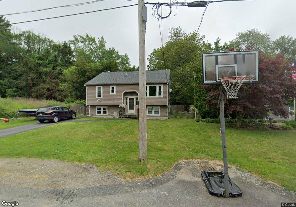
86 Hubbard Ave Brockton, MA 02301
Campello NeighborhoodEstimated Value: $511,000 - $623,000
3
Beds
2
Baths
1,450
Sq Ft
$378/Sq Ft
Est. Value
About This Home
This home is located at 86 Hubbard Ave, Brockton, MA 02301 and is currently estimated at $547,449, approximately $377 per square foot. 86 Hubbard Ave is a home located in Plymouth County with nearby schools including Davis K-8 School, John F. Kennedy Elementary School, and South Middle School.
Ownership History
Date
Name
Owned For
Owner Type
Purchase Details
Closed on
Aug 19, 2024
Sold by
Creney Helen A and Creney Edward M
Bought by
Creney Helen A and Creney Edward M
Current Estimated Value
Purchase Details
Closed on
Oct 5, 2009
Sold by
Creney Helen Lorray and Creney Helen A
Bought by
Creney Helen A and Creney Edward M
Home Financials for this Owner
Home Financials are based on the most recent Mortgage that was taken out on this home.
Original Mortgage
$50,000
Interest Rate
5.12%
Mortgage Type
Purchase Money Mortgage
Purchase Details
Closed on
Apr 3, 2006
Sold by
Creney Robert J and Lorray Mary Grace
Bought by
Lorray-Creney Helen
Purchase Details
Closed on
Dec 16, 1988
Sold by
Mather George E
Bought by
Lorray Mary G
Create a Home Valuation Report for This Property
The Home Valuation Report is an in-depth analysis detailing your home's value as well as a comparison with similar homes in the area
Home Values in the Area
Average Home Value in this Area
Purchase History
| Date | Buyer | Sale Price | Title Company |
|---|---|---|---|
| Creney Helen A | -- | None Available | |
| Creney Helen A | -- | None Available | |
| Creney Helen A | -- | -- | |
| Lorray-Creney Helen | -- | -- | |
| Creney Helen A | -- | -- | |
| Lorray-Creney Helen | -- | -- | |
| Lorray Mary G | $160,000 | -- |
Source: Public Records
Mortgage History
| Date | Status | Borrower | Loan Amount |
|---|---|---|---|
| Previous Owner | Lorray Mary G | $50,000 | |
| Previous Owner | Lorray Mary G | $10,500 |
Source: Public Records
Tax History Compared to Growth
Tax History
| Year | Tax Paid | Tax Assessment Tax Assessment Total Assessment is a certain percentage of the fair market value that is determined by local assessors to be the total taxable value of land and additions on the property. | Land | Improvement |
|---|---|---|---|---|
| 2025 | $5,558 | $459,000 | $154,000 | $305,000 |
| 2024 | $5,332 | $443,600 | $154,000 | $289,600 |
| 2023 | $5,169 | $398,200 | $104,000 | $294,200 |
| 2022 | $4,631 | $331,500 | $94,500 | $237,000 |
| 2021 | $4,518 | $311,600 | $85,800 | $225,800 |
| 2020 | $4,407 | $290,900 | $76,100 | $214,800 |
| 2019 | $3,986 | $256,500 | $71,900 | $184,600 |
| 2018 | $3,861 | $240,400 | $71,900 | $168,500 |
| 2017 | $3,569 | $221,700 | $71,900 | $149,800 |
| 2016 | $3,481 | $200,500 | $68,600 | $131,900 |
| 2015 | $3,223 | $177,600 | $68,600 | $109,000 |
| 2014 | $3,010 | $166,000 | $68,600 | $97,400 |
Source: Public Records
Map
Nearby Homes
- 358 Copeland St
- 15 Longworth Ave Unit 231
- 35 Longworth Ave Unit 17
- 13 Finny's Way
- 15 Fieldstone Dr
- 1 Fairway Dr
- 47 Southworth St
- 21 Roosevelt Ave
- 163 S Leyden St
- 16 Friendship Dr
- 115 Market St
- 18 American Ave
- 223 Clinton St Unit 10
- 223 Clinton St Unit 3
- 65 Tremont St
- 139 Geralynn Dr
- 122 Sinclair Rd
- 977 Warren Ave
- 137 Channing Ave
- 1036 Ash St
- 82 Hubbard Ave
- 92 Hubbard Ave
- 35 Glendale Ave
- 85 Hubbard Ave
- 47 Glendale Ave
- 95 Hubbard Ave
- 34 Glendale Ave
- 104 Hubbard Ave
- 44 Glendale Ave
- 28 Glendale Ave
- 57 Glendale Ave
- 11 Stockholm Ave
- 115 Hubbard Ave
- 110 Hubbard Ave
- 56 Glendale Ave
- 63 Glendale Ave
- 103 Hayward Ave
- 101 Stockholm Ave
- 14 Stockholm Ave
- 107 Hayward Ave