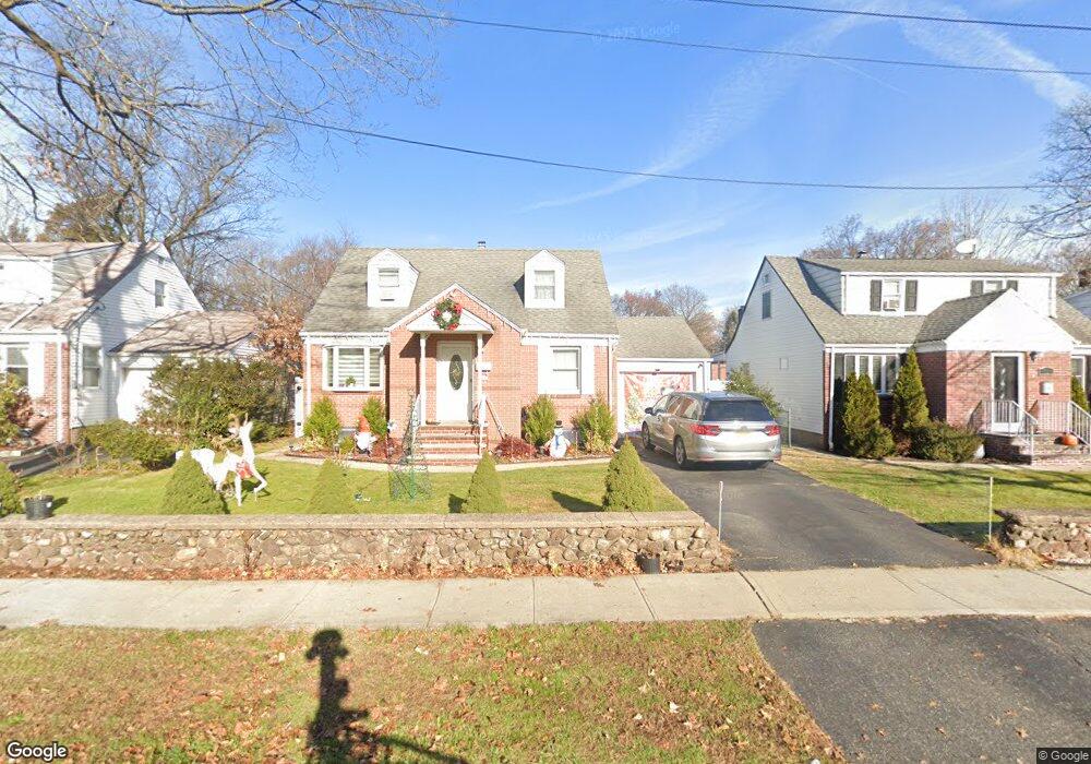
86 Maple St Dumont, NJ 07628
Estimated Value: $566,000 - $812,000
4
Beds
2
Baths
1,326
Sq Ft
$493/Sq Ft
Est. Value
About This Home
This home is located at 86 Maple St, Dumont, NJ 07628 and is currently estimated at $653,443, approximately $492 per square foot. 86 Maple St is a home located in Bergen County with nearby schools including Dumont High School.
Ownership History
Date
Name
Owned For
Owner Type
Purchase Details
Closed on
May 7, 2019
Sold by
Amato Damiano and Amato Danielle
Bought by
Odiver Abigail Z and Odiver Elwin E
Current Estimated Value
Purchase Details
Closed on
Sep 4, 2015
Sold by
Lopez Roderico and Lopez Jenifer
Bought by
Amato Danielle and Amato Damiano
Home Financials for this Owner
Home Financials are based on the most recent Mortgage that was taken out on this home.
Original Mortgage
$320,600
Interest Rate
3.88%
Mortgage Type
New Conventional
Purchase Details
Closed on
Oct 4, 2014
Sold by
Lopez Roderico and Lopez Jenifer
Bought by
Lopez Roderico and Lopez Jenifer
Home Financials for this Owner
Home Financials are based on the most recent Mortgage that was taken out on this home.
Original Mortgage
$159,000
Interest Rate
3.9%
Mortgage Type
New Conventional
Create a Home Valuation Report for This Property
The Home Valuation Report is an in-depth analysis detailing your home's value as well as a comparison with similar homes in the area
Home Values in the Area
Average Home Value in this Area
Purchase History
| Date | Buyer | Sale Price | Title Company |
|---|---|---|---|
| Odiver Abigail Z | $410,000 | -- | |
| Amato Danielle | $337,500 | Weichert Title Agency | |
| Lopez Roderico | -- | None Available |
Source: Public Records
Mortgage History
| Date | Status | Borrower | Loan Amount |
|---|---|---|---|
| Previous Owner | Amato Danielle | $320,600 | |
| Previous Owner | Lopez Roderico | $159,000 |
Source: Public Records
Tax History
| Year | Tax Paid | Tax Assessment Tax Assessment Total Assessment is a certain percentage of the fair market value that is determined by local assessors to be the total taxable value of land and additions on the property. | Land | Improvement |
|---|---|---|---|---|
| 2025 | $10,593 | $528,500 | $280,000 | $248,500 |
| 2024 | $10,333 | $260,600 | $150,000 | $110,600 |
| 2023 | $10,119 | $260,600 | $150,000 | $110,600 |
| 2022 | $10,119 | $260,600 | $150,000 | $110,600 |
| 2021 | $10,070 | $260,600 | $150,000 | $110,600 |
| 2020 | $9,796 | $260,600 | $150,000 | $110,600 |
| 2019 | $9,561 | $260,600 | $150,000 | $110,600 |
| 2018 | $9,183 | $255,500 | $150,000 | $105,500 |
| 2017 | $9,006 | $255,500 | $150,000 | $105,500 |
| 2016 | $8,797 | $255,500 | $150,000 | $105,500 |
| 2015 | $8,595 | $255,500 | $150,000 | $105,500 |
| 2014 | $8,426 | $255,500 | $150,000 | $105,500 |
Source: Public Records
Map
Nearby Homes
- 15 Dunn Place
- 51 Momar Dr
- 136 Elm St
- 181 Phelps Ave
- 196 Merritt Ave
- 119 Stonegate Trail
- 168 4th St
- 136 Stonegate Trail Unit 37
- 292 Magnolia Ave
- 40 Depew St
- 110 New York Ave
- 79 Blauvelt Ave
- 7 Overlook Dr
- 206 10th St
- 20 Dojean Ct
- 74 Shadyside Ave
- 9 New York Ave
- 241 E Main St Unit 1D
- 170 Hickory Ave
- 17 Wight Place
Your Personal Tour Guide
Ask me questions while you tour the home.