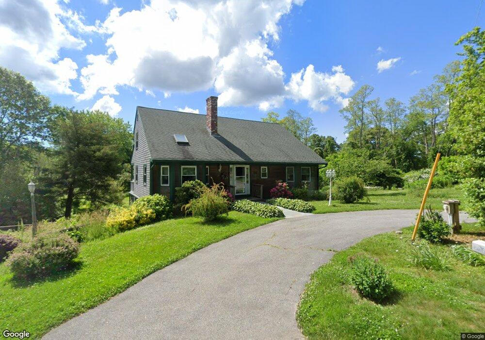
86 Maple St West Barnstable, MA 02668
West Barnstable NeighborhoodEstimated Value: $712,000 - $890,000
3
Beds
2
Baths
2,022
Sq Ft
$404/Sq Ft
Est. Value
About This Home
This home is located at 86 Maple St, West Barnstable, MA 02668 and is currently estimated at $816,462, approximately $403 per square foot. 86 Maple St is a home located in Barnstable County with nearby schools including West Barnstable Elementary School, Barnstable United Elementary School, and Barnstable Intermediate School.
Create a Home Valuation Report for This Property
The Home Valuation Report is an in-depth analysis detailing your home's value as well as a comparison with similar homes in the area
Home Values in the Area
Average Home Value in this Area
Tax History
We collect this data history from publicly available records. To have your information removed, we recommend requesting removal directly through your county’s website.
| Year | Tax Paid | Tax Assessment Tax Assessment Total Assessment is a certain percentage of the fair market value that is determined by local assessors to be the total taxable value of land and additions on the property. | Land | Improvement |
|---|---|---|---|---|
| 2025 | $7,366 | $788,600 | $300,300 | $488,300 |
| 2024 | $6,536 | $761,800 | $300,300 | $461,500 |
| 2023 | $6,474 | $710,600 | $297,100 | $413,500 |
| 2022 | $5,966 | $537,000 | $190,500 | $346,500 |
| 2021 | $5,828 | $497,300 | $202,400 | $294,900 |
| 2020 | $5,955 | $491,300 | $215,700 | $275,600 |
| 2019 | $5,835 | $475,200 | $227,500 | $247,700 |
| 2018 | $5,453 | $440,100 | $227,000 | $213,100 |
| 2017 | $5,339 | $436,200 | $233,300 | $202,900 |
| 2016 | $5,231 | $436,300 | $233,400 | $202,900 |
| 2015 | $5,101 | $426,500 | $231,400 | $195,100 |
Source: Public Records
Map
Nearby Homes
- 81 Indian Spring Rd
- 339 Cedar St
- 26 Carlson Ln
- 2231 Meetinghouse Way
- 16 Old Toll Rd
- 45 Wayside Ln
- 20 Howland Ln
- 243 Old County Rd
- 84 White Birch Way
- 14 Andersen Ave
- 2 Harpers Hollow
- 5 Andersen Ave
- 5 Quail Run Ln
- 30 Currycomb Cir
- 46 Service Rd
- 16 Morgan Way
- 350 Plum St
- 2 Jillson Way
- 96 Saddler Ln
- 14 Village Dr
Your Personal Tour Guide
Ask me questions while you tour the home.