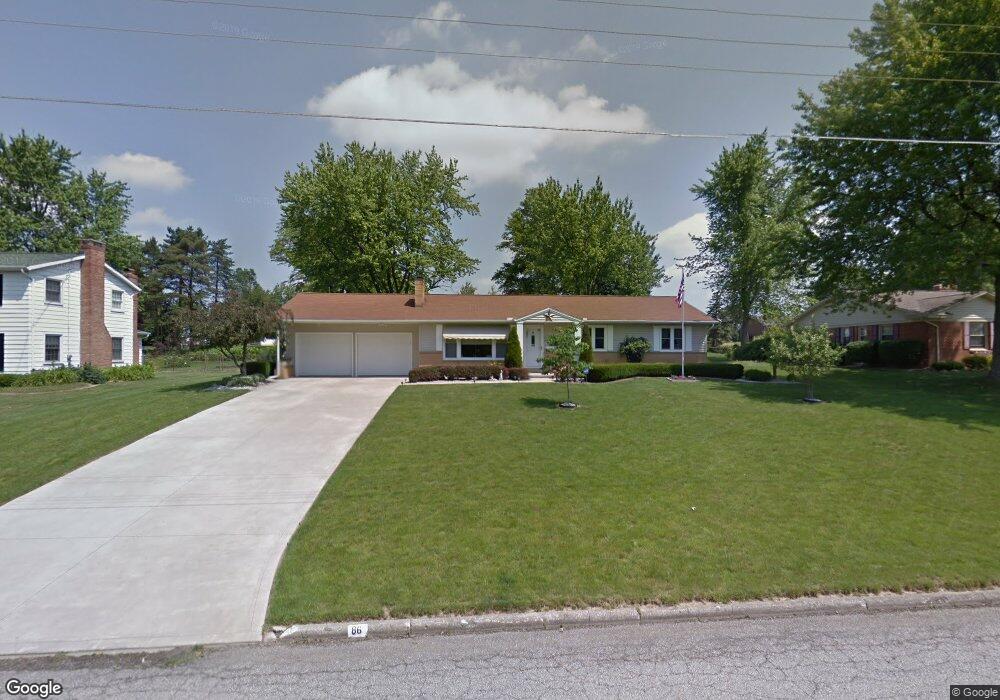
86 Sherbrook Rd Mansfield, OH 44907
Estimated Value: $220,797 - $246,000
3
Beds
2
Baths
1,528
Sq Ft
$154/Sq Ft
Est. Value
About This Home
This home is located at 86 Sherbrook Rd, Mansfield, OH 44907 and is currently estimated at $235,449, approximately $154 per square foot. 86 Sherbrook Rd is a home located in Richland County with nearby schools including Mansfield Christian School, St. Peter's Elementary/Montessori School, and St. Peter's Junior High / High School.
Ownership History
Date
Name
Owned For
Owner Type
Purchase Details
Closed on
Jul 11, 2006
Sold by
Doklovic Richard H and Doklovic Patricia A
Bought by
Doklovic Richard H and Doklovic Patricia A
Current Estimated Value
Purchase Details
Closed on
Jul 23, 2002
Sold by
Loveless Michael L
Bought by
Doklovic Richard H and Doklovic Patricia A
Home Financials for this Owner
Home Financials are based on the most recent Mortgage that was taken out on this home.
Original Mortgage
$94,400
Interest Rate
6.79%
Mortgage Type
New Conventional
Purchase Details
Closed on
Apr 13, 1998
Sold by
Hock Robert J
Bought by
Loveless Michael L and Loveless Karen A
Home Financials for this Owner
Home Financials are based on the most recent Mortgage that was taken out on this home.
Original Mortgage
$65,000
Interest Rate
7.19%
Mortgage Type
New Conventional
Purchase Details
Closed on
Feb 1, 1985
Create a Home Valuation Report for This Property
The Home Valuation Report is an in-depth analysis detailing your home's value as well as a comparison with similar homes in the area
Home Values in the Area
Average Home Value in this Area
Purchase History
| Date | Buyer | Sale Price | Title Company |
|---|---|---|---|
| Doklovic Richard H | -- | None Available | |
| Doklovic Richard H | $118,000 | -- | |
| Loveless Michael L | $92,000 | -- | |
| -- | $57,000 | -- |
Source: Public Records
Mortgage History
| Date | Status | Borrower | Loan Amount |
|---|---|---|---|
| Previous Owner | Doklovic Richard H | $94,400 | |
| Previous Owner | Loveless Michael L | $65,000 |
Source: Public Records
Tax History
| Year | Tax Paid | Tax Assessment Tax Assessment Total Assessment is a certain percentage of the fair market value that is determined by local assessors to be the total taxable value of land and additions on the property. | Land | Improvement |
|---|---|---|---|---|
| 2024 | $1,926 | $52,450 | $8,550 | $43,900 |
| 2023 | $1,997 | $52,450 | $8,550 | $43,900 |
| 2022 | $1,924 | $43,180 | $7,460 | $35,720 |
| 2021 | $1,937 | $43,180 | $7,460 | $35,720 |
| 2020 | $1,981 | $43,180 | $7,460 | $35,720 |
| 2019 | $1,776 | $36,600 | $6,320 | $30,280 |
| 2018 | $1,751 | $36,600 | $6,320 | $30,280 |
| 2017 | $1,791 | $36,600 | $6,320 | $30,280 |
| 2016 | $1,879 | $38,520 | $6,000 | $32,520 |
| 2015 | $1,795 | $38,520 | $6,000 | $32,520 |
| 2014 | $1,771 | $38,520 | $6,000 | $32,520 |
| 2012 | $675 | $38,530 | $6,320 | $32,210 |
Source: Public Records
Map
Nearby Homes
- 104 Elmridge Rd
- 1179 Burkwood Rd
- 33 Rambleside Dr
- 1066 Burkwood Rd
- 0 Lexington Ave Unit 224009661
- 50 Lilac Ct E
- 1599 S Main St
- 133 Winwood Dr
- 400 James Ave
- 0 George Ave
- 101 Chilton Ave
- 489 Clifton Blvd
- 810 Lexington Ave
- 710 Lexington Ave
- 575 Crescent Rd
- 889 Andover Rd
- 571 Luther St
- 470 Lexington Ave
- 466 Lexington Ave
- 0 Woodville Rd Unit Lot 14952, 14953
Your Personal Tour Guide
Ask me questions while you tour the home.