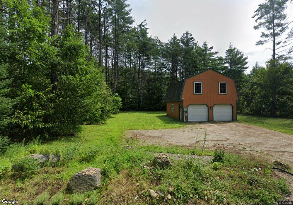
86 Stocker Pond Rd Grantham, NH 03753
Estimated Value: $471,016 - $522,000
3
Beds
2
Baths
1,700
Sq Ft
$294/Sq Ft
Est. Value
About This Home
This home is located at 86 Stocker Pond Rd, Grantham, NH 03753 and is currently estimated at $499,504, approximately $293 per square foot. 86 Stocker Pond Rd is a home located in Sullivan County with nearby schools including Grantham Village School and Lebanon High School.
Ownership History
Date
Name
Owned For
Owner Type
Purchase Details
Closed on
Mar 31, 1997
Sold by
Anthony Stephen P and Anthony Sheryl A
Bought by
Molloy Brian and Molloy Brenda
Current Estimated Value
Home Financials for this Owner
Home Financials are based on the most recent Mortgage that was taken out on this home.
Original Mortgage
$166,050
Interest Rate
7.59%
Create a Home Valuation Report for This Property
The Home Valuation Report is an in-depth analysis detailing your home's value as well as a comparison with similar homes in the area
Home Values in the Area
Average Home Value in this Area
Purchase History
| Date | Buyer | Sale Price | Title Company |
|---|---|---|---|
| Molloy Brian | $184,500 | -- |
Source: Public Records
Mortgage History
| Date | Status | Borrower | Loan Amount |
|---|---|---|---|
| Open | Molloy Brian | $251,200 | |
| Closed | Molloy Brian | $166,050 |
Source: Public Records
Tax History
| Year | Tax Paid | Tax Assessment Tax Assessment Total Assessment is a certain percentage of the fair market value that is determined by local assessors to be the total taxable value of land and additions on the property. | Land | Improvement |
|---|---|---|---|---|
| 2025 | $8,693 | $392,800 | $60,700 | $332,100 |
| 2024 | $7,703 | $392,800 | $60,700 | $332,100 |
| 2023 | $6,909 | $392,800 | $60,700 | $332,100 |
| 2022 | $6,458 | $392,800 | $60,700 | $332,100 |
| 2021 | $6,298 | $274,800 | $73,000 | $201,800 |
| 2020 | $6,447 | $274,800 | $73,000 | $201,800 |
| 2019 | $5,914 | $228,700 | $45,600 | $183,100 |
| 2018 | $5,967 | $228,700 | $45,600 | $183,100 |
| 2017 | $5,425 | $228,700 | $45,600 | $183,100 |
| 2016 | $5,452 | $228,700 | $45,600 | $183,100 |
| 2015 | $5,516 | $228,700 | $45,600 | $183,100 |
| 2014 | $6,086 | $273,300 | $80,300 | $193,000 |
| 2013 | $5,860 | $273,300 | $80,300 | $193,000 |
Source: Public Records
Map
Nearby Homes
- 151 Woodland Heights
- tbd Stocker Pond Unit 236-43
- tbd Stocker Pond
- 71 Greensward Dr
- 50 Longwood Dr
- 3 Fairway Dr
- 27 Eagle Dr
- 16 Clearwater Dr
- 119 Shedd Rd
- 26 Barn Owl Overlook
- 6 Brookside Dr
- 8 Cradle Hill Ln
- 9 Cradle Hill Ln
- 9 Pleasant Dr
- 27 Spring Valley Dr
- 11 Indian Point Rd
- 0 Route 10 N Unit 5058175
- 54 Black Duck Spur
- 242 Prospect Hill Rd
- 8 Sandy Brae
- 74 Stocker Pond Rd
- 102 Stocker Pond Rd
- 46 Stocker Pond Rd
- 83 Sanborn Hill Extension
- 65 Stocker Pond Rd
- 88 Stocker Pond Rd
- 77 Stocker Pond Rd
- 89 Stocker Pond Rd
- 97 Stocker Pond Rd
- 3 Stocker Pond Rd
- 19 Stocker Pond Rd
- 125 Stocker Pond Rd
- 0 Stocker Pond Rd
- 0 Stocker Pond Rd Unit 4069477
- 0 Stocker Pond Rd Unit 4021587
- 0 Stocker Pond Rd Unit 2809251
- 135 Sanborn Hill Extension
- 129 Stocker Pond Rd
- 133 Stocker Pond Rd
- 82 Sanborn Hill Extension
Your Personal Tour Guide
Ask me questions while you tour the home.