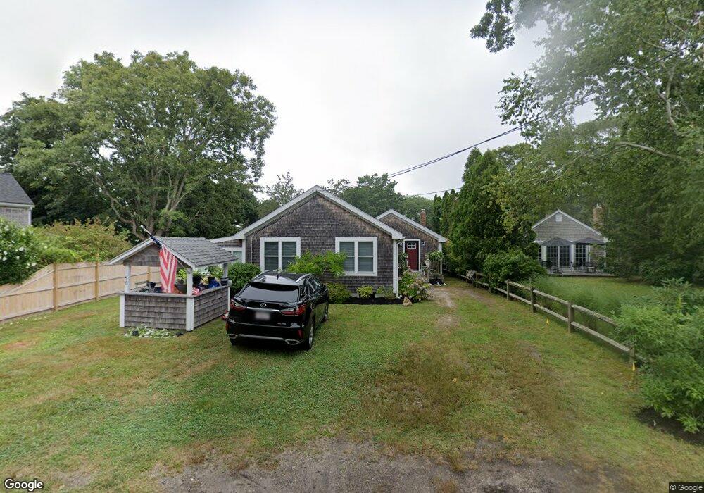
86 Tahanto Rd Pocasset, MA 02559
Pocasset NeighborhoodEstimated Value: $810,000 - $852,000
2
Beds
2
Baths
1,342
Sq Ft
$617/Sq Ft
Est. Value
About This Home
This home is located at 86 Tahanto Rd, Pocasset, MA 02559 and is currently estimated at $827,590, approximately $616 per square foot. 86 Tahanto Rd is a home located in Barnstable County with nearby schools including Bourne High School, Cadence Academy Preschool - Bourne, and St Margaret Regional School.
Ownership History
Date
Name
Owned For
Owner Type
Purchase Details
Closed on
Jun 30, 2025
Sold by
Molloy Maryann and Spendley Susan M
Bought by
Molloy Maryann
Current Estimated Value
Purchase Details
Closed on
Feb 23, 2022
Sold by
Molloy Maryann and Darling Barbara L
Bought by
Molloy Maryann and Spendley Susan M
Create a Home Valuation Report for This Property
The Home Valuation Report is an in-depth analysis detailing your home's value as well as a comparison with similar homes in the area
Home Values in the Area
Average Home Value in this Area
Purchase History
| Date | Buyer | Sale Price | Title Company |
|---|---|---|---|
| Molloy Maryann | -- | -- | |
| Molloy Maryann | -- | -- | |
| Molloy Maryann | $675,000 | None Available | |
| Molloy Maryann | $675,000 | None Available |
Source: Public Records
Tax History Compared to Growth
Tax History
| Year | Tax Paid | Tax Assessment Tax Assessment Total Assessment is a certain percentage of the fair market value that is determined by local assessors to be the total taxable value of land and additions on the property. | Land | Improvement |
|---|---|---|---|---|
| 2025 | $5,677 | $726,900 | $427,200 | $299,700 |
| 2024 | $5,551 | $692,100 | $406,800 | $285,300 |
| 2023 | $5,016 | $569,300 | $316,800 | $252,500 |
| 2022 | $4,529 | $448,900 | $248,500 | $200,400 |
| 2021 | $4,402 | $408,700 | $226,200 | $182,500 |
| 2020 | $4,271 | $397,700 | $224,000 | $173,700 |
| 2019 | $4,077 | $387,900 | $224,000 | $163,900 |
| 2018 | $3,869 | $367,100 | $218,900 | $148,200 |
| 2017 | $4,099 | $398,000 | $238,500 | $159,500 |
| 2016 | $3,190 | $314,000 | $216,800 | $97,200 |
| 2015 | $3,110 | $308,800 | $216,800 | $92,000 |
Source: Public Records
Map
Nearby Homes