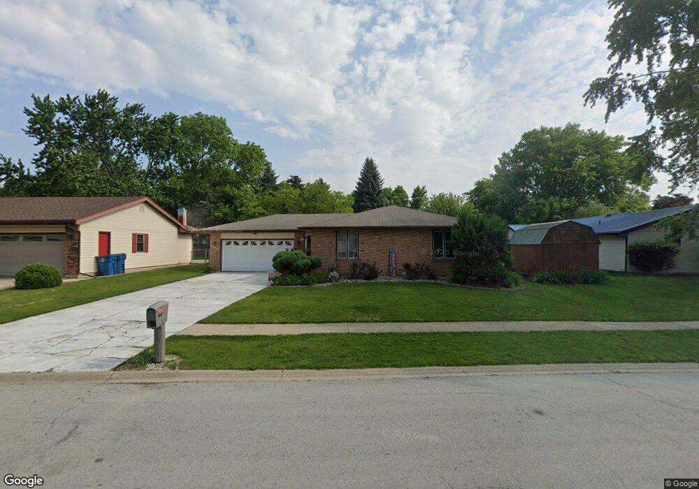
860 Pheasant Dr Bradley, IL 60915
Estimated Value: $221,000 - $254,000
3
Beds
3
Baths
1,235
Sq Ft
$192/Sq Ft
Est. Value
About This Home
This home is located at 860 Pheasant Dr, Bradley, IL 60915 and is currently estimated at $236,629, approximately $191 per square foot. 860 Pheasant Dr is a home located in Kankakee County with nearby schools including Bradley East Elementary School, Bradley West Elementary School, and Bradley Central Middle School.
Ownership History
Date
Name
Owned For
Owner Type
Purchase Details
Closed on
Apr 14, 2022
Sold by
Peterson Richard G and Peterson Patricia A
Bought by
Richard G Peterson And Patricia A Peterson Li
Current Estimated Value
Purchase Details
Closed on
Jun 21, 2007
Sold by
Cornucopia Insurance Inc
Bought by
Peterson Richard G and Peterson Patricia A
Create a Home Valuation Report for This Property
The Home Valuation Report is an in-depth analysis detailing your home's value as well as a comparison with similar homes in the area
Home Values in the Area
Average Home Value in this Area
Purchase History
| Date | Buyer | Sale Price | Title Company |
|---|---|---|---|
| Richard G Peterson And Patricia A Peterson Li | -- | Sharkey & Conroy Pc | |
| Peterson Richard G | $163,000 | Kankakee Cnty Title & Tr |
Source: Public Records
Tax History
| Year | Tax Paid | Tax Assessment Tax Assessment Total Assessment is a certain percentage of the fair market value that is determined by local assessors to be the total taxable value of land and additions on the property. | Land | Improvement |
|---|---|---|---|---|
| 2024 | $4,218 | $59,268 | $6,562 | $52,706 |
| 2023 | $3,982 | $54,878 | $6,076 | $48,802 |
| 2022 | $3,966 | $52,894 | $5,856 | $47,038 |
| 2021 | $2,697 | $48,274 | $5,727 | $42,547 |
| 2020 | $2,647 | $46,982 | $5,574 | $41,408 |
| 2019 | $2,778 | $44,068 | $5,412 | $38,656 |
| 2018 | $2,773 | $43,417 | $5,332 | $38,085 |
| 2017 | $2,841 | $42,358 | $5,202 | $37,156 |
| 2016 | $2,826 | $41,014 | $5,125 | $35,889 |
| 2015 | $2,837 | $39,241 | $5,074 | $34,167 |
| 2014 | $2,762 | $39,241 | $5,074 | $34,167 |
| 2013 | -- | $40,451 | $5,074 | $35,377 |
Source: Public Records
Map
Nearby Homes
- 973 Cardinal Dr
- 1008 Mallard Dr
- 19 Old Farm North Ct
- 1443 Truman Dr
- 1372 E Armour Rd
- 463 Edgebrook Dr
- 609 N Monroe Ave
- 104 Chesterfield Ct Unit 1
- 1325 N Arthur Burch Dr Unit B16
- 135 S Jackson Ave
- 166 N Randolph Ave
- 1622 Amhurst Way
- 1696 Yorktown Dr
- 1071 E Broadway St
- 224 N La Salle Ave
- 1355 N Arthur Burch Dr Unit R21
- 1355 N Arthur Burch Dr Unit F09
- 1802 Derby Dr
- 189 N La Salle Ave
- 284 N Clinton Ave
- 870 Pheasant Dr
- 955 Flamingo Ln
- 931 Mallard Dr
- 880 Pheasant Dr
- 915 Mallard Dr
- 947 Mallard Dr
- 851 Pheasant Dr
- 890 Pheasant Dr
- 863 Pheasant Dr
- 924 Flamingo Ln
- 972 Flamingo Ln
- 963 Mallard Dr
- 936 Flamingo Ln
- 948 Flamingo Ln
- 875 Pheasant Dr
- 960 Flamingo Ln
- 984 Flamingo Ln
- 920 Pheasant Dr
- 912 Flamingo Ln
- 887 Pheasant Dr
Your Personal Tour Guide
Ask me questions while you tour the home.