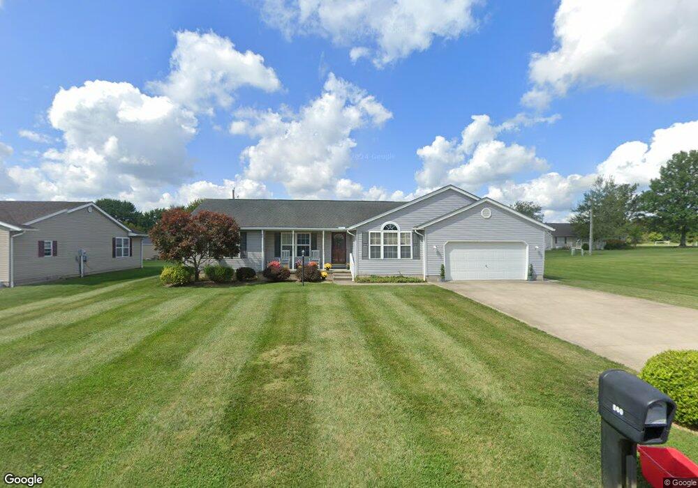
860 Terrace Dr Upper Sandusky, OH 43351
Estimated Value: $302,109 - $369,000
4
Beds
2
Baths
1,939
Sq Ft
$172/Sq Ft
Est. Value
About This Home
This home is located at 860 Terrace Dr, Upper Sandusky, OH 43351 and is currently estimated at $332,777, approximately $171 per square foot. 860 Terrace Dr is a home located in Wyandot County with nearby schools including Upper Sandusky High School and St. Peter Elementary School.
Ownership History
Date
Name
Owned For
Owner Type
Purchase Details
Closed on
Oct 17, 2006
Sold by
Bricely Lisa M
Bought by
Brinson Vonice and Brinson Regina
Current Estimated Value
Home Financials for this Owner
Home Financials are based on the most recent Mortgage that was taken out on this home.
Original Mortgage
$126,000
Outstanding Balance
$75,607
Interest Rate
6.75%
Mortgage Type
Adjustable Rate Mortgage/ARM
Estimated Equity
$257,170
Purchase Details
Closed on
Nov 2, 2005
Sold by
Bricely Mark E
Bought by
Bricely Lisa M
Create a Home Valuation Report for This Property
The Home Valuation Report is an in-depth analysis detailing your home's value as well as a comparison with similar homes in the area
Home Values in the Area
Average Home Value in this Area
Purchase History
| Date | Buyer | Sale Price | Title Company |
|---|---|---|---|
| Brinson Vonice | $158,000 | None Available | |
| Bricely Lisa M | -- | None Available |
Source: Public Records
Mortgage History
| Date | Status | Borrower | Loan Amount |
|---|---|---|---|
| Open | Brinson Vonice | $126,000 |
Source: Public Records
Tax History
| Year | Tax Paid | Tax Assessment Tax Assessment Total Assessment is a certain percentage of the fair market value that is determined by local assessors to be the total taxable value of land and additions on the property. | Land | Improvement |
|---|---|---|---|---|
| 2025 | $2,616 | $97,090 | $9,670 | $87,420 |
| 2024 | $2,316 | $82,580 | $8,050 | $74,530 |
| 2023 | $2,316 | $82,580 | $8,050 | $74,530 |
| 2022 | $2,349 | $65,630 | $6,710 | $58,920 |
| 2021 | $1,895 | $65,630 | $6,710 | $58,920 |
| 2020 | $1,894 | $65,630 | $6,710 | $58,920 |
| 2019 | $1,891 | $65,630 | $6,710 | $58,920 |
| 2018 | $1,713 | $61,260 | $6,110 | $55,150 |
| 2017 | $1,741 | $61,260 | $6,110 | $55,150 |
| 2016 | $1,630 | $61,260 | $6,110 | $55,150 |
| 2015 | -- | $59,050 | $6,110 | $52,940 |
| 2014 | -- | $59,050 | $6,110 | $52,940 |
| 2013 | -- | $59,050 | $6,110 | $52,940 |
Source: Public Records
Map
Nearby Homes
- 605 Polaris Dr
- 512 N 7th St
- 479 N 5th St
- 386 W Finley St
- 212 N Hazel St
- 333 N 5th St
- 334 N 4th St
- 314 N 4th St
- 137 N 8th St
- 116 E Walker St
- 432 E Bigelow St
- 479 Front St
- 0 Ohio 53
- 225 S Hazel St
- 0 State Route 53 & 67 Unit 11165687
- 9768 County Highway 111
- 326 S 8th St
- 1030 Halbedel St
- 955 Greenbrier Rd
- 123 Rivers Edge Ln
- 858 Terrace Dr
- 607 Polaris Dr
- 609 Polaris Dr
- 856 Terrace Dr
- 857 Terrace Dr
- 864 Terrace Dr
- 859 Terrace Dr
- 855 Terrace Dr
- 603 Polaris Dr
- 611 Polaris Dr
- 0 Polaris Drive and Sunset Drive Lot22b and 23b
- 853 Terrace Dr
- 861 Terrace Dr
- 854 Terrace Dr
- 708 Chestnut Dr Unit B
- 708 Chestnut Dr Unit A
- 708A Chestnut Dr
- 708 Chestnut Dr
- 708B Chestnut Dr
- 706 Chestnut Dr
Your Personal Tour Guide
Ask me questions while you tour the home.