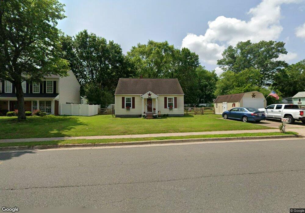
8601 Signal Hill Rd Manassas, VA 20110
Old Town Manassas NeighborhoodEstimated Value: $430,000 - $488,000
3
Beds
2
Baths
1,110
Sq Ft
$413/Sq Ft
Est. Value
About This Home
This home is located at 8601 Signal Hill Rd, Manassas, VA 20110 and is currently estimated at $458,466, approximately $413 per square foot. 8601 Signal Hill Rd is a home located in Manassas City with nearby schools including Baldwin Elementary School, Mayfield Intermediate School, and Grace E. Metz Middle School.
Ownership History
Date
Name
Owned For
Owner Type
Purchase Details
Closed on
Feb 18, 2005
Sold by
Powell James T
Bought by
Powell James T
Current Estimated Value
Home Financials for this Owner
Home Financials are based on the most recent Mortgage that was taken out on this home.
Original Mortgage
$154,000
Outstanding Balance
$78,173
Interest Rate
5.73%
Mortgage Type
New Conventional
Estimated Equity
$380,293
Purchase Details
Closed on
Dec 7, 1995
Sold by
Ward James O
Bought by
Powell James T
Create a Home Valuation Report for This Property
The Home Valuation Report is an in-depth analysis detailing your home's value as well as a comparison with similar homes in the area
Home Values in the Area
Average Home Value in this Area
Purchase History
| Date | Buyer | Sale Price | Title Company |
|---|---|---|---|
| Powell James T | -- | -- | |
| Powell James T | $85,013 | -- |
Source: Public Records
Mortgage History
| Date | Status | Borrower | Loan Amount |
|---|---|---|---|
| Open | Powell James T | $154,000 |
Source: Public Records
Tax History Compared to Growth
Tax History
| Year | Tax Paid | Tax Assessment Tax Assessment Total Assessment is a certain percentage of the fair market value that is determined by local assessors to be the total taxable value of land and additions on the property. | Land | Improvement |
|---|---|---|---|---|
| 2024 | $4,157 | $329,900 | $158,500 | $171,400 |
| 2023 | $4,028 | $319,700 | $154,000 | $165,700 |
| 2022 | $3,802 | $283,300 | $133,500 | $149,800 |
| 2021 | $3,573 | $250,000 | $119,500 | $130,500 |
| 2020 | $3,459 | $236,900 | $115,500 | $121,400 |
| 2019 | $3,352 | $226,500 | $112,000 | $114,500 |
| 2018 | $3,209 | $219,800 | $107,000 | $112,800 |
| 2017 | -- | $220,400 | $107,000 | $113,400 |
| 2016 | $3,092 | $220,400 | $0 | $0 |
| 2015 | -- | $213,900 | $107,000 | $106,900 |
| 2014 | -- | $0 | $0 | $0 |
Source: Public Records
Map
Nearby Homes
- 8591 Signal Hill Rd
- 9569 Coggs Bill Dr Unit 302
- 9559 Coggs Bill Dr Unit 102
- 8465 Crozier Ct Unit 402
- 9576 Jayhawk Terrace Unit 401
- 8393 Buttress Ln Unit 101
- 8374 Buttress Ln Unit 304
- 8385 Buttress Ln Unit 103
- 8503 Clearridge Ln
- 9554 Cannoneer Ct Unit 101
- 9552 Cannoneer Ct Unit 204
- 9540 Oakenshaw Dr
- 9544 Oakenshaw Dr
- 8683 Nagle St
- 9309 Maple St
- 8941 Quarry Rd
- 8600 Liberty Trail Unit 201
- 8600 Liberty Trail Unit 206
- 8600 Liberty Trail Unit 102
- 8600 Liberty Trail Unit 303
- 8599 Signal Hill Rd
- 9500 Lehr Ct
- 9502 Lehr Ct
- 9519 Brigantine Ln
- 8601 Sanderling Dr
- 9517 Brigantine Ln
- 8603 Sanderling Dr
- 9515 Brigantine Ln
- 9504 Lehr Ct
- 8605 Sanderling Dr
- 8615 Signal Hill Rd
- 9513 Brigantine Ln
- 8607 Sanderling Dr
- 9511 Brigantine Ln
- 8609 Sanderling Dr
- 9516 Brigantine Ln
- 8600 Sanderling Dr
- 9514 Brigantine Ln
- 9506 Lehr Ct
- 9512 Brigantine Ln