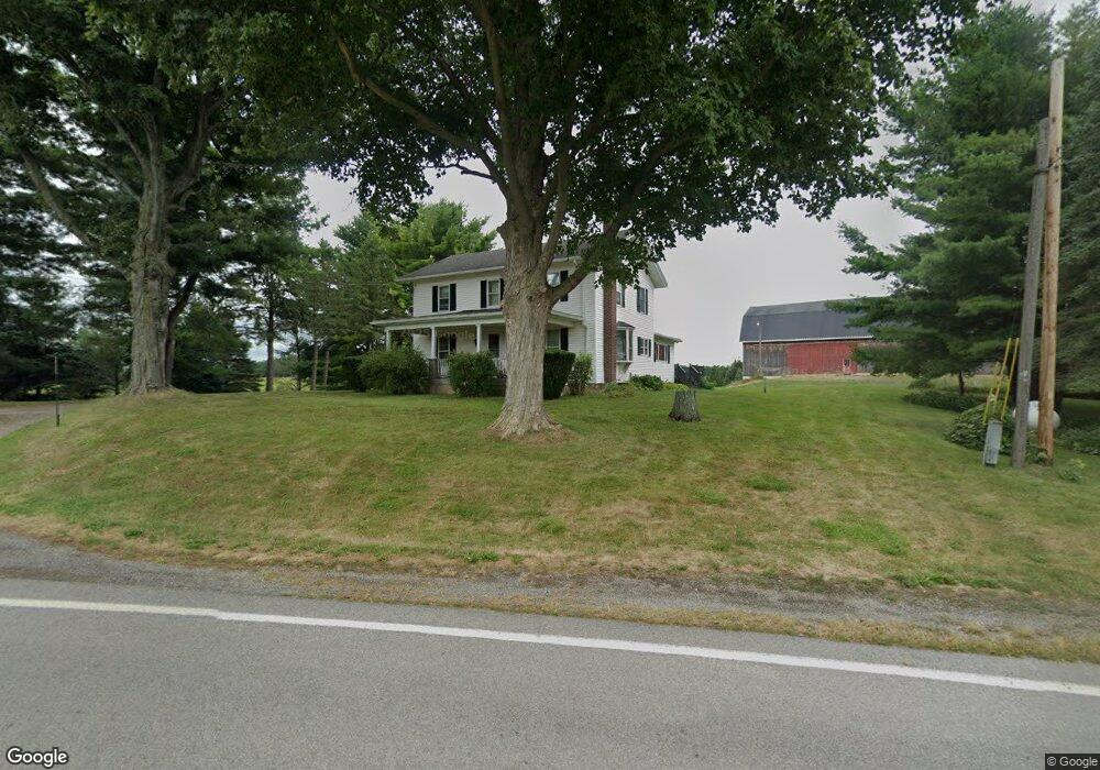
8602 Taft Rd Bloomfield, NY 14469
Estimated Value: $411,183 - $436,000
5
Beds
2
Baths
2,393
Sq Ft
$176/Sq Ft
Est. Value
About This Home
This home is located at 8602 Taft Rd, Bloomfield, NY 14469 and is currently estimated at $421,394, approximately $176 per square foot. 8602 Taft Rd is a home located in Ontario County with nearby schools including Bloomfield Elementary School, Bloomfield Middle School, and Bloomfield High School.
Create a Home Valuation Report for This Property
The Home Valuation Report is an in-depth analysis detailing your home's value as well as a comparison with similar homes in the area
Home Values in the Area
Average Home Value in this Area
Tax History
| Year | Tax Paid | Tax Assessment Tax Assessment Total Assessment is a certain percentage of the fair market value that is determined by local assessors to be the total taxable value of land and additions on the property. | Land | Improvement |
|---|---|---|---|---|
| 2024 | $6,905 | $248,200 | $69,100 | $179,100 |
| 2023 | $6,643 | $248,200 | $69,100 | $179,100 |
| 2022 | $6,626 | $248,200 | $69,100 | $179,100 |
| 2021 | $6,146 | $186,200 | $50,600 | $135,600 |
| 2020 | $3,873 | $186,200 | $50,600 | $135,600 |
| 2019 | -- | $186,200 | $50,600 | $135,600 |
| 2018 | $3,911 | $186,200 | $50,600 | $135,600 |
| 2017 | $0 | $176,600 | $43,500 | $133,100 |
| 2016 | $4,118 | $176,600 | $43,500 | $133,100 |
| 2015 | -- | $176,600 | $43,500 | $133,100 |
| 2014 | -- | $176,600 | $43,500 | $133,100 |
Source: Public Records
Map
Nearby Homes
- 0 Wesley Rd
- 8361 State Route 5 and 20
- 0 Olmstead Rd Unit R1646731
- 9 Rabbit Run
- 9164 State Route 5 and 20
- 74 Bloomdale Mobile Home Park
- 31 Picture Book Park
- 3970 County Road 40
- 8086 Dussett Ln
- 51 State St
- 39 South Ave
- 25 Church St
- 7592 North Rd
- 1819 Rochester St
- 7590 North Rd
- 18 Hunt Club Dr
- 6640 State Route 5 and 20
- 1495 W Bloomfield Rd
- 0000 Michigan Rd Lot 2c Rd
- 0000 Michigan Rd Lot 2b
Your Personal Tour Guide
Ask me questions while you tour the home.