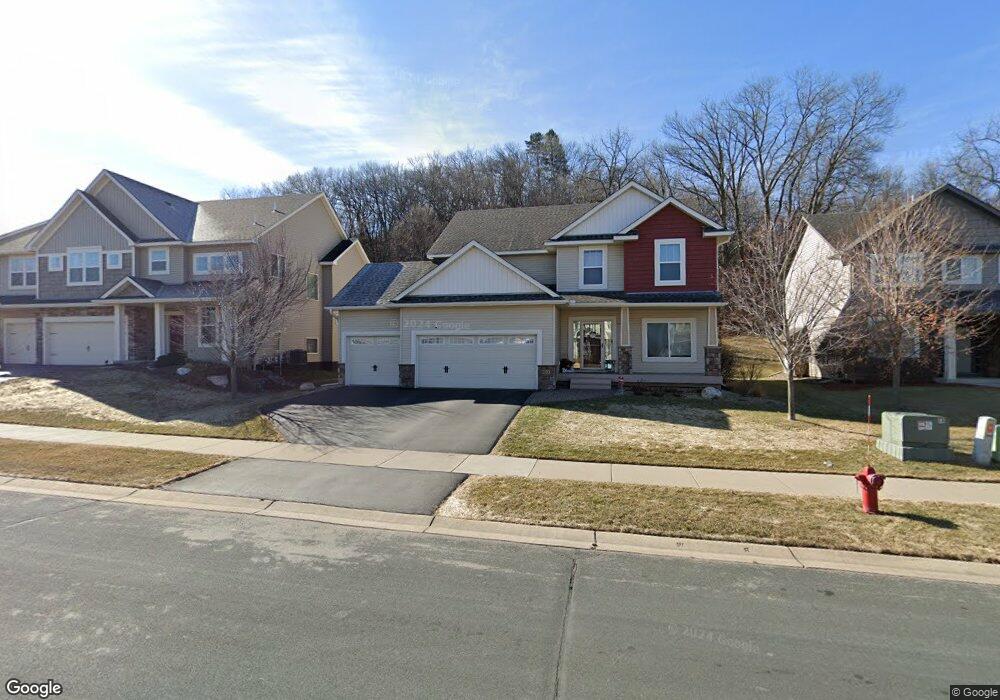
8603 W 132nd St Savage, MN 55378
Estimated Value: $567,325 - $584,000
4
Beds
3
Baths
2,462
Sq Ft
$233/Sq Ft
Est. Value
About This Home
This home is located at 8603 W 132nd St, Savage, MN 55378 and is currently estimated at $574,831, approximately $233 per square foot. 8603 W 132nd St is a home located in Scott County with nearby schools including Eagle Ridge Middle School, Burnsville High School, and Aspen Academy.
Ownership History
Date
Name
Owned For
Owner Type
Purchase Details
Closed on
Dec 14, 2012
Sold by
Brandl Anderson Homes Inc
Bought by
Neuenschwander Samuel L and Neuenschwander Danielle J
Current Estimated Value
Home Financials for this Owner
Home Financials are based on the most recent Mortgage that was taken out on this home.
Original Mortgage
$264,000
Outstanding Balance
$182,391
Interest Rate
3.31%
Mortgage Type
New Conventional
Estimated Equity
$392,440
Purchase Details
Closed on
Apr 19, 2012
Sold by
Trout Run Preserve Llc
Bought by
Brandl/Anderson Homes Inc
Create a Home Valuation Report for This Property
The Home Valuation Report is an in-depth analysis detailing your home's value as well as a comparison with similar homes in the area
Home Values in the Area
Average Home Value in this Area
Purchase History
| Date | Buyer | Sale Price | Title Company |
|---|---|---|---|
| Neuenschwander Samuel L | $330,000 | Land Title Inc | |
| Brandl/Anderson Homes Inc | $138,000 | None Available |
Source: Public Records
Mortgage History
| Date | Status | Borrower | Loan Amount |
|---|---|---|---|
| Open | Neuenschwander Samuel L | $264,000 |
Source: Public Records
Tax History Compared to Growth
Tax History
| Year | Tax Paid | Tax Assessment Tax Assessment Total Assessment is a certain percentage of the fair market value that is determined by local assessors to be the total taxable value of land and additions on the property. | Land | Improvement |
|---|---|---|---|---|
| 2025 | $5,296 | $525,100 | $180,300 | $344,800 |
| 2024 | $5,158 | $482,200 | $187,900 | $294,300 |
| 2023 | $5,262 | $474,100 | $184,300 | $289,800 |
| 2022 | $4,666 | $484,700 | $167,500 | $317,200 |
| 2021 | $4,688 | $406,500 | $126,000 | $280,500 |
| 2020 | $4,824 | $383,900 | $102,000 | $281,900 |
| 2019 | $4,732 | $381,300 | $95,000 | $286,300 |
| 2018 | $4,980 | $0 | $0 | $0 |
| 2016 | $4,708 | $0 | $0 | $0 |
| 2014 | -- | $0 | $0 | $0 |
Source: Public Records
Map
Nearby Homes
- 8600 W 132nd St
- 13186 Meadow Ln
- 8821 Preserve Place
- 9007 Meadow Place
- 8160 Virginia Ln
- 13032 Falcons Way
- 13539 Foxberry Rd
- 8940 W 137th St
- 9200 W 136th St
- 13251 Pennsylvania Ave
- 9120 138th St W
- 13651 Dan Patch Dr
- 9109 Edgewood Cir
- 12630 Independence Ave
- 13986 W Virginia Ave
- 8109 139th St
- 1850 Stagecoach Rd
- 13933 Ventura Place
- 8490 Moraine Cir
- 13954 Shoreside Cir
- 8603 8603 132nd St
- 8603 8603 132nd-Street-
- 8609 W 132nd St
- 8525 W 132nd St
- 8615 W 132nd St
- 8519 W 132nd St
- 8615 8615 132nd-Street-
- 8615 8615 132nd-Street-w
- 8600 8600 132nd St
- 8513 W 132nd St
- 8600 W 132nd St
- 8513 8513 132nd St
- 8513 8513 132nd-Street-
- 8524 8524 132nd St
- 8524 W 132nd St
- 8608 W 132nd St
- 8621 W 132nd St
- 8608 W 132nd St
- 8520 W 132nd St
- 8520 W 132nd St