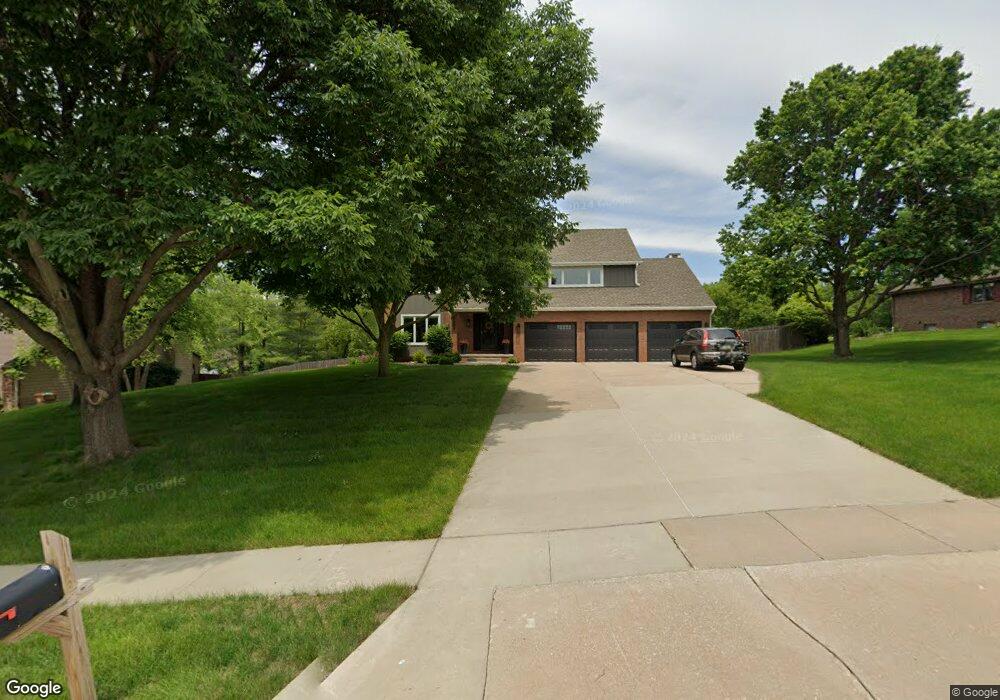
8605 Horton Cir Urbandale, IA 50322
Estimated Value: $443,000 - $612,000
4
Beds
3
Baths
3,291
Sq Ft
$173/Sq Ft
Est. Value
About This Home
This home is located at 8605 Horton Cir, Urbandale, IA 50322 and is currently estimated at $568,045, approximately $172 per square foot. 8605 Horton Cir is a home located in Polk County with nearby schools including Valerius Elementary School, Urbandale Middle School, and Urbandale High School.
Ownership History
Date
Name
Owned For
Owner Type
Purchase Details
Closed on
Aug 1, 2019
Sold by
Kennedy Shane and Kennedy Julie
Bought by
Dejong Aaron M and Dejong Maria B
Current Estimated Value
Purchase Details
Closed on
Oct 24, 2017
Sold by
Kennedy Shane and Kennedy Julie
Bought by
Kennedy Shane and Kennedy Julie
Home Financials for this Owner
Home Financials are based on the most recent Mortgage that was taken out on this home.
Original Mortgage
$359,999
Interest Rate
3.83%
Mortgage Type
New Conventional
Purchase Details
Closed on
Aug 13, 2008
Sold by
Kennedy Laura
Bought by
Kennedy Shane
Purchase Details
Closed on
Sep 5, 2002
Sold by
Curdue Kathryn J
Bought by
Kennedy Shane and Kennedy Laura
Home Financials for this Owner
Home Financials are based on the most recent Mortgage that was taken out on this home.
Original Mortgage
$252,000
Interest Rate
6.41%
Create a Home Valuation Report for This Property
The Home Valuation Report is an in-depth analysis detailing your home's value as well as a comparison with similar homes in the area
Home Values in the Area
Average Home Value in this Area
Purchase History
| Date | Buyer | Sale Price | Title Company |
|---|---|---|---|
| Dejong Aaron M | $410,000 | None Available | |
| Kennedy Shane | -- | First American Title | |
| Kennedy Shane | -- | None Available | |
| Kennedy Shane | $314,500 | -- |
Source: Public Records
Mortgage History
| Date | Status | Borrower | Loan Amount |
|---|---|---|---|
| Previous Owner | Kennedy Shane | $359,999 | |
| Previous Owner | Kennedy Shane | $252,000 | |
| Closed | Kennedy Shane | $63,000 |
Source: Public Records
Tax History Compared to Growth
Tax History
| Year | Tax Paid | Tax Assessment Tax Assessment Total Assessment is a certain percentage of the fair market value that is determined by local assessors to be the total taxable value of land and additions on the property. | Land | Improvement |
|---|---|---|---|---|
| 2025 | $9,728 | $583,900 | $125,400 | $458,500 |
| 2024 | $9,728 | $547,500 | $116,100 | $431,400 |
| 2023 | $9,110 | $547,500 | $116,100 | $431,400 |
| 2022 | $9,004 | $433,500 | $95,500 | $338,000 |
| 2021 | $9,268 | $433,500 | $95,500 | $338,000 |
| 2020 | $9,476 | $423,400 | $93,900 | $329,500 |
| 2019 | $9,172 | $440,200 | $93,900 | $346,300 |
| 2018 | $9,028 | $407,400 | $85,300 | $322,100 |
| 2017 | $8,708 | $407,400 | $85,300 | $322,100 |
| 2016 | $8,496 | $386,300 | $80,000 | $306,300 |
| 2015 | $8,496 | $386,300 | $80,000 | $306,300 |
| 2014 | $9,018 | $406,400 | $73,700 | $332,700 |
Source: Public Records
Map
Nearby Homes
- 8505 Airline Ave
- 8501 Airline Ave
- 3900 Rolling Green Dr
- 8914 Valdez Dr
- 3957 92nd Dr
- 4117 83rd St
- 3889 92nd Dr
- 4221 90th St
- 3924 80th St
- 3916 Greenview Dr
- 4517 90th St
- 4505 90th St
- 4500 90th St
- 37 89th St
- 8220 Twana Dr
- 3808 Mary Lynn Dr
- 3805 Melanie Cir
- 7815 Douglas Ave Unit 304
- 7815 Douglas Ave Unit 107
- 4460 90th St
- 8609 Horton Cir
- 8601 Horton Cir
- 8604 Horton Cir
- 8615 Horton Cir
- 8608 Horton Cir
- 8600 Horton Cir
- 8612 Horton Cir
- 8617 Horton Cir
- 8521 Horton Ave
- 8516 Airline Ave
- 8621 Horton Cir
- 8520 Horton Ave
- 8616 Horton Cir
- 8517 Horton Ave
- 8517 Airline Ave
- 8512 Airline Ave
- 8516 Horton Ave
- 3901 86th St
- 8513 Horton Ave
- 8513 Airline Ave