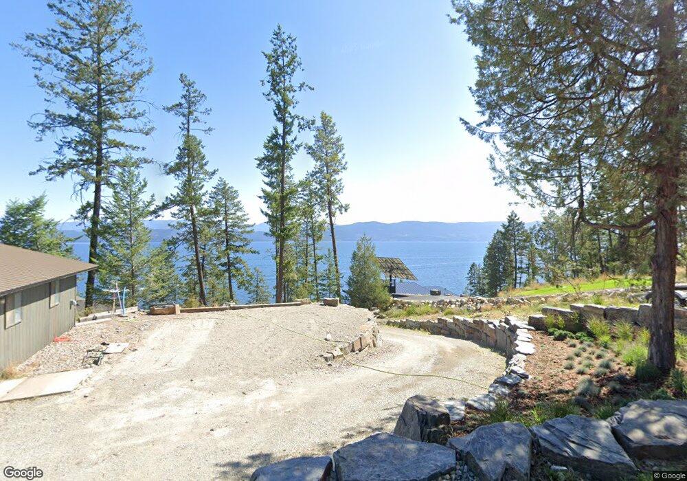
861 Angel Point Rd Lakeside, MT 59922
Estimated Value: $4,366,000 - $5,469,423
4
Beds
4
Baths
2,734
Sq Ft
$1,830/Sq Ft
Est. Value
About This Home
This home is located at 861 Angel Point Rd, Lakeside, MT 59922 and is currently estimated at $5,002,474, approximately $1,829 per square foot. 861 Angel Point Rd is a home located in Flathead County with nearby schools including Lakeside Elementary School, Somers Middle School, and Flathead High School.
Ownership History
Date
Name
Owned For
Owner Type
Purchase Details
Closed on
Feb 7, 2018
Sold by
Nuessle Michael H and Washburn Lori A
Bought by
Macdonald Philip and Macdonald Dena
Current Estimated Value
Home Financials for this Owner
Home Financials are based on the most recent Mortgage that was taken out on this home.
Original Mortgage
$200,000
Outstanding Balance
$142,099
Interest Rate
3.99%
Mortgage Type
New Conventional
Estimated Equity
$4,860,375
Purchase Details
Closed on
May 30, 2013
Sold by
Canfield Anne C
Bought by
Nuessle Michael H and Nuessle Lori A Washburn
Purchase Details
Closed on
Apr 28, 2010
Sold by
Clark Ronald
Bought by
Canfield Anne C
Create a Home Valuation Report for This Property
The Home Valuation Report is an in-depth analysis detailing your home's value as well as a comparison with similar homes in the area
Home Values in the Area
Average Home Value in this Area
Purchase History
| Date | Buyer | Sale Price | Title Company |
|---|---|---|---|
| Macdonald Philip | -- | Insured Title | |
| Nuessle Michael H | -- | Fidelity National Title | |
| Canfield Anne C | -- | None Available |
Source: Public Records
Mortgage History
| Date | Status | Borrower | Loan Amount |
|---|---|---|---|
| Open | Macdonald Philip | $200,000 |
Source: Public Records
Tax History Compared to Growth
Tax History
| Year | Tax Paid | Tax Assessment Tax Assessment Total Assessment is a certain percentage of the fair market value that is determined by local assessors to be the total taxable value of land and additions on the property. | Land | Improvement |
|---|---|---|---|---|
| 2025 | $24,224 | $3,554,100 | $0 | $0 |
| 2024 | $12,455 | $2,281,100 | $0 | $0 |
| 2023 | $16,353 | $2,281,100 | $0 | $0 |
| 2022 | $2,900 | $399,600 | $0 | $0 |
| 2021 | $3,144 | $399,600 | $0 | $0 |
| 2020 | $3,045 | $380,250 | $0 | $0 |
| 2019 | $2,927 | $380,250 | $0 | $0 |
| 2018 | $3,246 | $403,830 | $0 | $0 |
| 2017 | $2,993 | $403,830 | $0 | $0 |
| 2016 | $2,759 | $384,300 | $0 | $0 |
| 2015 | $2,860 | $384,300 | $0 | $0 |
| 2014 | $3,692 | $313,288 | $0 | $0 |
Source: Public Records
Map
Nearby Homes
- 207 Angel Point Preserve
- 168 Angel Point Preserve
- 268 Tamarack Terrace Rd
- 272 Tamarack Terrace Rd
- 253 Tamarack Terrace
- 36 Angel Ridge Rd
- 100 & 104 Deep Bay Dr
- 500 Conrad Point Rd
- 458 Political Hill Rd
- 480 Political Hill Rd
- NHN Benchmark Dr
- 360 Ridge Line Dr
- 100 Political Hill Rd
- 103 Tamarack Woods Dr
- 149 Monet Rd
- 207 Stoner Loop Unit A
- 39270 Running Rock Ln
- 381 Lakeside Blvd
- 212 Bierney Creek Rd
- 124 Woodacres Dr
- 861 Angel Point Rd
- 869 Angel Point Rd
- 869 Angel Point Rd
- 861 & 869 Angel Point Rd
- 853 Angel Point Rd
- 871 Angel Point Rd
- 28 Hockaday Ln
- 105 Greenwood Hills Ln
- 885 Angel Point Rd
- 837 Angel Point Rd
- 115 Greenwood Hills Ln
- 885 Angel Point Rd Lakeside Flathead
- 829 Angel Point Rd
- 125 Greenwood Hills Ln
- 813 Angel Point Rd
- 135 Greenwood Hills Ln
- 921 Angel Point Rd
- 805 Angel Point Rd