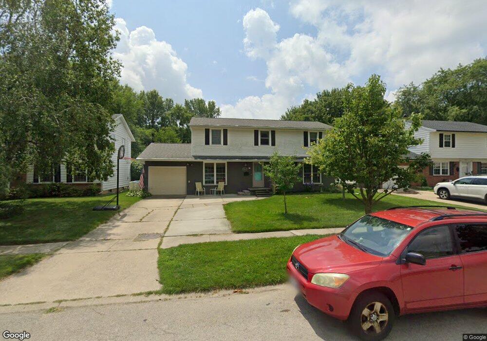
861 Maple Ln Waterville, OH 43566
Estimated Value: $301,621 - $327,000
5
Beds
3
Baths
2,214
Sq Ft
$142/Sq Ft
Est. Value
About This Home
This home is located at 861 Maple Ln, Waterville, OH 43566 and is currently estimated at $314,905, approximately $142 per square foot. 861 Maple Ln is a home located in Lucas County with nearby schools including Anthony Wayne High School.
Ownership History
Date
Name
Owned For
Owner Type
Purchase Details
Closed on
Apr 10, 2019
Sold by
Metzger Michael D and Metzger Jennifer
Bought by
Metzger Michael D
Current Estimated Value
Home Financials for this Owner
Home Financials are based on the most recent Mortgage that was taken out on this home.
Original Mortgage
$167,378
Outstanding Balance
$144,894
Interest Rate
3.87%
Mortgage Type
FHA
Estimated Equity
$170,011
Purchase Details
Closed on
Sep 8, 2006
Sold by
Wyandt Janet C and Heilmann Josanna M
Bought by
Metzger Michael D and Metzger Jennifer
Home Financials for this Owner
Home Financials are based on the most recent Mortgage that was taken out on this home.
Original Mortgage
$136,000
Interest Rate
6.59%
Mortgage Type
Purchase Money Mortgage
Purchase Details
Closed on
Dec 15, 1993
Sold by
Wyandt H C and J C
Create a Home Valuation Report for This Property
The Home Valuation Report is an in-depth analysis detailing your home's value as well as a comparison with similar homes in the area
Home Values in the Area
Average Home Value in this Area
Purchase History
| Date | Buyer | Sale Price | Title Company |
|---|---|---|---|
| Metzger Michael D | -- | None Available | |
| Metzger Michael D | $170,000 | Chicago Title Insurance Co | |
| -- | -- | -- |
Source: Public Records
Mortgage History
| Date | Status | Borrower | Loan Amount |
|---|---|---|---|
| Open | Metzger Michael D | $167,378 | |
| Closed | Metzger Michael D | $136,000 |
Source: Public Records
Tax History
| Year | Tax Paid | Tax Assessment Tax Assessment Total Assessment is a certain percentage of the fair market value that is determined by local assessors to be the total taxable value of land and additions on the property. | Land | Improvement |
|---|---|---|---|---|
| 2025 | -- | $85,715 | $12,705 | $73,010 |
| 2024 | $2,113 | $85,715 | $12,705 | $73,010 |
| 2023 | $3,674 | $67,305 | $10,220 | $57,085 |
| 2022 | $3,710 | $67,305 | $10,220 | $57,085 |
| 2021 | $3,857 | $67,305 | $10,220 | $57,085 |
| 2020 | $3,625 | $56,630 | $8,400 | $48,230 |
| 2019 | $3,340 | $56,630 | $8,400 | $48,230 |
| 2018 | $3,061 | $56,630 | $8,400 | $48,230 |
| 2017 | $2,983 | $47,320 | $10,220 | $37,100 |
| 2016 | $2,953 | $135,200 | $29,200 | $106,000 |
| 2015 | $2,824 | $135,200 | $29,200 | $106,000 |
| 2014 | $2,813 | $46,380 | $10,010 | $36,370 |
| 2013 | $2,813 | $46,380 | $10,010 | $36,370 |
Source: Public Records
Map
Nearby Homes
- 42 N Melody Ln
- 132 Wilkshire Dr
- 22 S 5th St
- 1195 Farnsworth Rd
- 305 Ridgepoint Cir
- 214 N 2nd St
- 792 Wilkshire Dr
- 1174 Riley Ln
- 938 Wilkshire Dr
- 1307 Limerick Ln
- 1335 Limerick Ln
- 1347 Limerick Ln
- 1591 Southridge Dr
- 1383 Limerick Ln
- 1391 Limerick Ln
- 8109 Bridgehampton Dr
- 410 Overlook Dr
- 0 W River Rd Unit 6134934
- 1800 Caleb Ct
- 1812 Caleb Ct
Your Personal Tour Guide
Ask me questions while you tour the home.