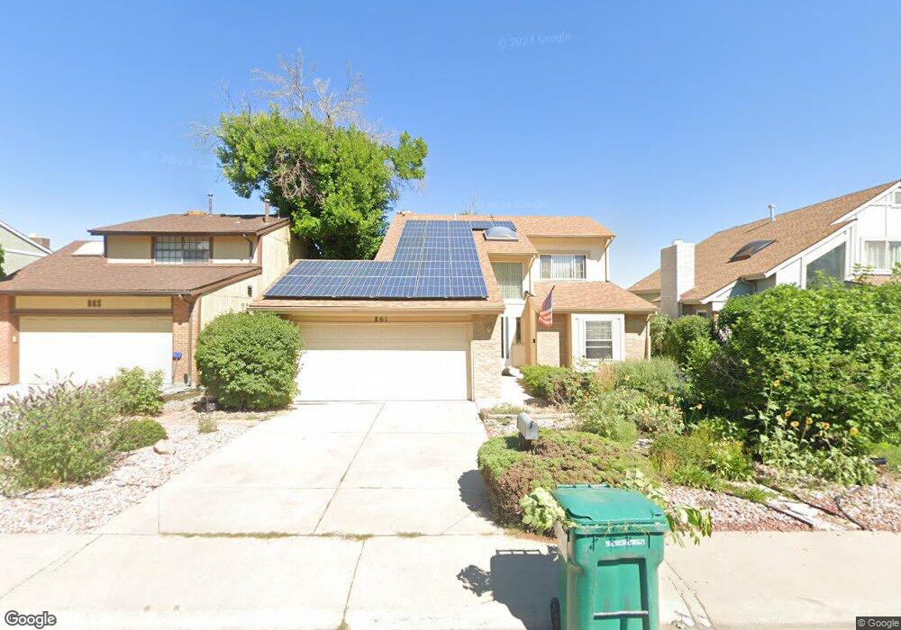
861 S Rifle Way Aurora, CO 80017
Tollgate Overlook NeighborhoodEstimated Value: $474,303 - $506,000
4
Beds
4
Baths
1,940
Sq Ft
$250/Sq Ft
Est. Value
About This Home
This home is located at 861 S Rifle Way, Aurora, CO 80017 and is currently estimated at $485,826, approximately $250 per square foot. 861 S Rifle Way is a home located in Arapahoe County with nearby schools including Iowa Elementary School, Mrachek Middle School, and Gateway High School.
Ownership History
Date
Name
Owned For
Owner Type
Purchase Details
Closed on
Nov 1, 2001
Sold by
Korn David Alan and Korn Dagmar
Bought by
Brooks Maurice D and Brooks Pamela W
Current Estimated Value
Home Financials for this Owner
Home Financials are based on the most recent Mortgage that was taken out on this home.
Original Mortgage
$184,775
Outstanding Balance
$72,485
Interest Rate
6.77%
Estimated Equity
$413,341
Purchase Details
Closed on
May 27, 1999
Sold by
Mcknire Russell W
Bought by
Korn David Alan and Korn Dagmar
Home Financials for this Owner
Home Financials are based on the most recent Mortgage that was taken out on this home.
Original Mortgage
$153,400
Interest Rate
6.91%
Purchase Details
Closed on
May 23, 1990
Sold by
Conversion Arapco
Bought by
Mcknire Russell W
Purchase Details
Closed on
Apr 1, 1979
Sold by
Conversion Arapco
Bought by
Conversion Arapco
Purchase Details
Closed on
Jul 4, 1776
Bought by
Conversion Arapco
Create a Home Valuation Report for This Property
The Home Valuation Report is an in-depth analysis detailing your home's value as well as a comparison with similar homes in the area
Home Values in the Area
Average Home Value in this Area
Purchase History
| Date | Buyer | Sale Price | Title Company |
|---|---|---|---|
| Brooks Maurice D | $194,500 | Guardian Title Agency | |
| Korn David Alan | $158,150 | -- | |
| Mcknire Russell W | -- | -- | |
| Conversion Arapco | -- | -- | |
| Conversion Arapco | -- | -- |
Source: Public Records
Mortgage History
| Date | Status | Borrower | Loan Amount |
|---|---|---|---|
| Open | Brooks Maurice D | $184,775 | |
| Previous Owner | Korn David Alan | $153,400 |
Source: Public Records
Tax History Compared to Growth
Tax History
| Year | Tax Paid | Tax Assessment Tax Assessment Total Assessment is a certain percentage of the fair market value that is determined by local assessors to be the total taxable value of land and additions on the property. | Land | Improvement |
|---|---|---|---|---|
| 2024 | $2,673 | $28,756 | -- | -- |
| 2023 | $2,673 | $28,756 | $0 | $0 |
| 2022 | $2,484 | $24,735 | $0 | $0 |
| 2021 | $2,564 | $24,735 | $0 | $0 |
| 2020 | $2,281 | $21,908 | $0 | $0 |
| 2019 | $2,269 | $21,908 | $0 | $0 |
| 2018 | $2,080 | $19,670 | $0 | $0 |
| 2017 | $1,809 | $19,670 | $0 | $0 |
| 2016 | $1,502 | $15,992 | $0 | $0 |
| 2015 | $1,450 | $15,992 | $0 | $0 |
| 2014 | -- | $11,104 | $0 | $0 |
| 2013 | -- | $13,270 | $0 | $0 |
Source: Public Records
Map
Nearby Homes
- 17714 E Ada Dr
- 17265 E Ford Dr
- 17775 E Tennessee Dr
- 17256 E Ford Dr
- 18003 E Ohio Ave Unit 102
- 18004 E Ohio Ave Unit 101
- 18033 E Ohio Ave Unit 201
- 972 S Pitkin Ct
- 17196 E Tennessee Dr
- 18043 E Ohio Ave Unit 202
- 461 S Salida St
- 17094 E Virginia Ave
- 18064 E Ohio Ave Unit 104
- 18073 E Ohio Ave Unit 203
- 17093 E Tennessee Dr Unit 212
- 18063 E Ohio Ave Unit 201
- 17216 E Alameda Pkwy
- 17053 E Tennessee Dr Unit 104
- 18105 E Ohio Ave Unit 204
- 18103 E Kentucky Ave Unit 203
- 863 S Rifle Way
- 853 S Rifle Way
- 851 S Rifle Way
- 871 S Rifle Way
- 843 S Rifle Way
- 873 S Rifle Way
- 862 S Rifle Way
- 854 S Rifle Way
- 872 S Rifle Way
- 852 S Rifle Way
- 841 S Rifle Way
- 882 S Rifle Way
- 881 S Rifle Way
- 844 S Rifle Way
- 833 S Rifle Way
- 877 S Rifle Ct
- 883 S Rifle Way
- 887 S Rifle Ct
- 892 S Rifle Way
- 831 S Rifle Way