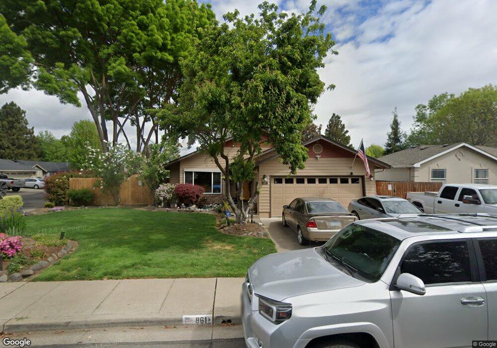
861 Westrop Dr Central Point, OR 97502
Estimated Value: $375,000 - $409,000
4
Beds
2
Baths
1,522
Sq Ft
$259/Sq Ft
Est. Value
About This Home
This home is located at 861 Westrop Dr, Central Point, OR 97502 and is currently estimated at $393,714, approximately $258 per square foot. 861 Westrop Dr is a home located in Jackson County with nearby schools including Howard Elementary School, McLoughlin Middle School, and North Medford High School.
Ownership History
Date
Name
Owned For
Owner Type
Purchase Details
Closed on
Mar 24, 2009
Sold by
Case Jeffrey L and Case Leslie B
Bought by
Chestnut Kevin R and Shannon Amanda A
Current Estimated Value
Home Financials for this Owner
Home Financials are based on the most recent Mortgage that was taken out on this home.
Original Mortgage
$191,468
Outstanding Balance
$121,877
Interest Rate
5.15%
Mortgage Type
FHA
Estimated Equity
$271,837
Create a Home Valuation Report for This Property
The Home Valuation Report is an in-depth analysis detailing your home's value as well as a comparison with similar homes in the area
Home Values in the Area
Average Home Value in this Area
Purchase History
| Date | Buyer | Sale Price | Title Company |
|---|---|---|---|
| Chestnut Kevin R | $195,000 | Lawyers Title Ins |
Source: Public Records
Mortgage History
| Date | Status | Borrower | Loan Amount |
|---|---|---|---|
| Open | Chestnut Kevin R | $191,468 |
Source: Public Records
Tax History Compared to Growth
Tax History
| Year | Tax Paid | Tax Assessment Tax Assessment Total Assessment is a certain percentage of the fair market value that is determined by local assessors to be the total taxable value of land and additions on the property. | Land | Improvement |
|---|---|---|---|---|
| 2025 | $3,632 | $217,080 | $97,000 | $120,080 |
| 2024 | $3,632 | $210,760 | $94,180 | $116,580 |
| 2023 | $3,521 | $204,630 | $91,440 | $113,190 |
| 2022 | $3,433 | $204,630 | $91,440 | $113,190 |
| 2021 | $3,343 | $198,670 | $88,780 | $109,890 |
| 2020 | $3,259 | $192,890 | $86,190 | $106,700 |
| 2019 | $3,179 | $181,830 | $81,250 | $100,580 |
| 2018 | $3,096 | $176,540 | $78,880 | $97,660 |
| 2017 | $3,035 | $176,540 | $78,880 | $97,660 |
| 2016 | $2,970 | $166,410 | $74,350 | $92,060 |
| 2015 | $2,855 | $166,410 | $74,350 | $92,060 |
| 2014 | $2,694 | $156,870 | $70,080 | $86,790 |
Source: Public Records
Map
Nearby Homes
- 881 Westrop Dr
- 745 Herman Ave
- 659 Herman Ave
- 921 Pittview Ave
- 1065 Edwina Ave
- 3496 Edella St
- 2825 Duell Ave
- 3600 N Pacific Hwy
- 3119 Merriman Rd
- 851 Juanita Way
- 1017 Fairfield Ave
- 1025 Fairfield Ave
- 2825 Howard Ave
- 1060 Hopkins Rd
- 2711 Elliott Ave
- 928 Brandi Way
- 571 Briarwood Dr
- 191 Mellecker Way
- 199 Mellecker Way
- 887 Silver Fox Dr
- 865 Westrop Dr
- 862 Isaac Way
- 11012 Heather Ln
- 866 Isaac Way
- 869 Westrop Dr
- 1251 Heather Ln
- 1261 Heather Ln
- 1231 Heather Ln
- 862 Westrop Dr
- 870 Isaac Way
- 866 Westrop Dr
- 1271 Heather Ln
- 1221 Heather Ln
- 873 Westrop Dr
- 870 Westrop Dr
- 874 Isaac Way
- 1281 Heather Ln
- 1219 Heather Ln
- 1210 Heather Ln
- 1252 Greentree Way