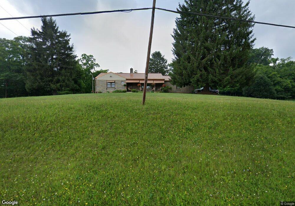
8615 State Route 821 Lower Salem, OH 45745
Estimated Value: $126,000 - $213,000
2
Beds
2
Baths
1,264
Sq Ft
$138/Sq Ft
Est. Value
About This Home
This home is located at 8615 State Route 821, Lower Salem, OH 45745 and is currently estimated at $174,689, approximately $138 per square foot. 8615 State Route 821 is a home with nearby schools including Fort Frye High School.
Ownership History
Date
Name
Owned For
Owner Type
Purchase Details
Closed on
Apr 29, 2022
Sold by
Adams Daniel B and Adams Cheri L
Bought by
Gerst Robert and Gerst Kimberly
Current Estimated Value
Purchase Details
Closed on
Jan 23, 2020
Sold by
Adams Daniel B and Kramer Carmen
Bought by
Adams Daniel B and Adams Cheri L
Purchase Details
Closed on
Nov 21, 2014
Sold by
Gerst Robert and Gerst Kimberly
Bought by
Adams Randall Gordon and Adams Lecia A
Home Financials for this Owner
Home Financials are based on the most recent Mortgage that was taken out on this home.
Original Mortgage
$112,000
Interest Rate
3.97%
Mortgage Type
New Conventional
Purchase Details
Closed on
Mar 19, 2009
Sold by
Spies Fay L
Bought by
Jones Icie F and Adams Daniel B
Purchase Details
Closed on
Feb 2, 1996
Bought by
Spies Fay
Create a Home Valuation Report for This Property
The Home Valuation Report is an in-depth analysis detailing your home's value as well as a comparison with similar homes in the area
Home Values in the Area
Average Home Value in this Area
Purchase History
| Date | Buyer | Sale Price | Title Company |
|---|---|---|---|
| Gerst Robert | -- | Theisen Brock | |
| Adams Daniel B | $200,100 | None Available | |
| Adams Randall Gordon | $140,000 | Attorney | |
| Jones Icie F | -- | Attorney | |
| Spies Fay | -- | -- |
Source: Public Records
Mortgage History
| Date | Status | Borrower | Loan Amount |
|---|---|---|---|
| Previous Owner | Adams Randall Gordon | $112,000 |
Source: Public Records
Tax History Compared to Growth
Tax History
| Year | Tax Paid | Tax Assessment Tax Assessment Total Assessment is a certain percentage of the fair market value that is determined by local assessors to be the total taxable value of land and additions on the property. | Land | Improvement |
|---|---|---|---|---|
| 2024 | $1,469 | $45,130 | $5,760 | $39,370 |
| 2023 | $1,469 | $45,130 | $5,760 | $39,370 |
| 2022 | $1,399 | $45,130 | $5,760 | $39,370 |
| 2021 | $917 | $28,340 | $3,570 | $24,770 |
| 2020 | $934 | $28,340 | $3,570 | $24,770 |
| 2019 | $938 | $28,340 | $3,570 | $24,770 |
| 2018 | $547 | $25,560 | $2,980 | $22,580 |
| 2017 | $549 | $25,560 | $2,980 | $22,580 |
| 2016 | $547 | $25,560 | $2,980 | $22,580 |
| 2015 | $475 | $22,680 | $2,890 | $19,790 |
| 2014 | -- | $22,680 | $2,890 | $19,790 |
| 2013 | $475 | $22,730 | $2,940 | $19,790 |
Source: Public Records
Map
Nearby Homes
- 9865 State Route 821
- 50 & 60 Railroad St
- 65 Warner Second St
- 3275 Highland Ridge Rd
- 2800 Tick Ridge Rd
- 0 Highland Ridge Rd
- 0 Stanleyville Rd
- 200 Frakes Rd
- 4595 Ohio 530
- 0 Highland Ridge Rd
- 2115 Goss Fork Rd
- 1 Brooks Ln
- Lot 4 Moss Run Rd
- 101 Winters Dr
- 2585 Glendale Rd
- 0 Dixon Ridge Rd Unit 5152245
- 123 Deerwalk Cir
- 9125 Highland Ridge Re
- 9125 Highland Ridge Rd
- 126 Sylvan Way
- 8590 State Route 821
- 8650 State Route 821
- 184 Davis Rd
- 0 Davis Rd
- 8470 State Route 821
- 8470 Ohio 821
- 0 Germantown Rd
- 0 Germantown Rd Unit M224642
- 8725 State Route 821
- 240 Davis Rd
- 8735 State Route 821
- 8389 State Route 821 Rd
- 8385 State Route 821
- 8380 State Route 821
- 8800 State Route 821
- 345 Davis Rd
- 72 Germantown Rd
- 8860 State Route 821
- 66 Germantown Rd
- 30 Dalzell Rd