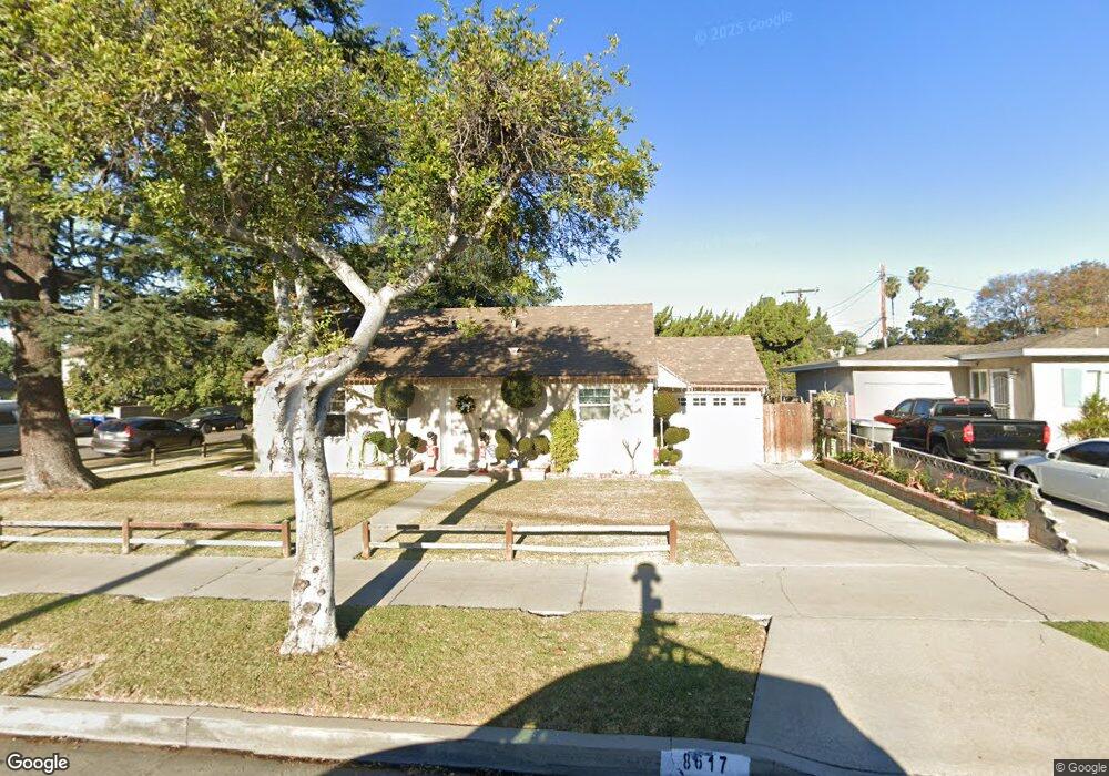
8617 Laurel Ave Whittier, CA 90605
South Whittier NeighborhoodEstimated Value: $691,010 - $751,000
2
Beds
1
Bath
864
Sq Ft
$832/Sq Ft
Est. Value
About This Home
This home is located at 8617 Laurel Ave, Whittier, CA 90605 and is currently estimated at $718,503, approximately $831 per square foot. 8617 Laurel Ave is a home located in Los Angeles County with nearby schools including Laurel Elementary School, East Whittier Middle School, and Whittier High School.
Ownership History
Date
Name
Owned For
Owner Type
Purchase Details
Closed on
Jun 30, 1999
Sold by
Tupanjanin John and Tupanjanin Maria C
Bought by
Cruz Ramiro and Lona Cruz Blanca A
Current Estimated Value
Home Financials for this Owner
Home Financials are based on the most recent Mortgage that was taken out on this home.
Original Mortgage
$153,375
Outstanding Balance
$43,234
Interest Rate
7.64%
Mortgage Type
FHA
Estimated Equity
$675,269
Create a Home Valuation Report for This Property
The Home Valuation Report is an in-depth analysis detailing your home's value as well as a comparison with similar homes in the area
Home Values in the Area
Average Home Value in this Area
Purchase History
| Date | Buyer | Sale Price | Title Company |
|---|---|---|---|
| Cruz Ramiro | $154,500 | Fidelity National Title |
Source: Public Records
Mortgage History
| Date | Status | Borrower | Loan Amount |
|---|---|---|---|
| Open | Cruz Ramiro | $153,375 |
Source: Public Records
Tax History
| Year | Tax Paid | Tax Assessment Tax Assessment Total Assessment is a certain percentage of the fair market value that is determined by local assessors to be the total taxable value of land and additions on the property. | Land | Improvement |
|---|---|---|---|---|
| 2025 | $3,147 | $237,433 | $144,769 | $92,664 |
| 2024 | $3,147 | $232,779 | $141,931 | $90,848 |
| 2023 | $3,141 | $228,216 | $139,149 | $89,067 |
| 2022 | $3,057 | $223,742 | $136,421 | $87,321 |
| 2021 | $3,016 | $219,356 | $133,747 | $85,609 |
| 2019 | $2,961 | $212,852 | $129,781 | $83,071 |
| 2018 | $2,867 | $208,680 | $127,237 | $81,443 |
| 2016 | $2,780 | $200,580 | $122,298 | $78,282 |
| 2015 | $2,733 | $197,568 | $120,461 | $77,107 |
| 2014 | $2,640 | $193,699 | $118,102 | $75,597 |
Source: Public Records
Map
Nearby Homes
- 13563 Carnell St
- 13649 Lanning Dr
- 13527 Ramona Dr
- 13840 Danbrook Dr
- 13448 Dunton Dr
- 8146 Bright Ave
- 9308 Tarryton Ave
- 13701 Russell St
- 9344 Firebird Ave
- 8901 Ocean View Ave
- 8847 Ocean View Ave
- 12822 Danbrook Dr
- 13605 La Cuarta St
- 8017 Greenleaf Ave
- 8720 Villa Dr
- 7924 Bright Ave
- 13856 Mulberry Dr
- 14351 Starbuck St
- 8003 Elden Ave
- 7928 Milton Ave
- 8611 Laurel Ave
- 13591 Carnell St
- 8629 Laurel Ave
- 13585 Carnell St
- 13602 Putnam St
- 13590 Starbuck St
- 13584 Starbuck St
- 8626 Laurel Ave
- 13581 Carnell St
- 13586 Carnell St
- 8633 Laurel Ave
- 13608 Putnam St
- 8632 Laurel Ave
- 13580 Starbuck St
- 13582 Carnell St
- 13601 Putnam St
- 13573 Carnell St
- 8537 Laurel Ave
- 8705 Laurel Ave
- 13616 Putnam St
Your Personal Tour Guide
Ask me questions while you tour the home.