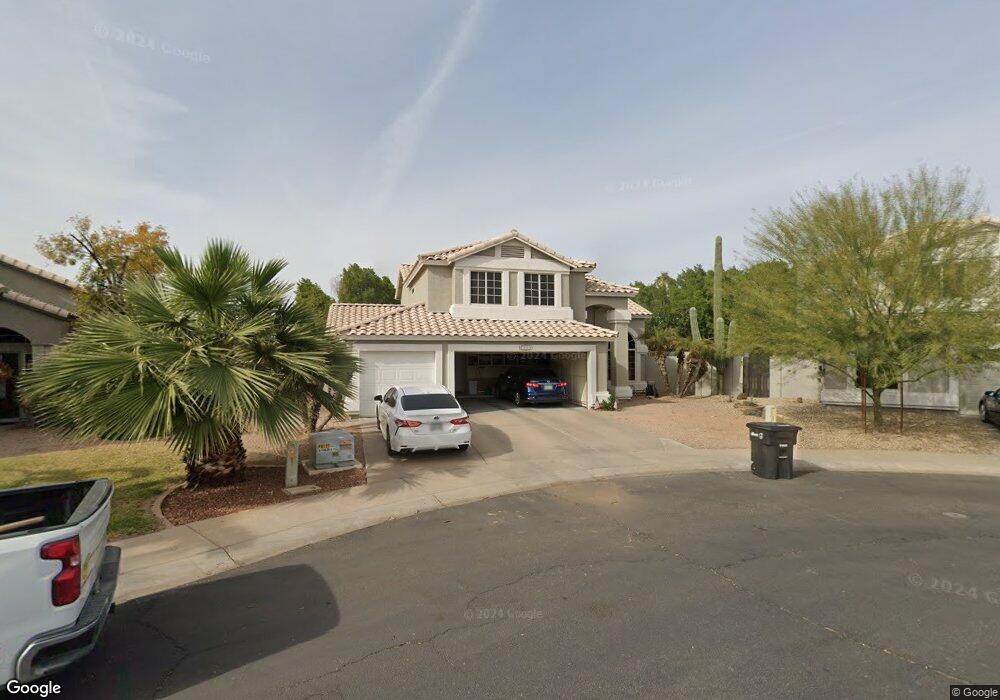
862 S Port Dr Gilbert, AZ 85233
The Islands NeighborhoodEstimated Value: $623,044 - $707,000
4
Beds
3
Baths
2,387
Sq Ft
$283/Sq Ft
Est. Value
About This Home
This home is located at 862 S Port Dr, Gilbert, AZ 85233 and is currently estimated at $674,761, approximately $282 per square foot. 862 S Port Dr is a home located in Maricopa County with nearby schools including Shumway Elementary School, Willis Junior High School, and Chandler High School.
Ownership History
Date
Name
Owned For
Owner Type
Purchase Details
Closed on
Oct 4, 2005
Sold by
Payne Darin M and Payne Marci L
Bought by
Corrado Michael and Corrado Christine
Current Estimated Value
Home Financials for this Owner
Home Financials are based on the most recent Mortgage that was taken out on this home.
Original Mortgage
$299,900
Outstanding Balance
$159,203
Interest Rate
5.63%
Mortgage Type
New Conventional
Estimated Equity
$515,558
Purchase Details
Closed on
Aug 18, 2003
Sold by
Jarvis Stephen D and Jarvis Terri L
Bought by
Payne Darin M and Payne Marci L
Home Financials for this Owner
Home Financials are based on the most recent Mortgage that was taken out on this home.
Original Mortgage
$191,920
Interest Rate
5%
Mortgage Type
New Conventional
Create a Home Valuation Report for This Property
The Home Valuation Report is an in-depth analysis detailing your home's value as well as a comparison with similar homes in the area
Home Values in the Area
Average Home Value in this Area
Purchase History
| Date | Buyer | Sale Price | Title Company |
|---|---|---|---|
| Corrado Michael | $399,900 | Capital Title Agency Inc | |
| Payne Darin M | $239,900 | Security Title Agency |
Source: Public Records
Mortgage History
| Date | Status | Borrower | Loan Amount |
|---|---|---|---|
| Open | Corrado Michael | $299,900 | |
| Previous Owner | Payne Darin M | $191,920 | |
| Closed | Payne Darin M | $47,980 |
Source: Public Records
Tax History Compared to Growth
Tax History
| Year | Tax Paid | Tax Assessment Tax Assessment Total Assessment is a certain percentage of the fair market value that is determined by local assessors to be the total taxable value of land and additions on the property. | Land | Improvement |
|---|---|---|---|---|
| 2025 | $2,626 | $33,601 | -- | -- |
| 2024 | $2,531 | $32,001 | -- | -- |
| 2023 | $2,531 | $51,760 | $10,350 | $41,410 |
| 2022 | $2,440 | $39,110 | $7,820 | $31,290 |
| 2021 | $2,557 | $38,570 | $7,710 | $30,860 |
| 2020 | $2,545 | $36,000 | $7,200 | $28,800 |
| 2019 | $2,444 | $32,050 | $6,410 | $25,640 |
| 2018 | $2,368 | $30,850 | $6,170 | $24,680 |
| 2017 | $2,217 | $29,920 | $5,980 | $23,940 |
| 2016 | $2,133 | $29,430 | $5,880 | $23,550 |
| 2015 | $2,070 | $27,360 | $5,470 | $21,890 |
Source: Public Records
Map
Nearby Homes
- 861 W Shellfish Dr
- 920 W Grand Caymen Dr
- 918 W Barbados Dr
- 715 W Stottler Place
- 938 W Iris Dr
- 794 S Martinique Dr
- 1135 W Sea Fog Dr
- 742 S Crows Nest Dr
- 617 W Cantebria Dr
- 1683 E Kent Ave
- 869 W Emerald Island Dr
- 820 S Copper Key Ct
- 814 S Copper Key Ct
- 510 W Amoroso Dr
- 1214 W Iris Dr
- 1305 W Lobster Trap Dr
- 510 S Lagoon Dr
- 1951 E Baylor Ct
- 919 S Paradise Dr Unit III
- 1122 W Sandy Banks
- 868 W Lobster Trap Dr
- 870 S Port Dr
- 860 W Lobster Trap Dr
- 878 S Port Dr
- 861 W Lobster Trap Dr
- 841 S Cancun Dr
- 852 W Lobster Trap Dr
- 886 S Port Dr
- 853 W Lobster Trap Dr
- 845 S Cancun Dr
- 837 S Cancun Dr
- 894 S Port Dr
- 844 W Lobster Trap Dr
- 845 W Lobster Trap Dr
- 849 S Cancun Dr
- 902 S Port Dr
- 833 S Cancun Dr
- 902 S Surfside Dr
- 855 S Cancun Dr
- 836 W Lobster Trap Dr