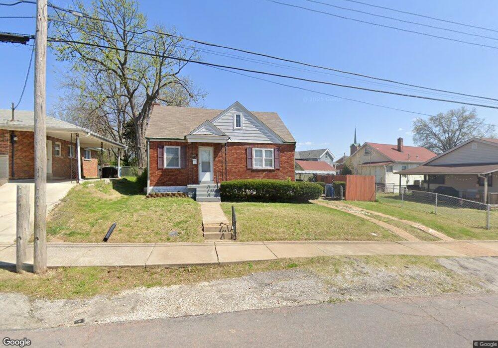
8630 Brinker Ave Saint Louis, MO 63123
Estimated Value: $176,000 - $194,000
2
Beds
1
Bath
786
Sq Ft
$233/Sq Ft
Est. Value
About This Home
This home is located at 8630 Brinker Ave, Saint Louis, MO 63123 and is currently estimated at $183,128, approximately $232 per square foot. 8630 Brinker Ave is a home located in St. Louis County with nearby schools including Mesnier Primary School, Gotsch Intermediate School, and Rogers Middle School.
Ownership History
Date
Name
Owned For
Owner Type
Purchase Details
Closed on
Jul 31, 2007
Sold by
Whitney David J and Whitney Judith Ann
Bought by
Hudson Cynthia R
Current Estimated Value
Home Financials for this Owner
Home Financials are based on the most recent Mortgage that was taken out on this home.
Original Mortgage
$21,980
Interest Rate
6.42%
Mortgage Type
Stand Alone Second
Purchase Details
Closed on
Dec 28, 2004
Sold by
Whitney David J
Bought by
Whitney Ii David J and Whitney Judith Ann
Create a Home Valuation Report for This Property
The Home Valuation Report is an in-depth analysis detailing your home's value as well as a comparison with similar homes in the area
Home Values in the Area
Average Home Value in this Area
Purchase History
| Date | Buyer | Sale Price | Title Company |
|---|---|---|---|
| Hudson Cynthia R | $109,900 | None Available | |
| Whitney Ii David J | -- | -- |
Source: Public Records
Mortgage History
| Date | Status | Borrower | Loan Amount |
|---|---|---|---|
| Closed | Hudson Cynthia R | $21,980 | |
| Open | Hudson Cynthia R | $87,920 |
Source: Public Records
Tax History
| Year | Tax Paid | Tax Assessment Tax Assessment Total Assessment is a certain percentage of the fair market value that is determined by local assessors to be the total taxable value of land and additions on the property. | Land | Improvement |
|---|---|---|---|---|
| 2025 | $2,410 | $32,060 | $12,220 | $19,840 |
| 2024 | $2,410 | $29,600 | $8,150 | $21,450 |
| 2023 | $2,330 | $29,600 | $8,150 | $21,450 |
| 2022 | $2,084 | $22,650 | $8,150 | $14,500 |
| 2021 | $1,903 | $22,650 | $8,150 | $14,500 |
| 2020 | $1,797 | $19,950 | $8,150 | $11,800 |
| 2019 | $1,794 | $19,950 | $8,150 | $11,800 |
| 2018 | $1,552 | $15,220 | $5,700 | $9,520 |
| 2017 | $1,542 | $15,220 | $5,700 | $9,520 |
| 2016 | $1,306 | $13,660 | $3,250 | $10,410 |
Source: Public Records
Map
Nearby Homes
- 9225 Pavia Ave
- 6209 Bixby Ave
- 9320 Sterling Place
- 9018 Vasel Dr
- 8520 Ava Dr
- 6321 Sheppard Dr
- 8506 Mathilda Ave
- 6421 Judson Ave
- 8501 Palmetto Dr
- 9406 Mackenzie Rd
- 5315 Vine Ave
- 9117 Tiber Ct
- 5138 Lode Ave
- 6714 Colony Acres Dr
- 6722 Colony Acres Dr
- 6723 Colony Acres Dr
- 9530 Erie Dr
- 9200 Papoose Dr
- 8200 New Hampshire Ave
- 8942 Eden Ave
- 8626 Brinker Ave
- 9227 Pavia Ave
- 9223 Pavia Ave
- 9219 Pavia Ave
- 8629 Brinker Ave
- 8633 Brinker Ave
- 8625 Brinker Ave
- 8637 Brinker Ave
- 9217 Pavia Ave
- 8641 Brinker Ave
- 8621 Brinker Ave
- 8624 Brinker Ave
- 8620 Brinker Ave
- 9213 Pavia Ave
- 8617 Brinker Ave
- 8701 Brinker Ave
- 8628 Neier Ln
- 8632 Neier Ln
- 8636 Neier Ln
- 8624 Neier Ln
Your Personal Tour Guide
Ask me questions while you tour the home.