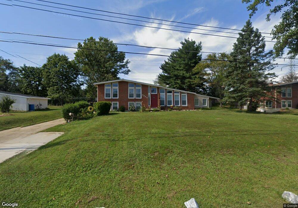
8634 Tower Dr Laurel, MD 20723
Estimated Value: $675,000 - $793,000
Studio
2
Baths
3,179
Sq Ft
$232/Sq Ft
Est. Value
About This Home
This home is located at 8634 Tower Dr, Laurel, MD 20723 and is currently estimated at $737,292, approximately $231 per square foot. 8634 Tower Dr is a home located in Howard County with nearby schools including Hammond Elementary School, Hammond Middle School, and Reservoir High School.
Ownership History
Date
Name
Owned For
Owner Type
Purchase Details
Closed on
Dec 29, 2004
Sold by
Kizzie Michael I
Bought by
Robert Reilly and Robert Pamela Reilly
Current Estimated Value
Purchase Details
Closed on
Dec 27, 2004
Sold by
Kizzie Michael I
Bought by
Robert Reilly and Robert Reilly
Purchase Details
Closed on
Oct 25, 2001
Sold by
Lomax Natalie C
Bought by
Kizzie Michael I
Purchase Details
Closed on
Dec 12, 1996
Sold by
Daniels David J
Bought by
Lomax Natalie C and Lomax Kizzie
Create a Home Valuation Report for This Property
The Home Valuation Report is an in-depth analysis detailing your home's value as well as a comparison with similar homes in the area
Home Values in the Area
Average Home Value in this Area
Purchase History
| Date | Buyer | Sale Price | Title Company |
|---|---|---|---|
| Robert Reilly | $450,000 | -- | |
| Robert Reilly | $450,000 | -- | |
| Kizzie Michael I | -- | -- | |
| Lomax Natalie C | $206,300 | -- |
Source: Public Records
Mortgage History
| Date | Status | Borrower | Loan Amount |
|---|---|---|---|
| Closed | Lomax Natalie C | -- |
Source: Public Records
Tax History
| Year | Tax Paid | Tax Assessment Tax Assessment Total Assessment is a certain percentage of the fair market value that is determined by local assessors to be the total taxable value of land and additions on the property. | Land | Improvement |
|---|---|---|---|---|
| 2025 | $7,252 | $529,800 | $250,100 | $279,700 |
| 2024 | $7,252 | $503,700 | $0 | $0 |
| 2023 | $6,771 | $477,600 | $0 | $0 |
| 2022 | $6,424 | $451,500 | $240,100 | $211,400 |
| 2021 | $5,825 | $419,933 | $0 | $0 |
| 2020 | $5,825 | $388,367 | $0 | $0 |
| 2019 | $5,542 | $356,800 | $183,000 | $173,800 |
| 2018 | $5,171 | $351,367 | $0 | $0 |
| 2017 | $5,078 | $356,800 | $0 | $0 |
| 2016 | -- | $340,500 | $0 | $0 |
| 2015 | -- | $336,533 | $0 | $0 |
| 2014 | -- | $332,567 | $0 | $0 |
Source: Public Records
Map
Nearby Homes
- 10571 Scaggsville Rd
- 8616 Doves Fly Way
- 10747 Glen Hannah Dr
- 8251 Mary Lee Ln
- 10213 Deep Skies Dr
- 8302 Spring Blossom Ct
- 9890 Deer Run
- 7926 Helmart Dr
- 9843 Snow Bird Ln
- 7920 Helmart Dr
- 8380 Ice Crystal Dr
- 7209 Brooklyn Bridge Rd
- 7106 Donston Dr
- 10725 E Crestview Ln
- 9046 Gorman Rd
- 9843 Wilderness Ln
- 9756 Knowledge Dr
- 11375 Harding Rd
- 16140 Kenny Rd
- 9342 Canterbury Riding
- 8638 Tower Dr
- 8630 Tower Dr
- 8642 Tower Dr
- 8633 Tower Dr
- 8637 Tower Dr
- 8629 Tower Dr
- 8646 Tower Dr
- 8641 Tower Dr
- 8625 Tower Dr
- 8645 Tower Dr
- 10509 Scaggsville Rd
- 8650 Tower Dr
- 10517 Scaggsville Rd
- 8621 Tower Dr
- 8649 Tower Dr
- 8654 Tower Dr
- 8610 Woods End Dr
- 10477 Scaggsville Rd
- 8606 Woods End Dr
- 8653 Tower Dr
Your Personal Tour Guide
Ask me questions while you tour the home.