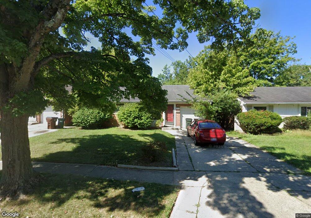
8637 Mockingbird Ln Cincinnati, OH 45231
Finneytown NeighborhoodEstimated Value: $237,000 - $268,000
3
Beds
2
Baths
1,889
Sq Ft
$132/Sq Ft
Est. Value
About This Home
This home is located at 8637 Mockingbird Ln, Cincinnati, OH 45231 and is currently estimated at $249,941, approximately $132 per square foot. 8637 Mockingbird Ln is a home located in Hamilton County with nearby schools including Finneytown Elementary School, Finneytown Secondary Campus, and St. Vivian School.
Ownership History
Date
Name
Owned For
Owner Type
Purchase Details
Closed on
May 20, 2011
Sold by
Miller Edward S
Bought by
Howell Rosemary
Current Estimated Value
Home Financials for this Owner
Home Financials are based on the most recent Mortgage that was taken out on this home.
Original Mortgage
$92,591
Outstanding Balance
$65,254
Interest Rate
5.5%
Mortgage Type
FHA
Estimated Equity
$184,687
Create a Home Valuation Report for This Property
The Home Valuation Report is an in-depth analysis detailing your home's value as well as a comparison with similar homes in the area
Home Values in the Area
Average Home Value in this Area
Purchase History
| Date | Buyer | Sale Price | Title Company |
|---|---|---|---|
| Howell Rosemary | $95,000 | Attorney |
Source: Public Records
Mortgage History
| Date | Status | Borrower | Loan Amount |
|---|---|---|---|
| Open | Howell Rosemary | $92,591 |
Source: Public Records
Tax History
| Year | Tax Paid | Tax Assessment Tax Assessment Total Assessment is a certain percentage of the fair market value that is determined by local assessors to be the total taxable value of land and additions on the property. | Land | Improvement |
|---|---|---|---|---|
| 2025 | $5,038 | $72,185 | $10,203 | $61,982 |
| 2024 | $4,921 | $72,185 | $10,203 | $61,982 |
| 2023 | $4,839 | $72,185 | $10,203 | $61,982 |
| 2022 | $3,925 | $42,445 | $10,070 | $32,375 |
| 2021 | $3,851 | $42,445 | $10,070 | $32,375 |
| 2020 | $3,914 | $42,445 | $10,070 | $32,375 |
| 2019 | $3,594 | $35,970 | $8,533 | $27,437 |
| 2018 | $3,318 | $35,970 | $8,533 | $27,437 |
| 2017 | $3,162 | $35,970 | $8,533 | $27,437 |
| 2016 | $2,828 | $31,591 | $8,813 | $22,778 |
| 2015 | $2,845 | $31,591 | $8,813 | $22,778 |
| 2014 | $2,847 | $31,591 | $8,813 | $22,778 |
| 2013 | $2,900 | $33,250 | $9,275 | $23,975 |
Source: Public Records
Map
Nearby Homes
- 8628 Mockingbird Ln
- 1055 Hempstead Dr
- 1116 Madeleine Cir
- 1144 Hempstead Dr
- 8754 Monsanto Dr
- 8829 Mockingbird Ln
- 1101 Meadowind Ct
- 958 Hollytree Dr
- 1006 Hearthstone Dr
- 8943 Monsanto Dr
- 9137 Fontainebleau Terrace
- 881 Sabino Ct
- 1297 Landis Ln
- 8719 Hood Ct
- 1123 Compton Rd
- 1115 Compton Rd
- 8771 Desoto Dr
- 1165 W Galbraith Rd
- 816 Sabino Ct
- 7352 Clovernook Ave
- 8643 Mockingbird Ln
- 8633 Mockingbird Ln
- 8647 Mockingbird Ln
- 1067 Vacationland Dr
- 8634 Mockingbird Ln
- 8657 Mockingbird Ln
- 1084 Hempstead Dr
- 1080 Hempstead Dr
- 1061 Vacationland Dr
- 1088 Hempstead Dr
- 1070 Vacationland Dr
- 1076 Hempstead Dr
- 8648 Melody Ln
- 8640 Melody Ln
- 1092 Hempstead Dr
- 8632 Melody Ln
- 8616 Mockingbird Ln
- 8656 Melody Ln
- 1055 Vacationland Dr
- 8624 Melody Ln
Your Personal Tour Guide
Ask me questions while you tour the home.