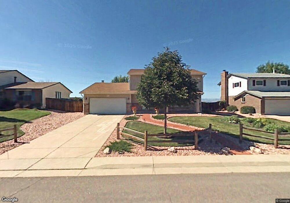
864 Mercury Cir Lone Tree, CO 80124
Estimated Value: $626,000 - $666,826
4
Beds
3
Baths
2,164
Sq Ft
$299/Sq Ft
Est. Value
About This Home
This home is located at 864 Mercury Cir, Lone Tree, CO 80124 and is currently estimated at $646,413, approximately $298 per square foot. 864 Mercury Cir is a home located in Douglas County with nearby schools including Acres Green Elementary School, Cresthill Middle School, and Highlands Ranch High School.
Ownership History
Date
Name
Owned For
Owner Type
Purchase Details
Closed on
Apr 20, 1999
Sold by
Delisle Cheryl L
Bought by
Thompson Russell S and Thompson Laura F
Current Estimated Value
Home Financials for this Owner
Home Financials are based on the most recent Mortgage that was taken out on this home.
Original Mortgage
$146,000
Outstanding Balance
$37,339
Interest Rate
7.16%
Estimated Equity
$609,074
Purchase Details
Closed on
Mar 27, 1996
Sold by
Delisle Jerry C
Bought by
Delisle Cheryl L
Purchase Details
Closed on
May 29, 1990
Sold by
Lightcap Keith N and Lightcap Joan S
Bought by
Lisle Jerry C De and Lisle Cheryl L De
Purchase Details
Closed on
Apr 7, 1986
Sold by
Cardwell William O and Cardwell Alicia T
Bought by
Lightcap Keith N and Lightcap Joan S
Create a Home Valuation Report for This Property
The Home Valuation Report is an in-depth analysis detailing your home's value as well as a comparison with similar homes in the area
Home Values in the Area
Average Home Value in this Area
Purchase History
| Date | Buyer | Sale Price | Title Company |
|---|---|---|---|
| Thompson Russell S | $182,500 | First American Heritage Titl | |
| Delisle Cheryl L | -- | -- | |
| Lisle Jerry C De | $111,500 | -- | |
| Lightcap Keith N | $113,000 | -- |
Source: Public Records
Mortgage History
| Date | Status | Borrower | Loan Amount |
|---|---|---|---|
| Open | Thompson Russell S | $146,000 |
Source: Public Records
Tax History Compared to Growth
Tax History
| Year | Tax Paid | Tax Assessment Tax Assessment Total Assessment is a certain percentage of the fair market value that is determined by local assessors to be the total taxable value of land and additions on the property. | Land | Improvement |
|---|---|---|---|---|
| 2024 | $3,074 | $43,890 | $10,040 | $33,850 |
| 2023 | $3,106 | $43,890 | $10,040 | $33,850 |
| 2022 | $2,655 | $36,780 | $8,530 | $28,250 |
| 2021 | $2,762 | $36,780 | $8,530 | $28,250 |
| 2020 | $3,277 | $36,250 | $7,800 | $28,450 |
| 2019 | $3,288 | $36,250 | $7,800 | $28,450 |
| 2018 | $2,437 | $28,780 | $7,070 | $21,710 |
| 2017 | $2,477 | $28,780 | $7,070 | $21,710 |
| 2016 | $2,464 | $28,040 | $6,420 | $21,620 |
| 2015 | $1,260 | $28,040 | $6,420 | $21,620 |
| 2014 | $1,854 | $19,320 | $3,980 | $15,340 |
Source: Public Records
Map
Nearby Homes
- 789 Hamal Dr
- 7057 Chestnut Hill St
- 979 Mercury Cir
- 7041 Chestnut Hill Trail
- 9275 Erminedale Dr
- 13134 Deneb Dr
- 7971 Arrowhead Ct
- 202 Helena Cir
- 7107 Mountain Brush Cir
- 7151 Palisade Dr
- 7804 Silverweed Way
- 13678 Omega Cir
- 8049 Sweet Water Rd
- 426 Jupiter Dr
- 6395 Nassau Ct
- 9416 Kemper Dr
- 6550 Ashburn Ln
- 9412 La Quinta Way
- 6482 Silver Mesa Dr Unit B
- 8159 Lodgepole Trail
- 858 Mercury Cir
- 866 Mercury Cir
- 868 Mercury Cir
- 856 Mercury Cir
- 859 Mercury Cir
- 854 Mercury Cir
- 855 Mercury Cir
- 869 Mercury Cir
- 13256 Canopus Dr
- 878 Mercury Cir
- 848 Mercury Cir
- 875 Mercury Cir
- 849 Mercury Cir
- 8922 Chestnut Hill Ln
- 13245 Canopus Dr
- 8932 Chestnut Hill Ln
- 8912 Chestnut Hill Ln
- 13246 Canopus Dr
- 8942 Chestnut Hill Ln
- 879 Mercury Cir