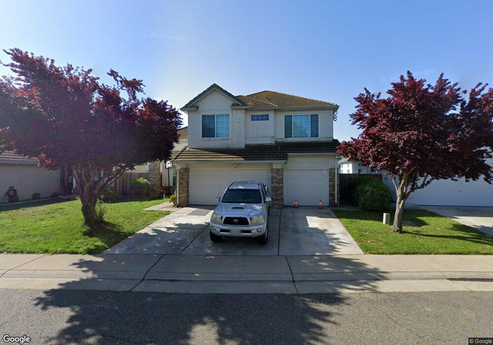
8642 Dorsey Way Sacramento, CA 95828
Estimated Value: $437,000 - $650,000
4
Beds
2
Baths
2,276
Sq Ft
$251/Sq Ft
Est. Value
About This Home
This home is located at 8642 Dorsey Way, Sacramento, CA 95828 and is currently estimated at $570,237, approximately $250 per square foot. 8642 Dorsey Way is a home located in Sacramento County with nearby schools including Raymond Case Elementary School, Edward Harris Jr. Middle School, and Monterey Trail High School.
Ownership History
Date
Name
Owned For
Owner Type
Purchase Details
Closed on
Jul 6, 2010
Sold by
Bank Of New York
Bought by
Yang Kong H and Thao Phoua
Current Estimated Value
Home Financials for this Owner
Home Financials are based on the most recent Mortgage that was taken out on this home.
Original Mortgage
$207,209
Outstanding Balance
$137,003
Interest Rate
4.62%
Mortgage Type
FHA
Estimated Equity
$433,234
Purchase Details
Closed on
Feb 3, 2010
Sold by
Chand Theresa and Chand Satish
Bought by
Bank Of New York
Purchase Details
Closed on
Feb 14, 2007
Sold by
Chand Theresa and Chand Satish
Bought by
Bank Of New York
Purchase Details
Closed on
Jun 22, 2005
Sold by
Singh Sat Pal
Bought by
Chand Satish and Chand Theresa
Home Financials for this Owner
Home Financials are based on the most recent Mortgage that was taken out on this home.
Original Mortgage
$356,000
Interest Rate
1%
Mortgage Type
Negative Amortization
Purchase Details
Closed on
Feb 19, 2004
Sold by
Kaur Rani
Bought by
Singh Sat Pal
Home Financials for this Owner
Home Financials are based on the most recent Mortgage that was taken out on this home.
Original Mortgage
$185,000
Interest Rate
5.62%
Mortgage Type
New Conventional
Purchase Details
Closed on
Oct 1, 2001
Sold by
Singh Sat Pal
Bought by
Singh Sat Pal and Kaur Rani
Home Financials for this Owner
Home Financials are based on the most recent Mortgage that was taken out on this home.
Original Mortgage
$189,000
Interest Rate
6.63%
Purchase Details
Closed on
Aug 11, 2000
Sold by
Kaur Rani
Bought by
Singh Sat Pal
Home Financials for this Owner
Home Financials are based on the most recent Mortgage that was taken out on this home.
Original Mortgage
$186,200
Interest Rate
8.15%
Purchase Details
Closed on
Apr 11, 2000
Sold by
Carter Longshaw Patrick C and Carter Jack
Bought by
Federal National Mortgage Association
Purchase Details
Closed on
May 9, 1997
Sold by
Smc Development Corp
Bought by
Longshaw Patrick C and Carter Jack
Home Financials for this Owner
Home Financials are based on the most recent Mortgage that was taken out on this home.
Original Mortgage
$155,325
Interest Rate
8.15%
Create a Home Valuation Report for This Property
The Home Valuation Report is an in-depth analysis detailing your home's value as well as a comparison with similar homes in the area
Home Values in the Area
Average Home Value in this Area
Purchase History
| Date | Buyer | Sale Price | Title Company |
|---|---|---|---|
| Yang Kong H | $210,000 | Landsafe Title Of California | |
| Bank Of New York | $192,150 | Landsafe Title | |
| Bank Of New York | $353,250 | Landsafe Title | |
| Chand Satish | $445,000 | Fidelity National Title Co | |
| Singh Sat Pal | -- | Alliance Title Company | |
| Singh Sat Pal | -- | Old Republic Title Company | |
| Singh Sat Pal | -- | Chicago Title Co | |
| Singh Sat Pal | $196,000 | Chicago Title Co | |
| Federal National Mortgage Association | $165,144 | Fidelity National Title Co | |
| Longshaw Patrick C | $164,000 | Old Republic Title Company |
Source: Public Records
Mortgage History
| Date | Status | Borrower | Loan Amount |
|---|---|---|---|
| Open | Yang Kong H | $207,209 | |
| Previous Owner | Chand Satish | $356,000 | |
| Previous Owner | Singh Sat Pal | $185,000 | |
| Previous Owner | Singh Sat Pal | $189,000 | |
| Previous Owner | Singh Sat Pal | $186,200 | |
| Previous Owner | Longshaw Patrick C | $155,325 |
Source: Public Records
Tax History Compared to Growth
Tax History
| Year | Tax Paid | Tax Assessment Tax Assessment Total Assessment is a certain percentage of the fair market value that is determined by local assessors to be the total taxable value of land and additions on the property. | Land | Improvement |
|---|---|---|---|---|
| 2025 | $2,979 | $269,031 | $44,833 | $224,198 |
| 2024 | $2,979 | $263,756 | $43,954 | $219,802 |
| 2023 | $2,906 | $258,586 | $43,093 | $215,493 |
| 2022 | $2,857 | $253,517 | $42,249 | $211,268 |
| 2021 | $2,826 | $248,547 | $41,421 | $207,126 |
| 2020 | $2,789 | $246,000 | $40,997 | $205,003 |
| 2019 | $2,739 | $241,178 | $40,194 | $200,984 |
| 2018 | $2,668 | $236,450 | $39,406 | $197,044 |
| 2017 | $2,623 | $231,815 | $38,634 | $193,181 |
| 2016 | $2,495 | $227,271 | $37,877 | $189,394 |
| 2015 | $2,450 | $223,859 | $37,309 | $186,550 |
| 2014 | $2,410 | $219,475 | $36,579 | $182,896 |
Source: Public Records
Map
Nearby Homes
- 8643 Rothenburg Ct
- 8216 Exbourne Cir
- 8578 Hydrangea Ct
- 8233 Short Rd
- 8159 Morgan Hill Way
- 8772 Crusheen Way
- 8447 Cassatt Way
- 8170 Derbyshire Cir
- 8247 Derbyshire Cir
- 8831 Liscarney Way
- 8437 Yermo Way
- 8809 Coral Berry Way
- 8329 Spengler Dr
- 8902 Cobble Crest Dr
- 8317 Honeycomb Way
- 8716 Cord Way
- 8336 Cutler Way
- 8269 Red Rock Dr
- 8788 Apricot Woods Way
- 8034 Kelty Ct
- 8638 Dorsey Way
- 8646 Dorsey Way
- 8634 Dorsey Way
- 8641 Everidge Ct
- 8650 Dorsey Way
- 8637 Everidge Ct
- 8643 Dorsey Way
- 8637 Dorsey Way
- 8633 Everidge Ct
- 8649 Everidge Ct
- 8306 Hardester Dr
- 8630 Dorsey Way
- 8633 Dorsey Way
- 8629 Everidge Ct
- 8300 Hardester Dr
- 8629 Dorsey Way
- 8626 Dorsey Way
- 8321 Hardester Dr
- 8317 Hardester Dr
- 8325 Hardester Dr