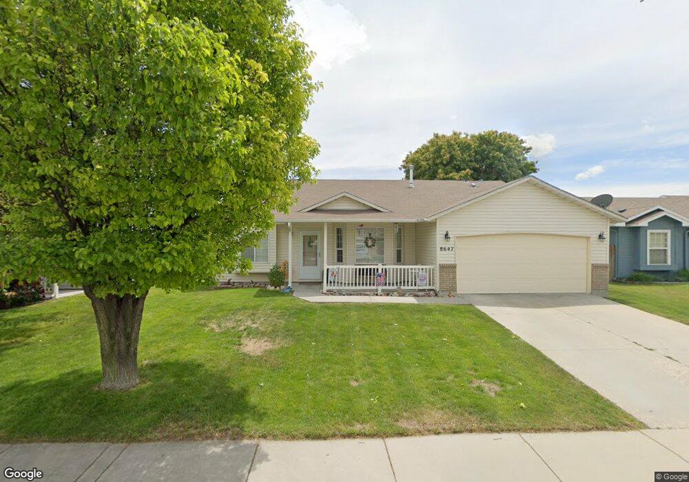
8647 W Wall Dr Boise, ID 83709
Southwest Boise NeighborhoodEstimated Value: $380,000 - $401,000
3
Beds
2
Baths
1,198
Sq Ft
$328/Sq Ft
Est. Value
About This Home
This home is located at 8647 W Wall Dr, Boise, ID 83709 and is currently estimated at $392,840, approximately $327 per square foot. 8647 W Wall Dr is a home located in Ada County with nearby schools including Silver Sage Elementary School, Lake Hazel Middle School, and Mountain View High School.
Ownership History
Date
Name
Owned For
Owner Type
Purchase Details
Closed on
Apr 5, 2001
Sold by
Corey Barton Construction Inc
Bought by
Nuhanovic Semso and Talic Zemina
Current Estimated Value
Home Financials for this Owner
Home Financials are based on the most recent Mortgage that was taken out on this home.
Original Mortgage
$102,136
Outstanding Balance
$38,128
Interest Rate
7.19%
Mortgage Type
FHA
Estimated Equity
$354,712
Purchase Details
Closed on
Dec 28, 2000
Sold by
Premier Homes Inc
Bought by
Republic Mtg Corp
Purchase Details
Closed on
Mar 10, 2000
Sold by
Parkland Development Llc
Bought by
Premier Homes Inc
Create a Home Valuation Report for This Property
The Home Valuation Report is an in-depth analysis detailing your home's value as well as a comparison with similar homes in the area
Home Values in the Area
Average Home Value in this Area
Purchase History
| Date | Buyer | Sale Price | Title Company |
|---|---|---|---|
| Nuhanovic Semso | -- | Stewart Title | |
| Republic Mtg Corp | $30,000 | Stewart Title | |
| Premier Homes Inc | -- | American Land Title Co |
Source: Public Records
Mortgage History
| Date | Status | Borrower | Loan Amount |
|---|---|---|---|
| Open | Nuhanovic Semso | $102,136 |
Source: Public Records
Tax History Compared to Growth
Tax History
| Year | Tax Paid | Tax Assessment Tax Assessment Total Assessment is a certain percentage of the fair market value that is determined by local assessors to be the total taxable value of land and additions on the property. | Land | Improvement |
|---|---|---|---|---|
| 2025 | $1,377 | $357,200 | -- | -- |
| 2024 | $1,437 | $344,400 | -- | -- |
| 2023 | $1,437 | $326,900 | $0 | $0 |
| 2022 | $1,717 | $395,800 | $0 | $0 |
| 2021 | $1,814 | $312,400 | $0 | $0 |
| 2020 | $1,813 | $238,200 | $0 | $0 |
| 2019 | $2,083 | $222,400 | $0 | $0 |
| 2018 | $1,831 | $187,600 | $0 | $0 |
| 2017 | $2,174 | $171,500 | $0 | $0 |
| 2016 | $1,749 | $160,100 | $0 | $0 |
| 2015 | -- | $145,600 | $0 | $0 |
| 2012 | -- | $100,900 | $0 | $0 |
Source: Public Records
Map
Nearby Homes
- 2959 S Saturn Way
- 8335 W Grubstake St
- 4735 S Rawhide Ave
- 4667 S Shawnee Way
- 7967 W Tillamook Dr
- 9538 W Silverbirch St
- 4444 S Carbine Ave
- 4400 S Carbine Ave
- 9339 W Sageberry Dr
- 9303 W Stirrup Dr
- 851 S Cole Rd
- 9117 W Wright St
- 6022 S Snowshoe Ave
- 4000 S Cole Rd
- 7134 W Amity Rd
- 4155 W Leland Way
- 9212 W Brogan Dr
- 9516 W Portola Dr
- 5109 S Cheyenne Ave
- 5708 S Kimmer Cove Way
- 8663 W Wall Dr
- 8631 W Wall Dr
- 8609 W Wall Dr
- 8685 W Wall Dr
- 8656 W Wall Dr
- 8634 W Wall Dr
- 4774 S Choctaw Ave
- 8612 W Wall Dr
- 8599 W Wall Dr
- 8699 W Wall Dr
- 4750 S Choctaw Ave
- 8598 W Wall Dr
- 8585 W Wall Dr
- 8713 W Wall Dr
- 8653 W Carnegie St
- 4736 S Choctaw Ave
- 8627 W Carnegie St
- 8675 W Carnegie St
- 4787 S Choctaw Ave
- 8601 W Carnegie St