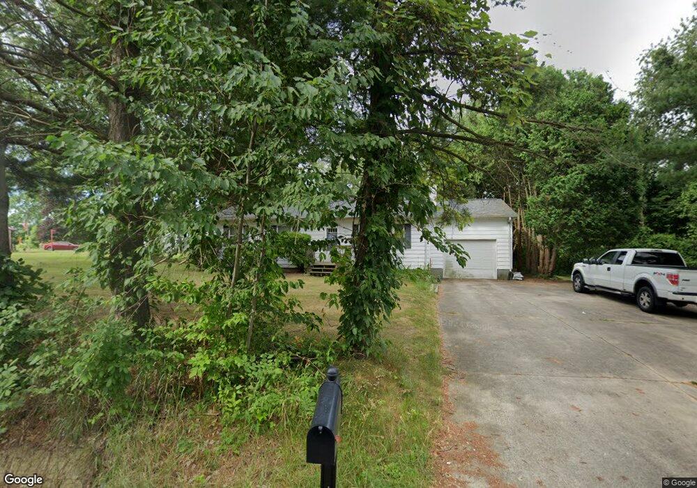
865 Cairns Rd Mansfield, OH 44903
Estimated Value: $175,016 - $222,000
3
Beds
1
Bath
1,320
Sq Ft
$155/Sq Ft
Est. Value
About This Home
This home is located at 865 Cairns Rd, Mansfield, OH 44903 and is currently estimated at $204,504, approximately $154 per square foot. 865 Cairns Rd is a home located in Richland County with nearby schools including Crestview Elementary School, Crestview Middle School, and Crestview High School.
Ownership History
Date
Name
Owned For
Owner Type
Purchase Details
Closed on
Nov 1, 2004
Sold by
Mitchell James R
Bought by
Nettles Alvin R
Current Estimated Value
Home Financials for this Owner
Home Financials are based on the most recent Mortgage that was taken out on this home.
Original Mortgage
$99,900
Outstanding Balance
$50,086
Interest Rate
5.85%
Mortgage Type
VA
Estimated Equity
$154,418
Purchase Details
Closed on
Aug 25, 1995
Sold by
Kuykendoll Milton D
Bought by
Mitchell James R
Home Financials for this Owner
Home Financials are based on the most recent Mortgage that was taken out on this home.
Original Mortgage
$62,500
Interest Rate
6.75%
Mortgage Type
New Conventional
Purchase Details
Closed on
Jul 31, 1992
Sold by
Yetzer Gerald L
Bought by
Kuykendoll Milton D
Purchase Details
Closed on
Sep 28, 1990
Purchase Details
Closed on
Jan 1, 1985
Create a Home Valuation Report for This Property
The Home Valuation Report is an in-depth analysis detailing your home's value as well as a comparison with similar homes in the area
Home Values in the Area
Average Home Value in this Area
Purchase History
| Date | Buyer | Sale Price | Title Company |
|---|---|---|---|
| Nettles Alvin R | $99,900 | -- | |
| Mitchell James R | $69,500 | -- | |
| Kuykendoll Milton D | $59,000 | -- | |
| -- | $57,900 | -- | |
| -- | $40,000 | -- |
Source: Public Records
Mortgage History
| Date | Status | Borrower | Loan Amount |
|---|---|---|---|
| Open | Nettles Alvin R | $99,900 | |
| Previous Owner | Mitchell James R | $62,500 |
Source: Public Records
Tax History
| Year | Tax Paid | Tax Assessment Tax Assessment Total Assessment is a certain percentage of the fair market value that is determined by local assessors to be the total taxable value of land and additions on the property. | Land | Improvement |
|---|---|---|---|---|
| 2024 | $2,122 | $44,760 | $9,790 | $34,970 |
| 2023 | $2,170 | $44,760 | $9,790 | $34,970 |
| 2022 | $2,009 | $36,810 | $8,750 | $28,060 |
| 2021 | $2,009 | $36,810 | $8,750 | $28,060 |
| 2020 | $2,024 | $36,810 | $8,750 | $28,060 |
| 2019 | $1,930 | $31,200 | $7,420 | $23,780 |
| 2018 | $1,804 | $31,200 | $7,420 | $23,780 |
| 2017 | $1,766 | $31,200 | $7,420 | $23,780 |
| 2016 | $1,808 | $30,860 | $7,050 | $23,810 |
| 2015 | $1,808 | $30,860 | $7,050 | $23,810 |
| 2014 | $1,718 | $30,860 | $7,050 | $23,810 |
| 2012 | $854 | $32,490 | $7,420 | $25,070 |
Source: Public Records
Map
Nearby Homes
- 1501 Bowman St
- 395 Cairns Rd
- 1101 Lenox Ave
- 1092 N Trimble Rd
- 0 Miller Pkwy
- 640 Hanna Rd
- 630 Hanna Rd
- 933 Fairfax Ave
- 880 Fairfax Ave
- 878 Fairfax Ave
- 891 Springmill Rd
- 1590 Walker Woods Blvd
- 1592 Walker Woods Blvd
- 761 Fairfax Ave
- Lot 2 Spring Village Ln
- 728 N Trimble Rd
- 1113 Wyandotte Ave
- 641 Averill Ave
- 0 Highway 30
- 572 France St
- 863 Cairns Rd
- 861 Cairns Rd
- 888 Cairns Rd
- 888 Cairns Rd
- 808 Cairns Rd
- 808 Cairns Rd
- 788 Cairns Rd
- 1765 Bowman Street Rd
- 1765 Bowman Street Rd
- 778 Cairns Rd
- 1677 Stevens Ct
- 1679 Stevens Ct
- 775 Cairns Rd
- 766 Cairns Rd
- 1669 Stevens Ct
- 1671 Stevens Ct Unit 1677
- 1676 Stevens Ct Unit 1678
- 763 Cairns Rd
- 754 Cairns Rd
- 1757 Bowman Street Rd
Your Personal Tour Guide
Ask me questions while you tour the home.