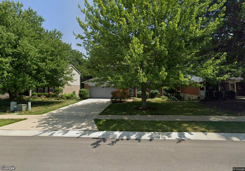
8656 Beckys Ridge Dr Cincinnati, OH 45251
Estimated Value: $304,173 - $324,000
4
Beds
3
Baths
2,064
Sq Ft
$152/Sq Ft
Est. Value
About This Home
This home is located at 8656 Beckys Ridge Dr, Cincinnati, OH 45251 and is currently estimated at $314,543, approximately $152 per square foot. 8656 Beckys Ridge Dr is a home located in Hamilton County with nearby schools including Colerain Elementary School, Colerain Middle School, and Colerain High School.
Ownership History
Date
Name
Owned For
Owner Type
Purchase Details
Closed on
Apr 11, 2024
Sold by
Cox Monica M
Bought by
Cox Monica M and Smart Thomas W
Current Estimated Value
Purchase Details
Closed on
Aug 10, 2011
Sold by
Cox Maureen G and Cox Monica M
Bought by
Cox Maureen G and Cox Monica M
Purchase Details
Closed on
Jan 6, 1994
Sold by
Sample David S and Sample Kathy A
Bought by
Cox Maureen G and Cox Monica M
Home Financials for this Owner
Home Financials are based on the most recent Mortgage that was taken out on this home.
Original Mortgage
$95,900
Interest Rate
7.35%
Create a Home Valuation Report for This Property
The Home Valuation Report is an in-depth analysis detailing your home's value as well as a comparison with similar homes in the area
Home Values in the Area
Average Home Value in this Area
Purchase History
| Date | Buyer | Sale Price | Title Company |
|---|---|---|---|
| Cox Monica M | -- | None Listed On Document | |
| Cox Maureen G | -- | Attorney | |
| Cox Maureen G | -- | -- |
Source: Public Records
Mortgage History
| Date | Status | Borrower | Loan Amount |
|---|---|---|---|
| Previous Owner | Cox Maureen G | $95,900 |
Source: Public Records
Tax History Compared to Growth
Tax History
| Year | Tax Paid | Tax Assessment Tax Assessment Total Assessment is a certain percentage of the fair market value that is determined by local assessors to be the total taxable value of land and additions on the property. | Land | Improvement |
|---|---|---|---|---|
| 2024 | $3,669 | $78,775 | $12,467 | $66,308 |
| 2023 | $3,736 | $78,775 | $12,467 | $66,308 |
| 2022 | $3,703 | $65,038 | $10,826 | $54,212 |
| 2021 | $3,660 | $65,038 | $10,826 | $54,212 |
| 2020 | $3,712 | $65,038 | $10,826 | $54,212 |
| 2019 | $3,085 | $52,448 | $8,729 | $43,719 |
| 2018 | $2,767 | $52,448 | $8,729 | $43,719 |
| 2017 | $2,614 | $52,448 | $8,729 | $43,719 |
| 2016 | $2,787 | $54,831 | $8,687 | $46,144 |
| 2015 | $2,822 | $54,831 | $8,687 | $46,144 |
| 2014 | $2,827 | $54,831 | $8,687 | $46,144 |
| 2013 | $2,859 | $57,719 | $9,146 | $48,573 |
Source: Public Records
Map
Nearby Homes
- 8625 Noelle Dr
- 2787 Rylan Dr
- 2807 Sovereign Dr
- 8628 Paisley Dr
- 8741 Beckys Ridge Dr
- 2803 Sovereign Dr
- 2919 Sovereign Dr
- 8537 Noelle Dr
- Dallas Plan at North Ridge
- Avalon Plan at North Ridge
- Rockford Plan at North Ridge
- Aster Plan at North Ridge
- Daffodil Plan at North Ridge
- Sanibel Plan at North Ridge
- Daisy Plan at North Ridge
- 8659 Sarahs Bend Dr
- 3055 Sovereign Dr
- 2422 Bluelark Dr
- 8784 Pippin Rd
- 2378 Bluelark Dr
- 8650 Beckys Ridge Dr
- 8676 Beckys Ridge Dr
- 2808 Sovereign Dr
- 8638 Beckys Ridge Dr
- 2857 Michaels Run
- 8684 Beckys Ridge Dr
- 2856 Sovereign Dr
- 2871 Michaels Run
- 8617 Noelle Dr
- 2858 Michaels Run
- 8692 Beckys Ridge Dr
- 2870 Sovereign Dr
- 2883 Michaels Run
- 2809 Sovereign Dr
- 2872 Michaels Run
- 2833 Sovereign Dr
- 2882 Sovereign Dr
- 2805 Sovereign Dr
- 2845 Sovereign Dr
- Lot 26 Rylan Dr