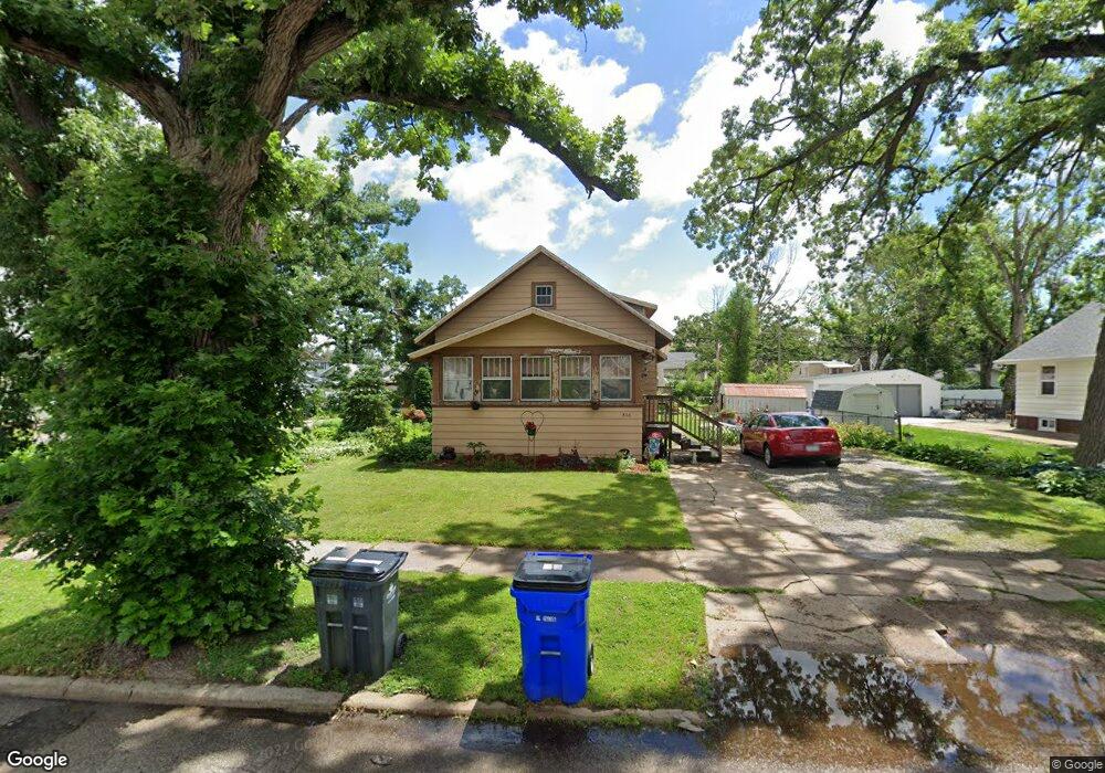
866 Daniels St NE Cedar Rapids, IA 52402
Mound View NeighborhoodEstimated Value: $156,000 - $167,918
5
Beds
2
Baths
1,335
Sq Ft
$120/Sq Ft
Est. Value
About This Home
This home is located at 866 Daniels St NE, Cedar Rapids, IA 52402 and is currently estimated at $160,730, approximately $120 per square foot. 866 Daniels St NE is a home located in Linn County with nearby schools including Garfield Elementary School, Franklin Middle School, and George Washington High School.
Ownership History
Date
Name
Owned For
Owner Type
Purchase Details
Closed on
Apr 8, 2016
Sold by
Nye Cynthia D and Blessing Cynthia D
Bought by
Nye Scott A and Nye Cynthia D
Current Estimated Value
Purchase Details
Closed on
Nov 12, 2002
Sold by
Dufoe David J
Bought by
Blessing Cynthia D and Kolter Gloria D
Home Financials for this Owner
Home Financials are based on the most recent Mortgage that was taken out on this home.
Original Mortgage
$78,380
Outstanding Balance
$33,023
Interest Rate
6.1%
Mortgage Type
FHA
Estimated Equity
$127,707
Purchase Details
Closed on
Dec 3, 1999
Sold by
Ryun Debra A and Rassler Steven C
Bought by
Dufoe David J
Home Financials for this Owner
Home Financials are based on the most recent Mortgage that was taken out on this home.
Original Mortgage
$71,250
Interest Rate
7.97%
Create a Home Valuation Report for This Property
The Home Valuation Report is an in-depth analysis detailing your home's value as well as a comparison with similar homes in the area
Home Values in the Area
Average Home Value in this Area
Purchase History
| Date | Buyer | Sale Price | Title Company |
|---|---|---|---|
| Nye Scott A | -- | None Available | |
| Blessing Cynthia D | $78,500 | -- | |
| Dufoe David J | $74,500 | -- |
Source: Public Records
Mortgage History
| Date | Status | Borrower | Loan Amount |
|---|---|---|---|
| Open | Blessing Cynthia D | $78,380 | |
| Previous Owner | Dufoe David J | $71,250 |
Source: Public Records
Tax History Compared to Growth
Tax History
| Year | Tax Paid | Tax Assessment Tax Assessment Total Assessment is a certain percentage of the fair market value that is determined by local assessors to be the total taxable value of land and additions on the property. | Land | Improvement |
|---|---|---|---|---|
| 2025 | $2,190 | $143,100 | $32,100 | $111,000 |
| 2024 | $2,234 | $134,200 | $28,900 | $105,300 |
| 2023 | $2,234 | $134,200 | $28,900 | $105,300 |
| 2022 | $1,956 | $114,800 | $27,300 | $87,500 |
| 2021 | $2,102 | $103,400 | $22,500 | $80,900 |
| 2020 | $2,102 | $103,900 | $22,500 | $81,400 |
| 2019 | $2,000 | $101,300 | $22,500 | $78,800 |
| 2018 | $1,940 | $101,300 | $22,500 | $78,800 |
| 2017 | $1,766 | $89,600 | $22,500 | $67,100 |
| 2016 | $1,971 | $92,700 | $22,500 | $70,200 |
| 2015 | $1,786 | $96,391 | $22,470 | $73,921 |
| 2014 | $1,866 | $101,431 | $22,470 | $78,961 |
| 2013 | $1,926 | $101,431 | $22,470 | $78,961 |
Source: Public Records
Map
Nearby Homes
- 832 Daniels St NE
- 826 Daniels St NE
- 1311 I Ave NE
- 910 Maplewood Dr NE
- 1046 12th St NE
- 420 16th St NE
- 1551 C Ave NE
- 1060 17th St NE
- 1608 B Ave NE
- 517 18th St NE
- 1204 Elmhurst Dr NE
- 2011 Sierra Cir NE
- 1815 E Ave NE
- 1719 C Ave NE
- 2015 Sierra Cir NE
- 2000 Sierra Cir NE
- 2019 Sierra Cir NE
- 2006 Sierra Cir NE
- 1735 C Ave NE
- 2023 Sierra Cir NE
- 868 Daniels St NE
- 854 Daniels St NE
- 872 Daniels St NE
- 850 Daniels St NE
- 848 Daniels St NE
- 880 Daniels St NE
- 865 Oakland Rd NE
- 861 Oakland Rd NE
- 844 Daniels St NE
- 875 Oakland Rd NE
- 857 Oakland Rd NE
- 886 Daniels St NE
- 877 Oakland Rd NE
- 851 Oakland Rd NE
- 861 Daniels St NE
- 842 Daniels St NE
- 865 Daniels St NE
- 857 Daniels St NE
- 881 Oakland Rd NE
- 888 Daniels St NE