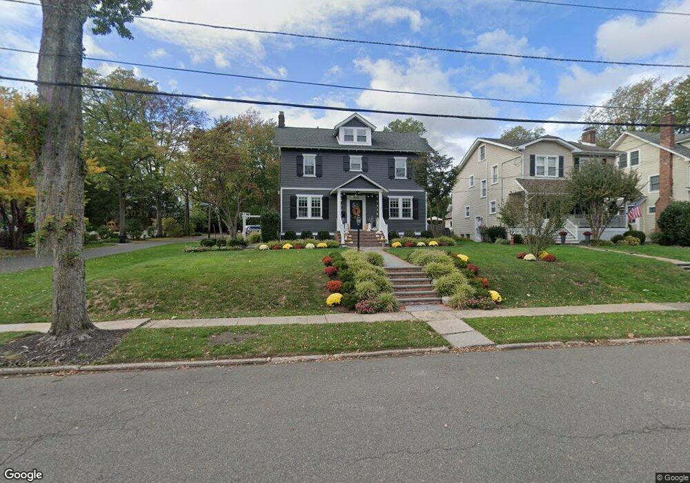
866 Dorian Rd Westfield, NJ 07090
Estimated Value: $1,156,374 - $1,405,000
--
Bed
--
Bath
2,412
Sq Ft
$523/Sq Ft
Est. Value
About This Home
This home is located at 866 Dorian Rd, Westfield, NJ 07090 and is currently estimated at $1,262,594, approximately $523 per square foot. 866 Dorian Rd is a home located in Union County with nearby schools including McKinley Elementary School, Westfield Senior High School, and Holy Trinity School.
Ownership History
Date
Name
Owned For
Owner Type
Purchase Details
Closed on
Feb 12, 1999
Sold by
Wilterdink Matthew A and Wilterdink Jodi A
Bought by
Cox Thomas J and Cox Renee J
Current Estimated Value
Home Financials for this Owner
Home Financials are based on the most recent Mortgage that was taken out on this home.
Original Mortgage
$200,000
Outstanding Balance
$47,379
Interest Rate
6.75%
Mortgage Type
Stand Alone First
Estimated Equity
$1,215,215
Purchase Details
Closed on
Jun 14, 1995
Sold by
Obrien John G and Obrien Marian F
Bought by
Wilterdink Matthew A and Wilterdink Jodi A
Create a Home Valuation Report for This Property
The Home Valuation Report is an in-depth analysis detailing your home's value as well as a comparison with similar homes in the area
Home Values in the Area
Average Home Value in this Area
Purchase History
| Date | Buyer | Sale Price | Title Company |
|---|---|---|---|
| Cox Thomas J | $385,000 | -- | |
| Wilterdink Matthew A | $283,000 | -- |
Source: Public Records
Mortgage History
| Date | Status | Borrower | Loan Amount |
|---|---|---|---|
| Open | Cox Thomas J | $200,000 |
Source: Public Records
Tax History Compared to Growth
Tax History
| Year | Tax Paid | Tax Assessment Tax Assessment Total Assessment is a certain percentage of the fair market value that is determined by local assessors to be the total taxable value of land and additions on the property. | Land | Improvement |
|---|---|---|---|---|
| 2025 | $17,811 | $790,900 | $506,500 | $284,400 |
| 2024 | $17,447 | $790,900 | $506,500 | $284,400 |
| 2023 | $17,447 | $790,900 | $506,500 | $284,400 |
| 2022 | $17,083 | $790,900 | $506,500 | $284,400 |
| 2021 | $17,107 | $790,900 | $506,500 | $284,400 |
| 2020 | $17,068 | $790,900 | $506,500 | $284,400 |
| 2019 | $17,004 | $790,900 | $506,500 | $284,400 |
| 2018 | $15,600 | $167,800 | $62,500 | $105,300 |
| 2017 | $15,515 | $167,800 | $62,500 | $105,300 |
| 2016 | $15,151 | $167,800 | $62,500 | $105,300 |
| 2015 | $14,849 | $167,800 | $62,500 | $105,300 |
| 2014 | $14,359 | $167,800 | $62,500 | $105,300 |
Source: Public Records
Map
Nearby Homes
- 314 Highgate Ave
- 1466 Lamberts Mill Rd
- 119 Lamberts Mill Rd
- 2154 W Broad St
- 525 Edgar Rd
- 524 Edgar Rd
- 614 Dorian Rd
- 2 Brookside Ct
- 676 Vermont St
- 538 Westfield Ave
- 2116 Newark Ave
- 724 South Ave W Unit 724A
- 1933 W Broad St
- 2 Dutch Ln
- 1933 Mary Ellen Ln
- 522 Boulevard
- 834 Tice Place
- 350 W Dudley Ave
- 814 Summit Ave
- 215 Ross Place Unit J
- 862 Dorian Rd
- 858 Dorian Rd
- 874 Dorian Rd
- 321 Saint Johns Place
- 856 Dorian Rd
- 320 Highgate Ave
- 867 Dorian Rd
- 863 Dorian Rd
- 869 Dorian Rd
- 310 Saint Johns Place
- 857 Dorian Rd
- 871 Dorian Rd
- 321 Lamberts Mill Rd
- 884 Dorian Rd
- 855 Dorian Rd
- 759 Warren St
- 844 Dorian Rd
- 765 Warren St
- 753 Warren St
- 311 Lamberts Mill Rd