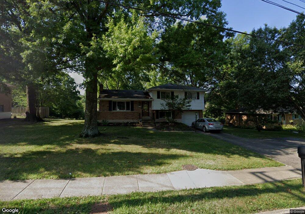
867 Compton Rd Cincinnati, OH 45231
Finneytown NeighborhoodEstimated Value: $266,000 - $287,000
3
Beds
3
Baths
2,130
Sq Ft
$129/Sq Ft
Est. Value
About This Home
This home is located at 867 Compton Rd, Cincinnati, OH 45231 and is currently estimated at $273,787, approximately $128 per square foot. 867 Compton Rd is a home located in Hamilton County with nearby schools including Finneytown Elementary School, Finneytown Secondary Campus, and John Paul II Catholic School.
Ownership History
Date
Name
Owned For
Owner Type
Purchase Details
Closed on
Oct 4, 2000
Sold by
Vordenberg Eric R and Vordenberg Verna L
Bought by
Ewing Lashaunda
Current Estimated Value
Home Financials for this Owner
Home Financials are based on the most recent Mortgage that was taken out on this home.
Original Mortgage
$116,875
Interest Rate
10.41%
Purchase Details
Closed on
Jul 2, 1996
Sold by
Steinle Janice
Bought by
Vordenberg Eric R and Vordenberg Verna L
Home Financials for this Owner
Home Financials are based on the most recent Mortgage that was taken out on this home.
Original Mortgage
$57,000
Interest Rate
8.09%
Create a Home Valuation Report for This Property
The Home Valuation Report is an in-depth analysis detailing your home's value as well as a comparison with similar homes in the area
Home Values in the Area
Average Home Value in this Area
Purchase History
| Date | Buyer | Sale Price | Title Company |
|---|---|---|---|
| Ewing Lashaunda | $115,000 | -- | |
| Vordenberg Eric R | $85,000 | -- |
Source: Public Records
Mortgage History
| Date | Status | Borrower | Loan Amount |
|---|---|---|---|
| Previous Owner | Ewing Lashaunda | $116,875 | |
| Previous Owner | Vordenberg Eric R | $57,000 |
Source: Public Records
Tax History
| Year | Tax Paid | Tax Assessment Tax Assessment Total Assessment is a certain percentage of the fair market value that is determined by local assessors to be the total taxable value of land and additions on the property. | Land | Improvement |
|---|---|---|---|---|
| 2025 | $4,737 | $67,858 | $15,813 | $52,045 |
| 2024 | $4,628 | $67,858 | $15,813 | $52,045 |
| 2023 | $4,550 | $67,858 | $15,813 | $52,045 |
| 2022 | $4,354 | $47,100 | $15,603 | $31,497 |
| 2021 | $4,272 | $47,100 | $15,603 | $31,497 |
| 2020 | $4,341 | $47,100 | $15,603 | $31,497 |
| 2019 | $3,986 | $39,914 | $13,223 | $26,691 |
| 2018 | $3,680 | $39,914 | $13,223 | $26,691 |
| 2017 | $3,507 | $39,914 | $13,223 | $26,691 |
| 2016 | $3,373 | $37,706 | $13,657 | $24,049 |
| 2015 | $3,394 | $37,706 | $13,657 | $24,049 |
| 2014 | $3,396 | $37,706 | $13,657 | $24,049 |
| 2013 | $3,458 | $39,691 | $14,375 | $25,316 |
Source: Public Records
Map
Nearby Homes
- 9319 Winton Rd
- 9315 Winton Rd
- 9305 Bridgecreek Dr Unit 14A
- 9382 Stoneybrooke
- 9367 Stoneybrooke Unit 10G
- 8990 Mockingbird Ln
- 958 Hollytree Dr
- 1115 Compton Rd
- 9197 Long Ln
- 8829 Mockingbird Ln
- 1123 Compton Rd
- 9732 Woodmill Ln
- 1101 Meadowind Ct
- 8768 Cavalier Dr
- 906 Garnoa Dr
- 9606 Millbrook Dr
- 8491 Daly Rd
- 1052 Vacationland Dr
- 1125 Murkett Ct
- 8663 Mockingbird Ln
- 873 Compton Rd
- 859 Compton Rd
- 881 Compton Rd
- 855 Compton Rd
- 908 Twincrest Ct
- 872 Compton Rd
- 901 Twincrest Ct
- 909 Twincrest Ct
- 849 Compton Rd
- 846 Redmill Dr
- 889 Compton Rd
- 916 Twincrest Ct
- 845 Compton Rd
- 849 Redmill Dr
- 915 Twincrest Ct
- 9146 Cherry Blossom Ln
- 897 Compton Rd
- 842 Redmill Dr
- 9138 Cherry Blossom Ln
- 839 Compton Rd
Your Personal Tour Guide
Ask me questions while you tour the home.