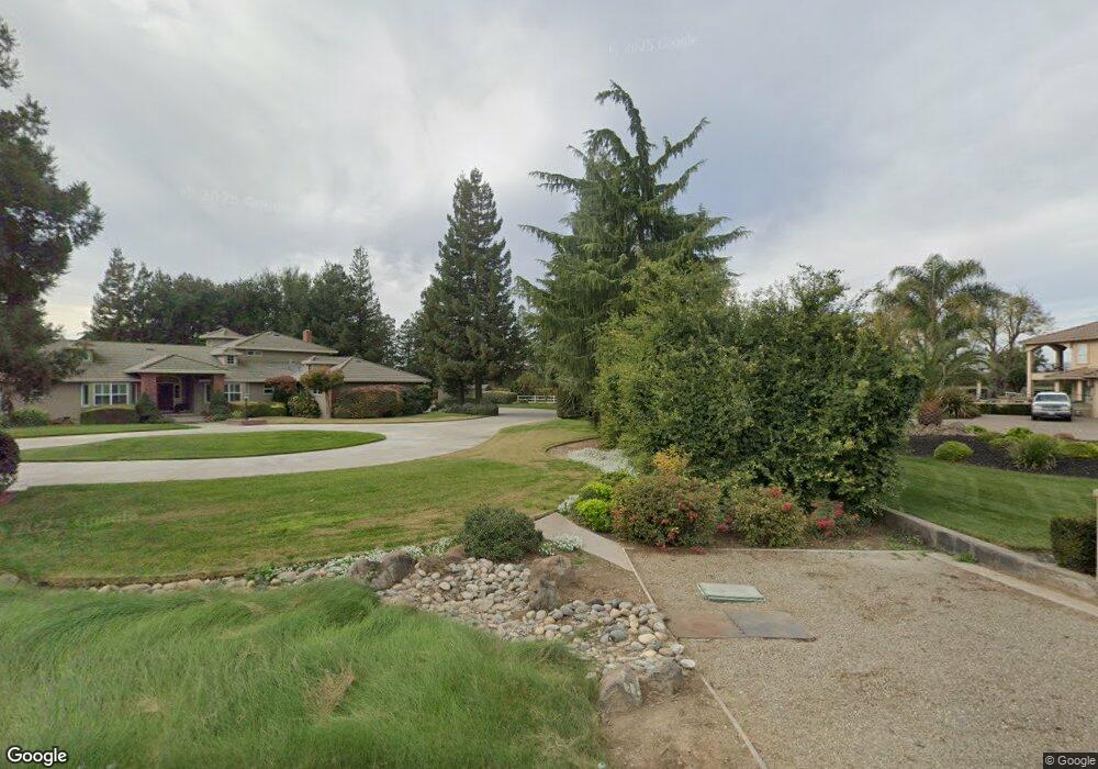
8670 Southland Rd Manteca, CA 95336
Estimated Value: $1,365,718
--
Bed
--
Bath
--
Sq Ft
19.69
Acres
About This Home
This home is located at 8670 Southland Rd, Manteca, CA 95336 and is currently estimated at $1,365,718. 8670 Southland Rd is a home located in San Joaquin County with nearby schools including New Haven Elementary School, East Union High School, and St. Anthony's Catholic School.
Ownership History
Date
Name
Owned For
Owner Type
Purchase Details
Closed on
Jul 12, 2016
Sold by
Lopes David L
Bought by
Brocchini Family Partnership
Current Estimated Value
Purchase Details
Closed on
Sep 9, 2009
Sold by
U S Bank National Association
Bought by
Lin Andrew E and Lin Annie
Purchase Details
Closed on
Sep 1, 2003
Sold by
Lopes Angie
Bought by
South San Joaquin Irrigation District
Purchase Details
Closed on
Sep 21, 1999
Sold by
Lopes David L and Macgregor John Wayne
Bought by
Lopes Angie E
Create a Home Valuation Report for This Property
The Home Valuation Report is an in-depth analysis detailing your home's value as well as a comparison with similar homes in the area
Home Values in the Area
Average Home Value in this Area
Purchase History
| Date | Buyer | Sale Price | Title Company |
|---|---|---|---|
| Brocchini Family Partnership | $825,000 | Old Republic Title Company | |
| Lin Andrew E | $175,000 | Lawyers Title | |
| South San Joaquin Irrigation District | $247 | -- | |
| Lopes Angie E | -- | -- |
Source: Public Records
Tax History Compared to Growth
Tax History
| Year | Tax Paid | Tax Assessment Tax Assessment Total Assessment is a certain percentage of the fair market value that is determined by local assessors to be the total taxable value of land and additions on the property. | Land | Improvement |
|---|---|---|---|---|
| 2025 | $13,084 | $1,070,685 | $957,482 | $113,203 |
| 2024 | $12,593 | $1,049,692 | $938,708 | $110,984 |
| 2023 | $12,177 | $1,029,110 | $920,302 | $108,808 |
| 2022 | $10,902 | $934,422 | $902,257 | $32,165 |
| 2021 | $10,788 | $916,101 | $884,566 | $31,535 |
| 2020 | $10,369 | $906,708 | $875,496 | $31,212 |
| 2019 | $10,240 | $888,930 | $858,330 | $30,600 |
| 2018 | $9,780 | $841,500 | $841,500 | $0 |
| 2017 | $9,644 | $825,000 | $825,000 | $0 |
| 2016 | $1,779 | $116,702 | $79,208 | $37,494 |
| 2015 | $1,298 | $114,949 | $78,018 | $36,931 |
| 2014 | $1,211 | $112,698 | $76,490 | $36,208 |
Source: Public Records
Map
Nearby Homes
- 1983 Cork Oak Ln
- 1931 Diamond Oak Way
- 1849 Holly Oak Ct
- 1023 Marsh Creek Ln
- 938 Buttercup Place
- 1560 Snapdragon Way
- 1527 Deerpark Dr
- 1089 Vasconcellos Ave
- 1361 Marceline Dr
- 1052 Camborne Dr
- 1834 Treeline Way
- 1015 Lucio St
- 1003 Alfonso Ln
- 1786 Brookside Dr
- 1526 Brookside Dr
- Residence 1 Plan at Origin at The Collective 55+
- Residence 2 Plan at Origin at The Collective 55+
- 762 Conrad St
- 771 Conrad St
- 1292 Laurel Dr
- 15879 Southland Ct
- 15949 Southland Ct
- 15791 Southland Ct
- 16059 Southland Ct
- 8670 E Southland Rd
- 8908 E Southland Rd
- 1859 Pin Oak Ct
- 1847 Pin Oak Ct
- 1873 Pin Oak Ct
- 1835 Pin Oak Ct
- 1889 Pin Oak Ct
- 1823 Pin Oak Ct
- 15940 Southland Ct
- 1909 1909 Pin Oak Ln
- 1805 Pin Oak Ct
- 1917 Pin Oak Ln
- 16050 Southland Ct
- 1925 Pin Oak Ln
- 1697 Blush St
- 15870 Southland Ct