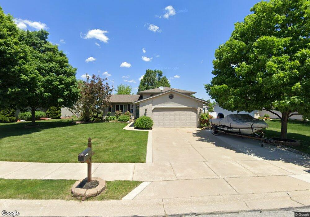
8675 Sherman St Crown Point, IN 46307
Estimated Value: $335,547 - $375,000
4
Beds
2
Baths
1,972
Sq Ft
$179/Sq Ft
Est. Value
About This Home
This home is located at 8675 Sherman St, Crown Point, IN 46307 and is currently estimated at $352,137, approximately $178 per square foot. 8675 Sherman St is a home located in Lake County with nearby schools including Kolling Elementary School, Hal E Clark Middle School, and Lake Central High School.
Ownership History
Date
Name
Owned For
Owner Type
Purchase Details
Closed on
Jul 11, 2008
Sold by
Blaze Michael C and Blaze Jeanne P
Bought by
Pietrzak Gina R
Current Estimated Value
Home Financials for this Owner
Home Financials are based on the most recent Mortgage that was taken out on this home.
Original Mortgage
$187,775
Outstanding Balance
$121,109
Interest Rate
6.15%
Mortgage Type
FHA
Estimated Equity
$231,028
Create a Home Valuation Report for This Property
The Home Valuation Report is an in-depth analysis detailing your home's value as well as a comparison with similar homes in the area
Home Values in the Area
Average Home Value in this Area
Purchase History
| Date | Buyer | Sale Price | Title Company |
|---|---|---|---|
| Pietrzak Gina R | -- | Ticor Scher |
Source: Public Records
Mortgage History
| Date | Status | Borrower | Loan Amount |
|---|---|---|---|
| Open | Pietrzak Gina R | $187,775 |
Source: Public Records
Tax History Compared to Growth
Tax History
| Year | Tax Paid | Tax Assessment Tax Assessment Total Assessment is a certain percentage of the fair market value that is determined by local assessors to be the total taxable value of land and additions on the property. | Land | Improvement |
|---|---|---|---|---|
| 2024 | $2,078 | $288,200 | $61,300 | $226,900 |
| 2023 | $1,971 | $278,900 | $61,300 | $217,600 |
| 2022 | $1,971 | $249,100 | $48,200 | $200,900 |
| 2021 | $1,778 | $234,800 | $48,200 | $186,600 |
| 2020 | $1,799 | $231,900 | $55,900 | $176,000 |
| 2019 | $1,988 | $227,900 | $52,300 | $175,600 |
| 2018 | $1,911 | $219,300 | $52,300 | $167,000 |
| 2017 | $1,710 | $210,900 | $52,300 | $158,600 |
| 2016 | $1,579 | $201,200 | $52,300 | $148,900 |
| 2014 | $1,460 | $201,500 | $52,300 | $149,200 |
| 2013 | $1,447 | $199,500 | $52,300 | $147,200 |
Source: Public Records
Map
Nearby Homes
- 6440 W 89th Ave
- 6076 Wexford Way
- 6501 W 89th Ave
- 8849 Calhoun Place
- 8903 Edison St
- 8521 Morse Place
- 2921 Morningside Dr
- 2914 Morningside Dr
- 7403 W 85th Ave
- 7605 W 86th Ave
- 6308 W 91st Ave
- 8748 Durbin Ln
- 2720 Painted Leaf Ct
- 5547 Maggie Mae Ct
- 2756 Autumn Dr
- 8355 Blaine Place
- 1813 Redwood Ct
- 5544 Maggie Mae Ct
- 6640 W 89th Ave
- 1881 Orchard Ct
- 8683 Sherman St
- 8667 Sherman St
- 8622 Sherman St
- 8650 Wheeler Place
- 8687 Sherman St
- 8659 Sherman St
- 8638 Wheeler Place
- 8678 Sherman St
- 8672 Sherman St
- 8682 Sherman St
- 8664 Sherman St
- 8627 Wheeler Place
- 8690 Sherman St
- 8647 Sherman St
- 8658 Sherman St
- 8615 Wheeler Place
- 8694 Sherman St
- 14526 Wheeler Place
- 8646 Sherman St
- 8635 Sherman St