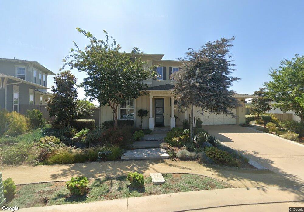
868 Channel Island Dr Encinitas, CA 92024
Leucadia NeighborhoodEstimated Value: $2,974,457 - $3,543,000
3
Beds
5
Baths
3,511
Sq Ft
$948/Sq Ft
Est. Value
About This Home
This home is located at 868 Channel Island Dr, Encinitas, CA 92024 and is currently estimated at $3,329,364, approximately $948 per square foot. 868 Channel Island Dr is a home with nearby schools including Capri Elementary School, Diegueno Middle School, and La Costa Canyon High School.
Ownership History
Date
Name
Owned For
Owner Type
Purchase Details
Closed on
Nov 18, 2015
Sold by
Shea Homes Limited Partnership
Bought by
Goad Brian T and Goad Wendy L
Current Estimated Value
Home Financials for this Owner
Home Financials are based on the most recent Mortgage that was taken out on this home.
Original Mortgage
$1,147,568
Outstanding Balance
$885,721
Interest Rate
3.25%
Mortgage Type
Adjustable Rate Mortgage/ARM
Estimated Equity
$2,443,643
Create a Home Valuation Report for This Property
The Home Valuation Report is an in-depth analysis detailing your home's value as well as a comparison with similar homes in the area
Home Values in the Area
Average Home Value in this Area
Purchase History
| Date | Buyer | Sale Price | Title Company |
|---|---|---|---|
| Goad Brian T | $1,530,500 | First American Title Company |
Source: Public Records
Mortgage History
| Date | Status | Borrower | Loan Amount |
|---|---|---|---|
| Open | Goad Brian T | $1,147,568 |
Source: Public Records
Tax History Compared to Growth
Tax History
| Year | Tax Paid | Tax Assessment Tax Assessment Total Assessment is a certain percentage of the fair market value that is determined by local assessors to be the total taxable value of land and additions on the property. | Land | Improvement |
|---|---|---|---|---|
| 2025 | $20,705 | $1,864,858 | $923,359 | $941,499 |
| 2024 | $20,705 | $1,828,293 | $905,254 | $923,039 |
| 2023 | $20,184 | $1,792,445 | $887,504 | $904,941 |
| 2022 | $19,866 | $1,757,300 | $870,102 | $887,198 |
| 2021 | $19,517 | $1,722,844 | $853,042 | $869,802 |
| 2020 | $19,309 | $1,705,180 | $844,296 | $860,884 |
| 2019 | $18,933 | $1,671,746 | $827,742 | $844,004 |
| 2018 | $18,134 | $1,638,967 | $811,512 | $827,455 |
| 2017 | $17,819 | $1,606,831 | $795,600 | $811,231 |
| 2016 | $16,596 | $1,511,325 | $780,000 | $731,325 |
| 2015 | $3,400 | $245,905 | $245,905 | $0 |
| 2014 | $2,550 | $241,089 | $241,089 | $0 |
Source: Public Records
Map
Nearby Homes
- 773 Puebla St
- 623 Quail Gardens Ln
- 844 Saxony Rd
- 1403 Anacona Place Unit 103
- 1400 Anacona Place Unit 105
- 875 La Mirada Ave
- 1601 San Remo Place Unit 101
- 1603 San Remo Place Unit 105
- 697 Ocean View Ave
- 1129 31 Saxony Rd
- 1139 41 Saxony Rd
- 614 Ocean View Ave
- 836 Jensen Ct
- 0 Mays Hollow Ln
- 557 Samuel Ct
- 431 Orpheus Ave
- 201 Coneflower St
- 553 Hygeia Ave Unit A
- 0 Fulvia St Unit NDP2505418
- 515 Verbena Ct
- 864 Channel Island Dr
- 872 Channel Island Dr
- 860 Channel Island Dr
- 873 Channel Island Dr
- 877 Channel Island Dr
- 876 Channel Island Dr
- 880 Channel Island Dr
- 869 Channel Island Dr
- 856 Channel Island Dr
- 884 Channel Island Dr
- 865 Channel Island Dr
- 881 Channel Island Dr
- 852 Channel Island Dr
- 888 Channel Island Dr
- 861 Channel Island Dr
- 621 Polaris Dr
- 885 Channel Island Dr
- 625 Polaris Dr
- 848 Channel Island Dr
- 629 Polaris Dr