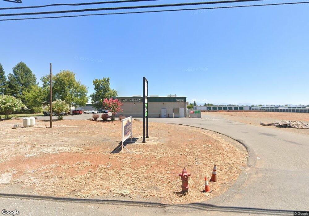
8693 Airport Rd Redding, CA 96002
Clover Creek Neighborhood
Studio
--
Bath
7,200
Sq Ft
226,512
Sq Ft Lot
About This Home
This home is located at 8693 Airport Rd, Redding, CA 96002. 8693 Airport Rd is a home located in Shasta County with nearby schools including Junction Elementary School, Foothill High School, and California Heritage Youth Build Academy.
Ownership History
Date
Name
Owned For
Owner Type
Purchase Details
Closed on
Mar 10, 2020
Sold by
Batten Sean and Batten Nichola
Bought by
Clearwater Business Park Llc
Purchase Details
Closed on
Sep 1, 2005
Sold by
Batten Sean
Bought by
Batten Sean and Batten Nichola
Purchase Details
Closed on
Aug 14, 2002
Sold by
Stayer Patrick J
Bought by
Batten Sean
Home Financials for this Owner
Home Financials are based on the most recent Mortgage that was taken out on this home.
Original Mortgage
$153,600
Interest Rate
6.43%
Mortgage Type
Seller Take Back
Purchase Details
Closed on
Mar 20, 1999
Sold by
Stayer L A
Bought by
Stayer L A and Stayer Patrick J
Create a Home Valuation Report for This Property
The Home Valuation Report is an in-depth analysis detailing your home's value as well as a comparison with similar homes in the area
Home Values in the Area
Average Home Value in this Area
Purchase History
| Date | Buyer | Sale Price | Title Company |
|---|---|---|---|
| Clearwater Business Park Llc | -- | None Available | |
| Batten Sean | -- | -- | |
| Batten Sean | $194,000 | Chicago Title Co | |
| Stayer L A | -- | Chicago Title Co |
Source: Public Records
Mortgage History
| Date | Status | Borrower | Loan Amount |
|---|---|---|---|
| Previous Owner | Batten Sean | $153,600 |
Source: Public Records
Tax History
| Year | Tax Paid | Tax Assessment Tax Assessment Total Assessment is a certain percentage of the fair market value that is determined by local assessors to be the total taxable value of land and additions on the property. | Land | Improvement |
|---|---|---|---|---|
| 2025 | $20,750 | $1,980,754 | $294,053 | $1,686,701 |
| 2024 | $20,421 | $1,941,917 | $288,288 | $1,653,629 |
| 2023 | $20,421 | $1,903,841 | $282,636 | $1,621,205 |
| 2022 | $19,921 | $1,866,512 | $277,095 | $1,589,417 |
| 2021 | $19,574 | $1,829,914 | $271,662 | $1,558,252 |
| 2020 | $13,018 | $1,200,000 | $650,000 | $550,000 |
| 2019 | $12,131 | $1,140,000 | $650,000 | $490,000 |
| 2018 | $11,509 | $1,040,000 | $350,000 | $690,000 |
| 2017 | $10,409 | $950,000 | $330,000 | $620,000 |
| 2016 | $7,332 | $690,000 | $230,000 | $460,000 |
| 2015 | $6,974 | $675,000 | $225,000 | $450,000 |
| 2014 | $6,250 | $600,000 | $225,000 | $375,000 |
Source: Public Records
Map
Nearby Homes
- 8743 Airport Rd
- 20250 Demac Dr
- 8567 Winona Way
- 4655 Goodwater Ave
- 5090 Bogie Ln
- 20340 Gibson Ct
- 3086 Henrys Fork Dr
- 3030 Clear Water Ct
- 2995 Henrys Fork Dr
- 9105 Madrone Way
- 5101 Mclaren Dr
- 4302 Yellowstone Dr
- 3874 Palm Springs Dr
- 2875 Eastbrook Dr
- 5016 Monaco Pkwy
- 5229 Monaco Pkwy
- 3424 Lowland Ave
- 3824 Thomason Trail
- 3239 Lowland Ave
- 5528 Muir Peak Rd
- 8711 Airport Rd
- 8715 Airport Rd
- 0 Demac Dr
- 8700 Airport Rd
- 20318 Demac Dr
- 8719 Airport Rd
- 8719 Airport Rd
- 8730 Airport Rd
- 20319 Demac Dr
- 20307 Demac Dr
- 8748 Airport Rd
- 20299 Demac Dr
- 20259 Blue Jay Dr
- 4738 Airport Rd
- 8779 Airport Rd
- 8640 Airport Rd
- 20270 Demac Dr
- 20291 Demac Dr
- 20277 Demac Dr
- 8770 Airport Rd
Your Personal Tour Guide
Ask me questions while you tour the home.